MyTopo
Old Woman Statue California US Topo Map
Couldn't load pickup availability
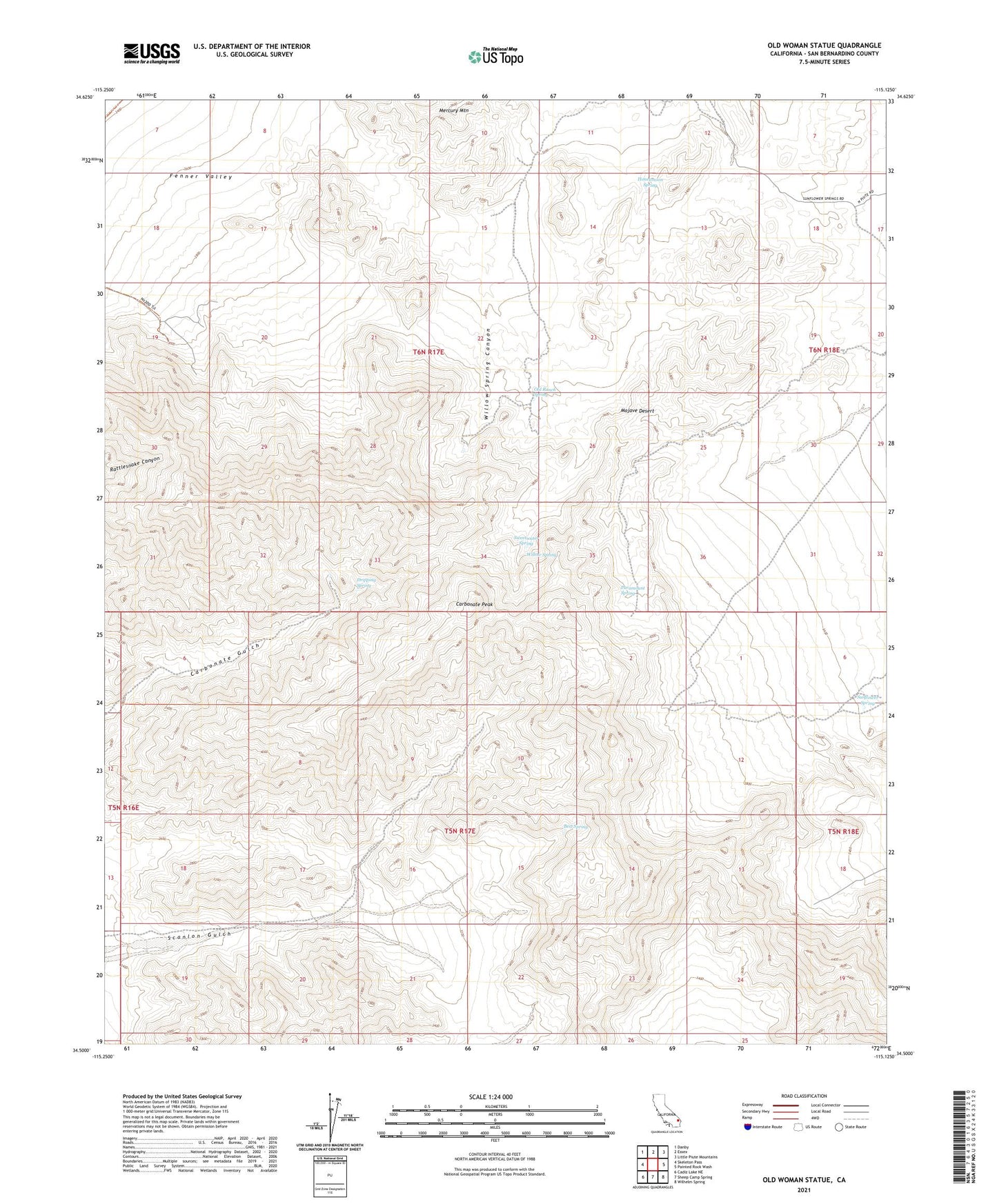
2021 topographic map quadrangle Old Woman Statue in the state of California. Scale: 1:24000. Based on the newly updated USGS 7.5' US Topo map series, this map is in the following counties: San Bernardino. The map contains contour data, water features, and other items you are used to seeing on USGS maps, but also has updated roads and other features. This is the next generation of topographic maps. Printed on high-quality waterproof paper with UV fade-resistant inks.
Quads adjacent to this one:
West: Skeleton Pass
Northwest: Danby
North: Essex
Northeast: Little Piute Mountains
East: Painted Rock Wash
Southeast: Wilhelm Spring
South: Sheep Camp Spring
Southwest: Cadiz Lake NE
This map covers the same area as the classic USGS quad with code o34115e2.
Contains the following named places: Azalea Wash, Bert Spring, Carbonate Peak, Dripping Spring, Enterprise Mine, Florence Mine, Gemco Mine, Golden Fleece Mine, Hang Mine, Honeymoon Spring, Mercury Mountain, Old Ranch Spring, Old Woman Statue, Paramount Spring, Silverware Mine, Sunflower Spring, Sweetwater Spring, Sweetwater Wash, Weavers Well, Willow Spring, Willow Spring Canyon, Willow Spring Wash