MyTopo
Parker SW California US Topo Map
Couldn't load pickup availability
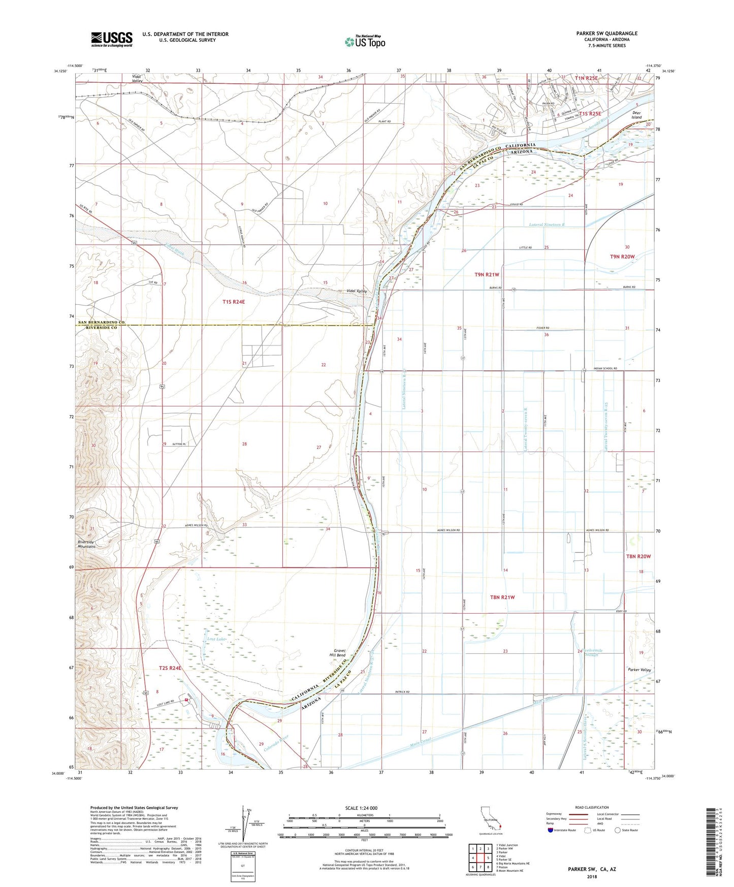
2023 topographic map quadrangle Parker SW in the states of California, Arizona. Scale: 1:24000. Based on the newly updated USGS 7.5' US Topo map series, this map is in the following counties: Riverside, La Paz, San Bernardino. The map contains contour data, water features, and other items you are used to seeing on USGS maps, but also has updated roads and other features. This is the next generation of topographic maps. Printed on high-quality waterproof paper with UV fade-resistant inks.
Quads adjacent to this one:
West: Vidal
Northwest: Vidal Junction
North: Parker NW
Northeast: Parker
East: Parker SE
Southeast: Moon Mountain NE
South: Poston
Southwest: Big Maria Mountains NE
This map covers the same area as the classic USGS quad with code o34114a4.
Contains the following named places: Alligator Slough, Colorado River Day School, Deer Island, Gravel Hill Bend, Harvest Mission, Lateral Nineteen R, Lateral Nineteen R-37, Lateral Nineteen R-37-24, Lateral Number Seventy-nine, Lateral Twenty-seven R-25, Lost Lake, Lost Lake Resort, Riverside County Fire Department Station 47 - Lost Lake, Twelvemile Slough, Vidal Valley, Vidal Wash