
MyTopo
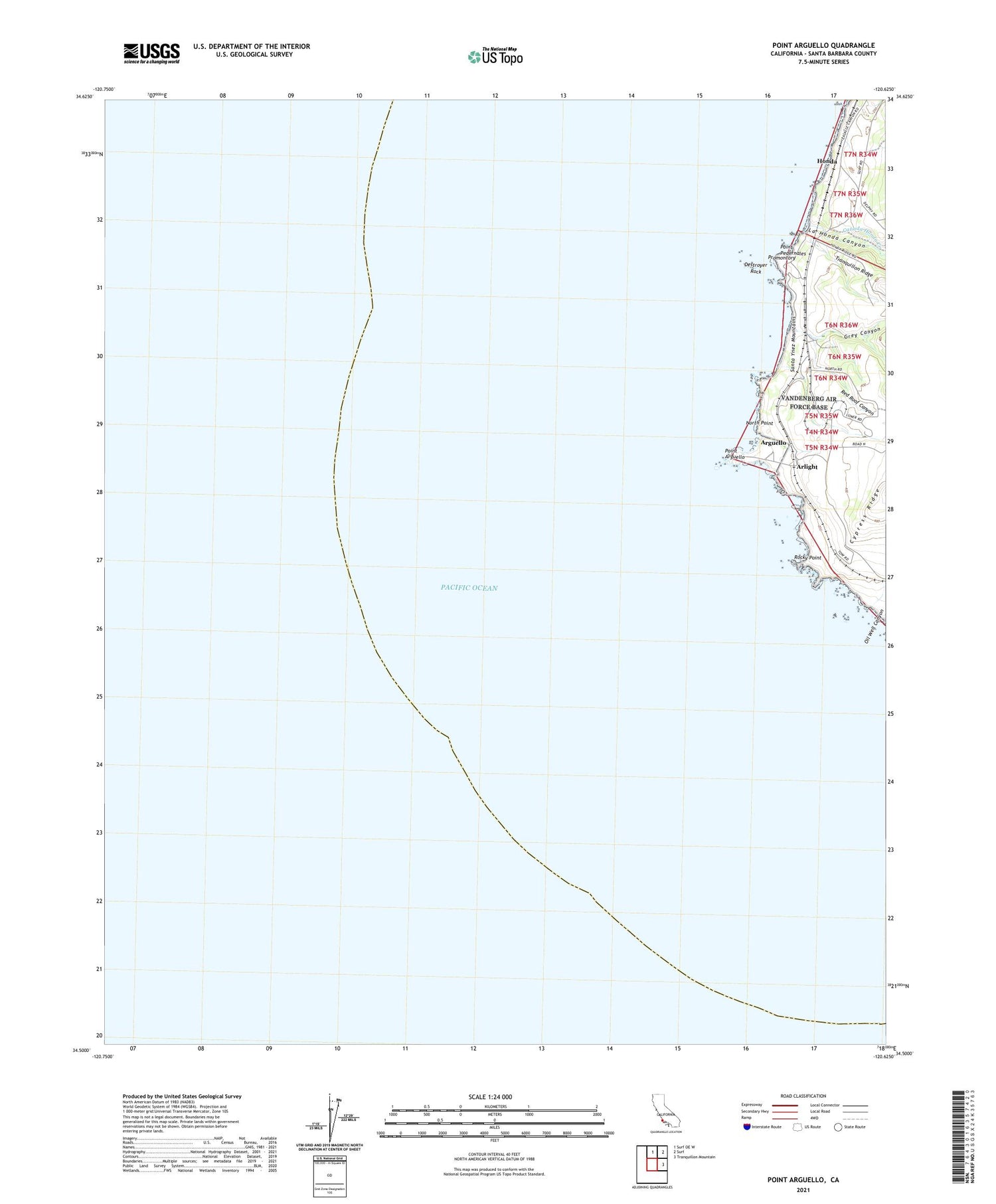
Point Arguello California US Topo Map
Couldn't load pickup availability
2021 topographic map quadrangle Point Arguello in the state of California. Scale: 1:24000. Based on the newly updated USGS 7.5' US Topo map series, this map is in the following counties: Santa Barbara. The map contains contour data, water features, and other items you are used to seeing on USGS maps, but also has updated roads and other features. This is the next generation of topographic maps. Printed on high-quality waterproof paper with UV fade-resistant inks.
Quads adjacent to this one:
North: Surf OE W
Northeast: Surf
East: Tranquillon Mountain
This map covers the same area as the classic USGS quad with code o34120e6.
Contains the following named places: Arguello, Arlight, Canada Honda Creek, Destroyer Rock, Grey Canyon, Honda, La Honda Canyon, North Point, Point Arguello, Point Arguello Lighthouse, Point Pedernales, Promontory, Red Roof Canyon, Rocky Point


