MyTopo
San Miguel Island East California US Topo Map
Couldn't load pickup availability
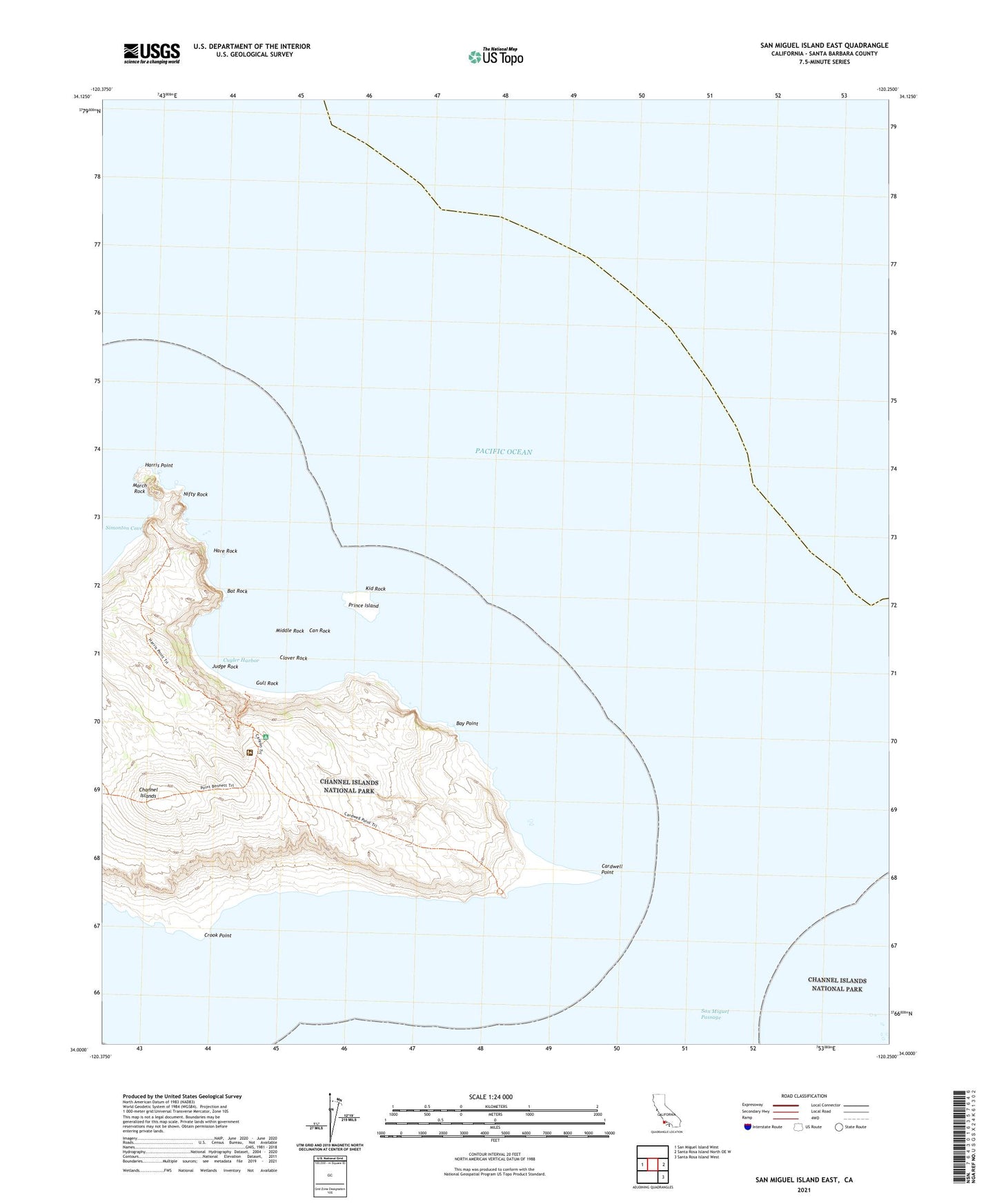
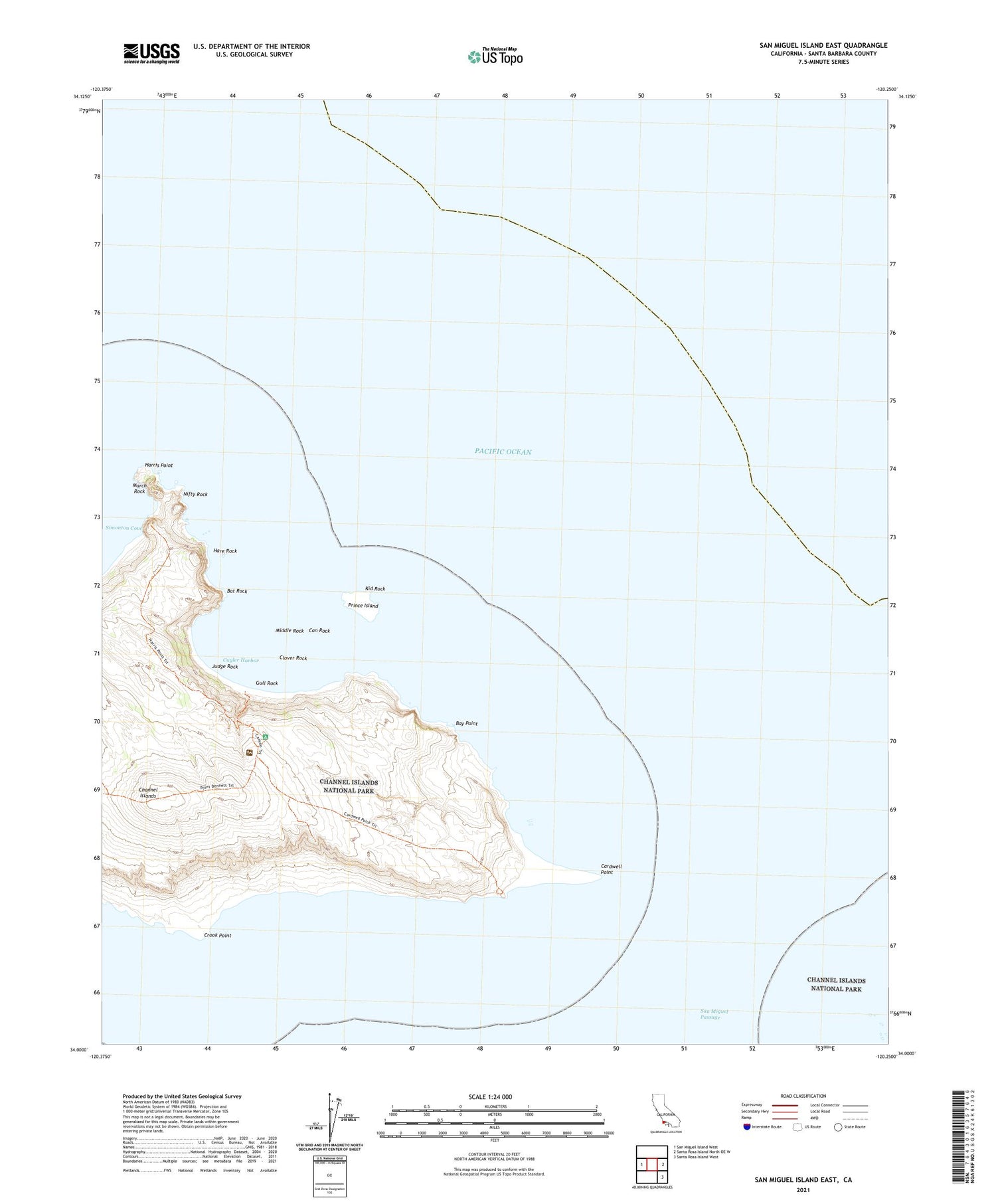
2021 topographic map quadrangle San Miguel Island East in the state of California. Scale: 1:24000. Based on the newly updated USGS 7.5' US Topo map series, this map is in the following counties: Santa Barbara. The map contains contour data, water features, and other items you are used to seeing on USGS maps, but also has updated roads and other features. This is the next generation of topographic maps. Printed on high-quality waterproof paper with UV fade-resistant inks.
Quads adjacent to this one:
West: San Miguel Island West
East: Santa Rosa Island North OE W
Southeast: Santa Rosa Island West
Contains the following named places: Bat Rock, Bay Point, Can Rock, Cardwell Point, Clover Rock, Crook Point, Cuyler Harbor, Gull Rock, Hare Rock, Harris Point, Judge Rock, Kid Rock, March Rock, Middle Rock, Nifty Rock, Prince Island, Ranch House Flagpole