MyTopo
Santa Cruz Island D California US Topo Map
Couldn't load pickup availability
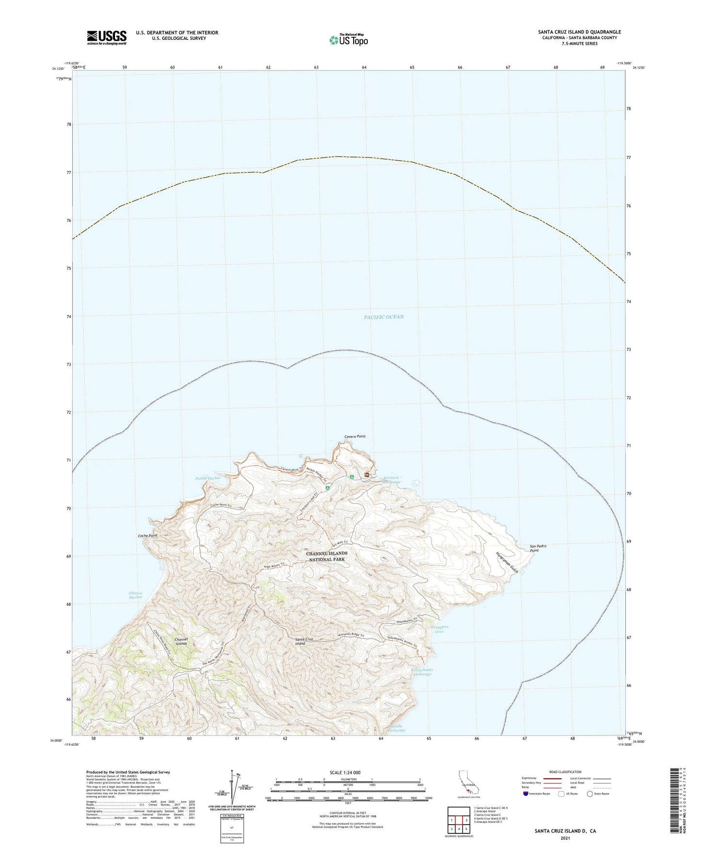
2021 topographic map quadrangle Santa Cruz Island D in the state of California. Scale: 1:24000. Based on the newly updated USGS 7.5' US Topo map series, this map is in the following counties: Santa Barbara. The map contains contour data, water features, and other items you are used to seeing on USGS maps, but also has updated roads and other features. This is the next generation of topographic maps. Printed on high-quality waterproof paper with UV fade-resistant inks.
Quads adjacent to this one:
West: Santa Cruz Island C OE N
East: Anacapa Island
Southeast: Anacapa Island OE S
South: Santa Cruz Island D OE S
Southwest: Santa Cruz Island C
This map covers the same area as the classic USGS quad with code o33119h4.
Contains the following named places: Cavern Point, Chinese Harbor, Coche Point, Hungryman Gulch, Middle Anchorage, Potato Harbor, San Pedro Point, Scorpion Anchorage, Smugglers Cove, Yellowbanks Anchorage