MyTopo
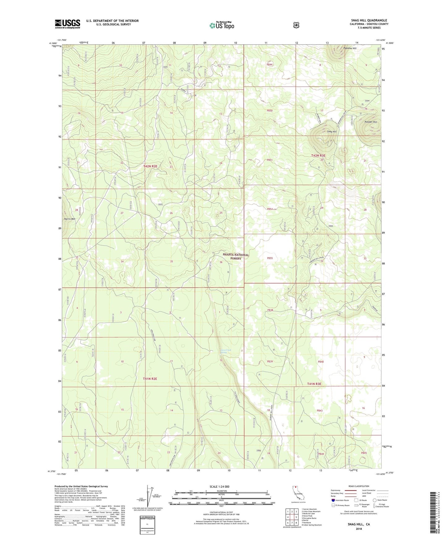
Snag Hill California US Topo Map
Couldn't load pickup availability
Also explore the Snag Hill Forest Service Topo of this same quad for updated USFS data
2022 topographic map quadrangle Snag Hill in the state of California. Scale: 1:24000. Based on the newly updated USGS 7.5' US Topo map series, this map is in the following counties: Siskiyou. The map contains contour data, water features, and other items you are used to seeing on USGS maps, but also has updated roads and other features. This is the next generation of topographic maps. Printed on high-quality waterproof paper with UV fade-resistant inks.
Quads adjacent to this one:
West: Horse Peak
Northwest: Garner Mountain
North: Little Glass Mountain
Northeast: Medicine Lake
East: Porcupine Butte
Southeast: Indian Spring Mountain
South: Hambone
Southwest: Bartle
This map covers the same area as the classic USGS quad with code o41121d6.
Contains the following named places: Chippy Spur, Lava Crack Spring, Papoose Hill, Powder Hill, Snag Hill