
MyTopo
Battle Rock Colorado US Topo Map
Couldn't load pickup availability
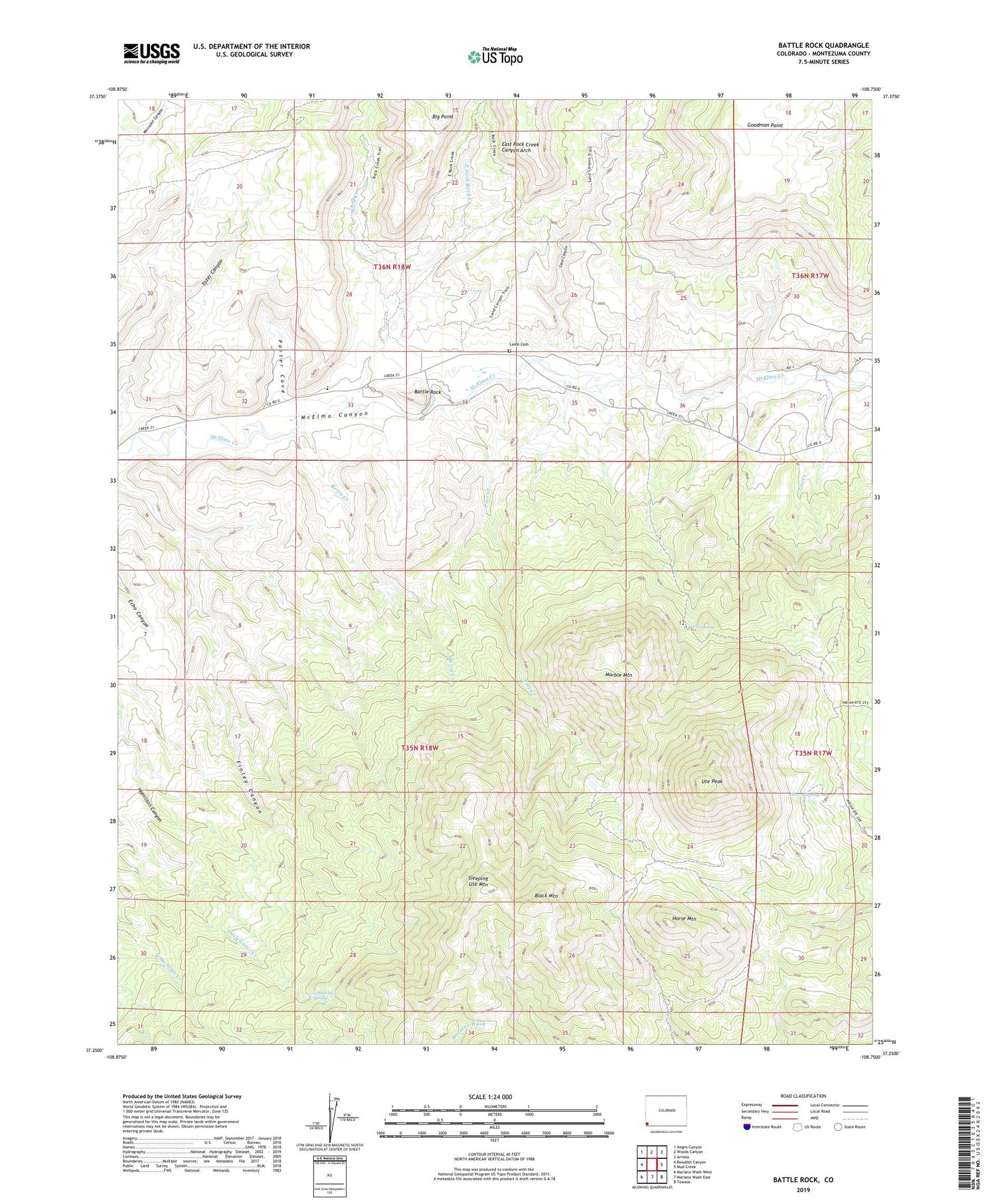
2022 topographic map quadrangle Battle Rock in the state of Colorado. Scale: 1:24000. Based on the newly updated USGS 7.5' US Topo map series, this map is in the following counties: Montezuma. The map contains contour data, water features, and other items you are used to seeing on USGS maps, but also has updated roads and other features. This is the next generation of topographic maps. Printed on high-quality waterproof paper with UV fade-resistant inks.
Quads adjacent to this one:
West: Bowdish Canyon
Northwest: Negro Canyon
North: Woods Canyon
Northeast: Arriola
East: Mud Creek
Southeast: Towaoc
South: Mariano Wash East
Southwest: Mariano Wash West
This map covers the same area as the classic USGS quad with code o37108c7.
Contains the following named places: Battle Rock, Battle Rock Mine, Battle Rock School, Berry Creek, Black Mountain, Cliff House Mine, East Fork Rock Creek, East Rock Creek Canyon Arch, Goodman Point, Hanna Spring, Horse Mountain, Karla Kay Mine, Lamb Cemetery, Little Maude Mine, Littlewater Spring, Marble Mountain, Pine Creek, Porter Cove, Rock Creek, Sand Canyon, Sleeping Ute Mountain, Three States Mine, Ute Creek, Ute Peak, Ute Spring


