MyTopo
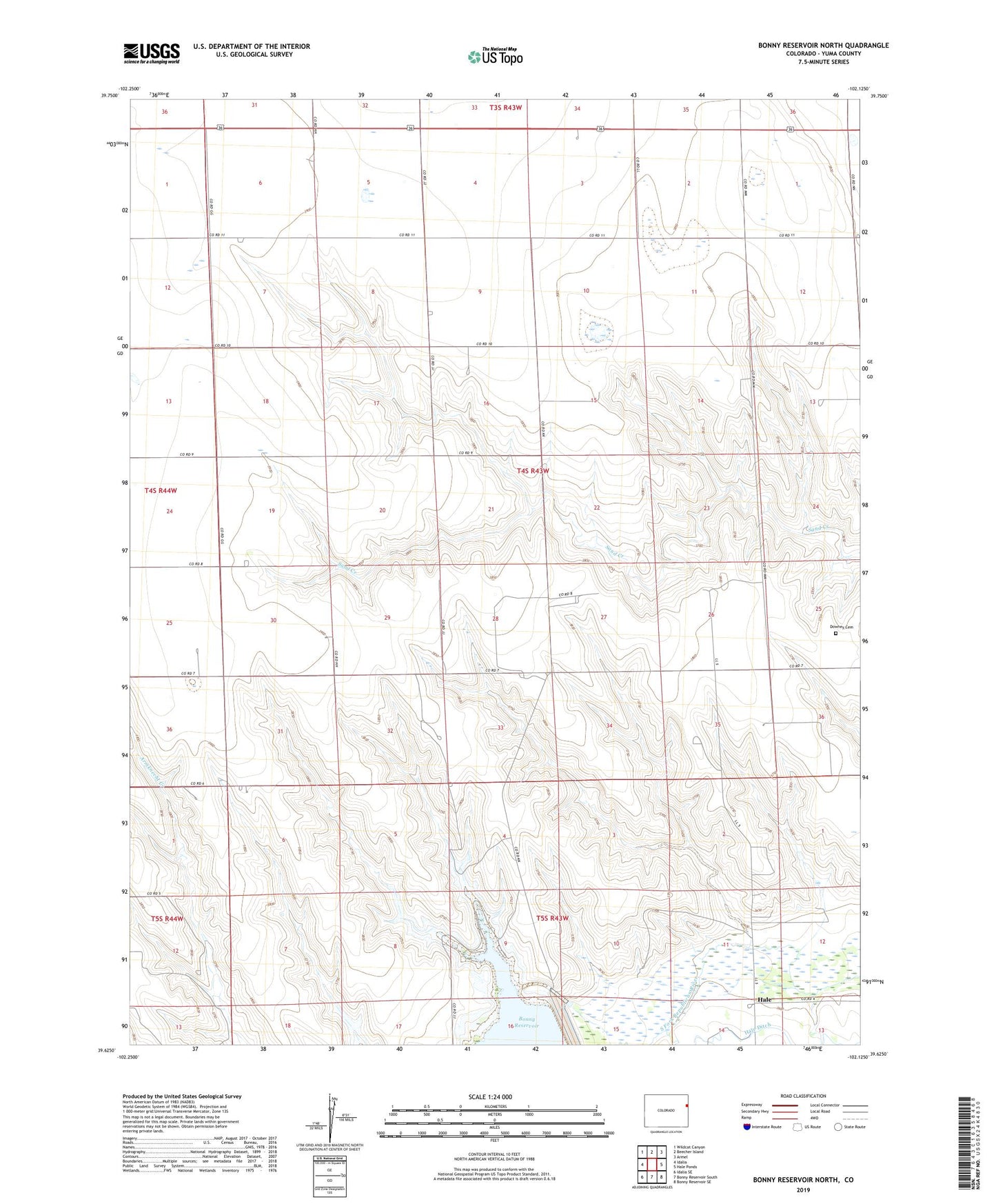
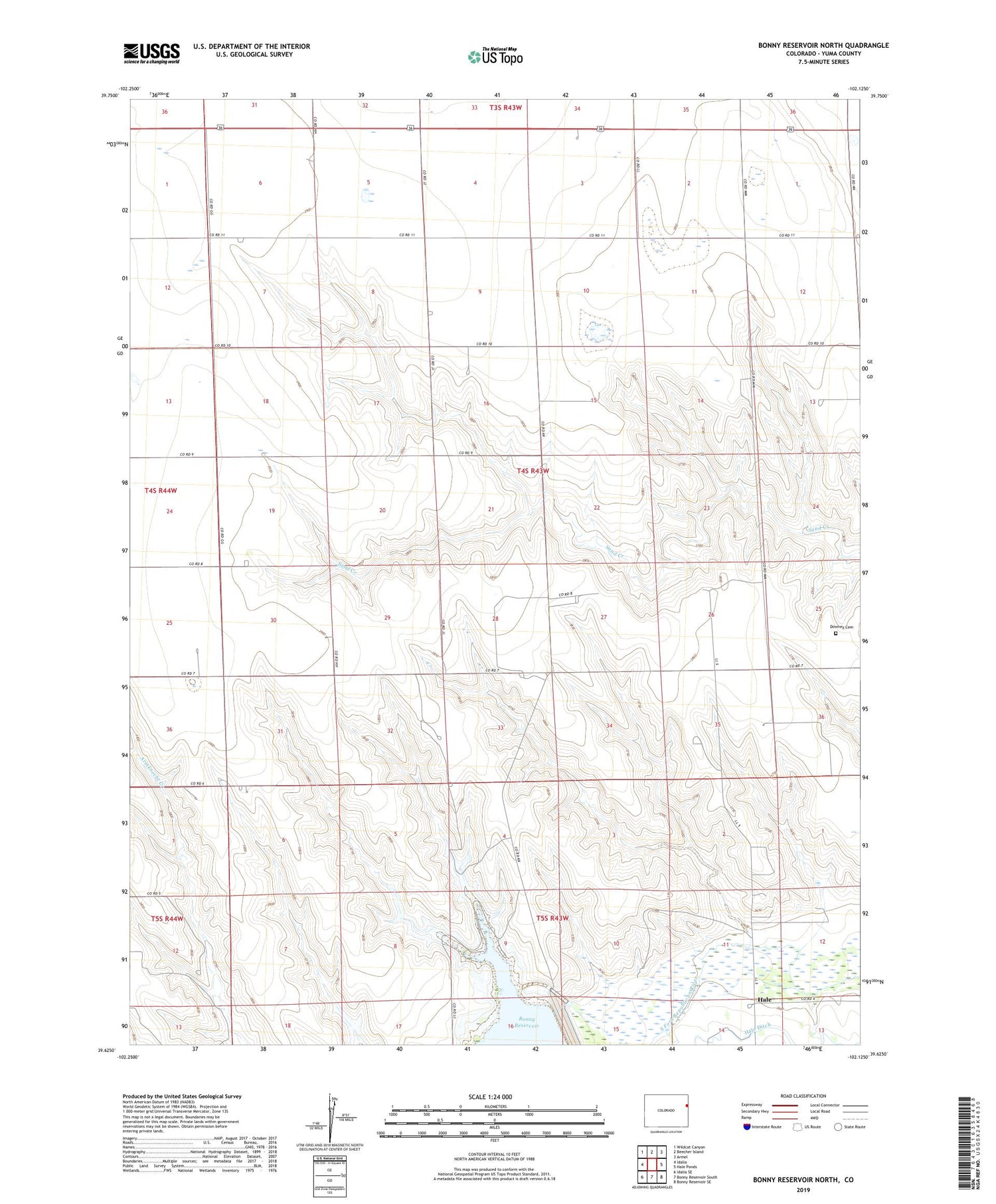
Bonny Reservoir North Colorado US Topo Map
Couldn't load pickup availability
2022 topographic map quadrangle Bonny Reservoir North in the state of Colorado. Scale: 1:24000. Based on the newly updated USGS 7.5' US Topo map series, this map is in the following counties: Yuma. The map contains contour data, water features, and other items you are used to seeing on USGS maps, but also has updated roads and other features. This is the next generation of topographic maps. Printed on high-quality waterproof paper with UV fade-resistant inks.
Quads adjacent to this one:
West: Idalia
Northwest: Wildcat Canyon
North: Beecher Island
Northeast: Armel
East: Hale Ponds
Southeast: Bonny Reservoir SE
South: Bonny Reservoir South
Southwest: Idalia SE
This map covers the same area as the classic USGS quad with code o39102f2.
Contains the following named places: Bonny Dam Landing Strip, Burr Ranch, Downey Cemetery, Hale, Hale Ditch Aqueduct, M A and K A Dickson Airport, Moellenberg Ranch