MyTopo
Buttes Colorado US Topo Map
Couldn't load pickup availability
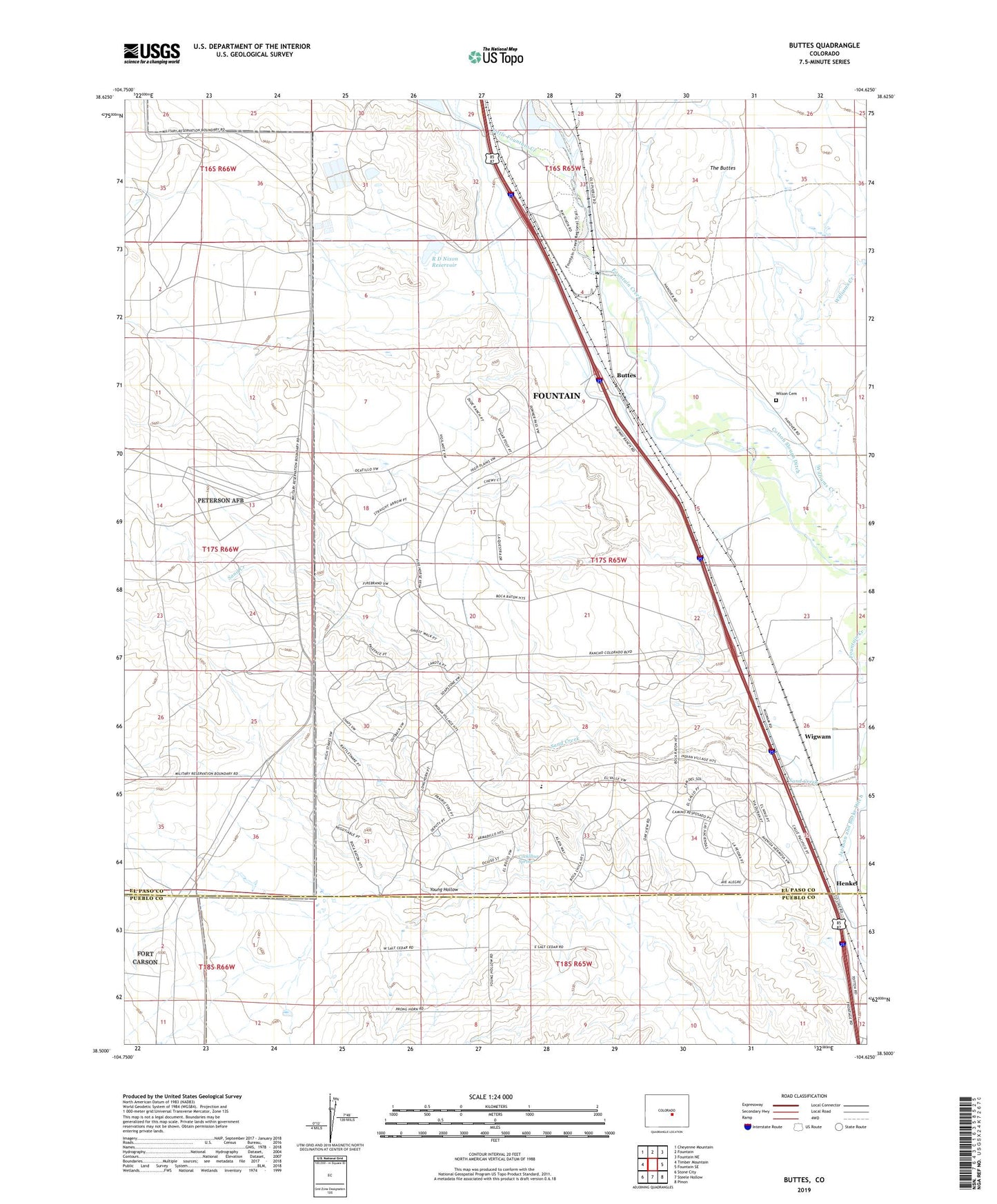
2022 topographic map quadrangle Buttes in the state of Colorado. Scale: 1:24000. Based on the newly updated USGS 7.5' US Topo map series, this map is in the following counties: El Paso, Pueblo. The map contains contour data, water features, and other items you are used to seeing on USGS maps, but also has updated roads and other features. This is the next generation of topographic maps. Printed on high-quality waterproof paper with UV fade-resistant inks.
Quads adjacent to this one:
West: Timber Mountain
Northwest: Cheyenne Mountain
North: Fountain
Northeast: Fountain NE
East: Fountain SE
Southeast: Pinon
South: Steele Hollow
Southwest: Stone City
This map covers the same area as the classic USGS quad with code o38104e6.
Contains the following named places: 7 L Bar Ranch, Buttes, Cockllbur Spring, Cotton Slough Ditch, Henkel, Jackson and Burke Ditch, Little Fountain Creek, Midway Landfill, Midway Ranch, R D Nixon Dam, R D Nixon Reservoir, The Buttes, Tom Wanlass Ditch, Wigwam, Wigwam School, Williams Creek, Wilson Cemetery