MyTopo
Eads Colorado US Topo Map
Couldn't load pickup availability
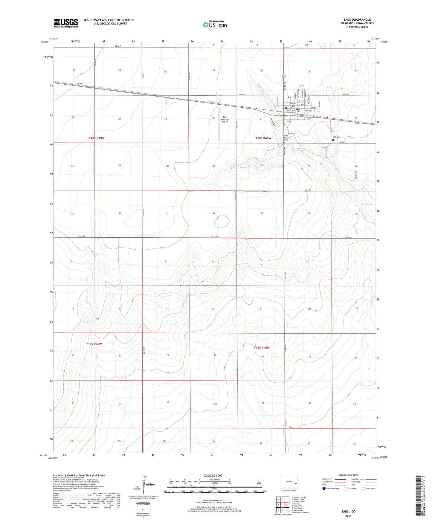
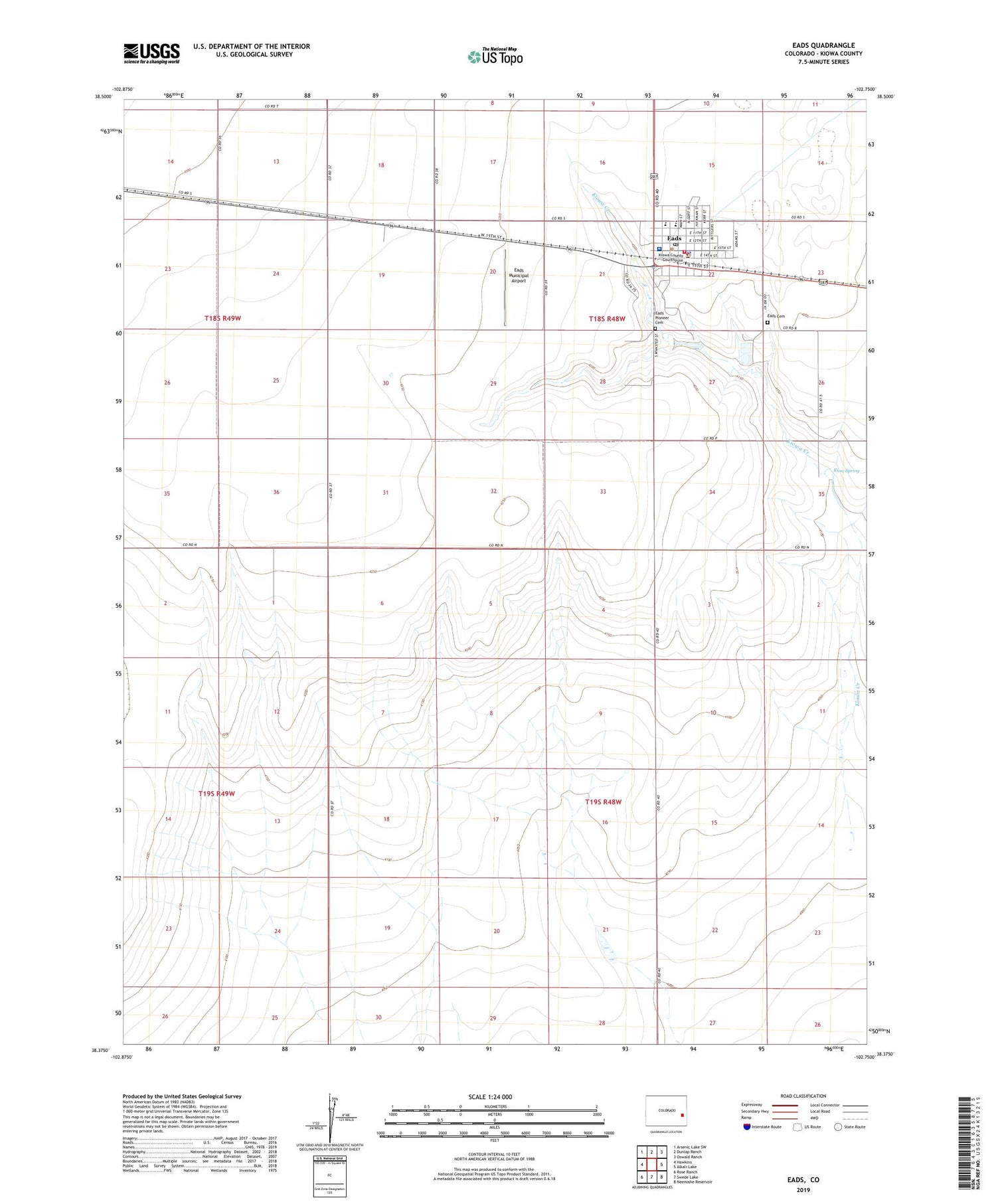
2022 topographic map quadrangle Eads in the state of Colorado. Scale: 1:24000. Based on the newly updated USGS 7.5' US Topo map series, this map is in the following counties: Kiowa. The map contains contour data, water features, and other items you are used to seeing on USGS maps, but also has updated roads and other features. This is the next generation of topographic maps. Printed on high-quality waterproof paper with UV fade-resistant inks.
Quads adjacent to this one:
West: Hawkins
Northwest: Arsenic Lake SW
North: Dunlap Ranch
Northeast: Oswald Ranch
East: Alkali Lake
Southeast: Neenoshe Reservoir
South: Swede Lake
Southwest: Rose Ranch
This map covers the same area as the classic USGS quad with code o38102d7.
Contains the following named places: Eads, Eads Cemetery, Eads Division, Eads Municipal Airport, Eads Pioneer Cemetery, Eads Post Office, Kiow Spring, Kiowa County Ambulance Service, Kiowa County Fire Protection District, Kiowa County Sheriff's Office, Kiowa Creek, Town of Eads, Weisbrod Memorial County Hospital, ZIP Code: 81036