MyTopo
Haegler Ranch Colorado US Topo Map
Couldn't load pickup availability
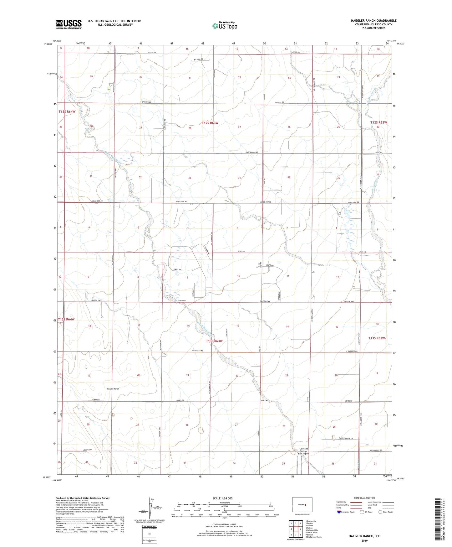
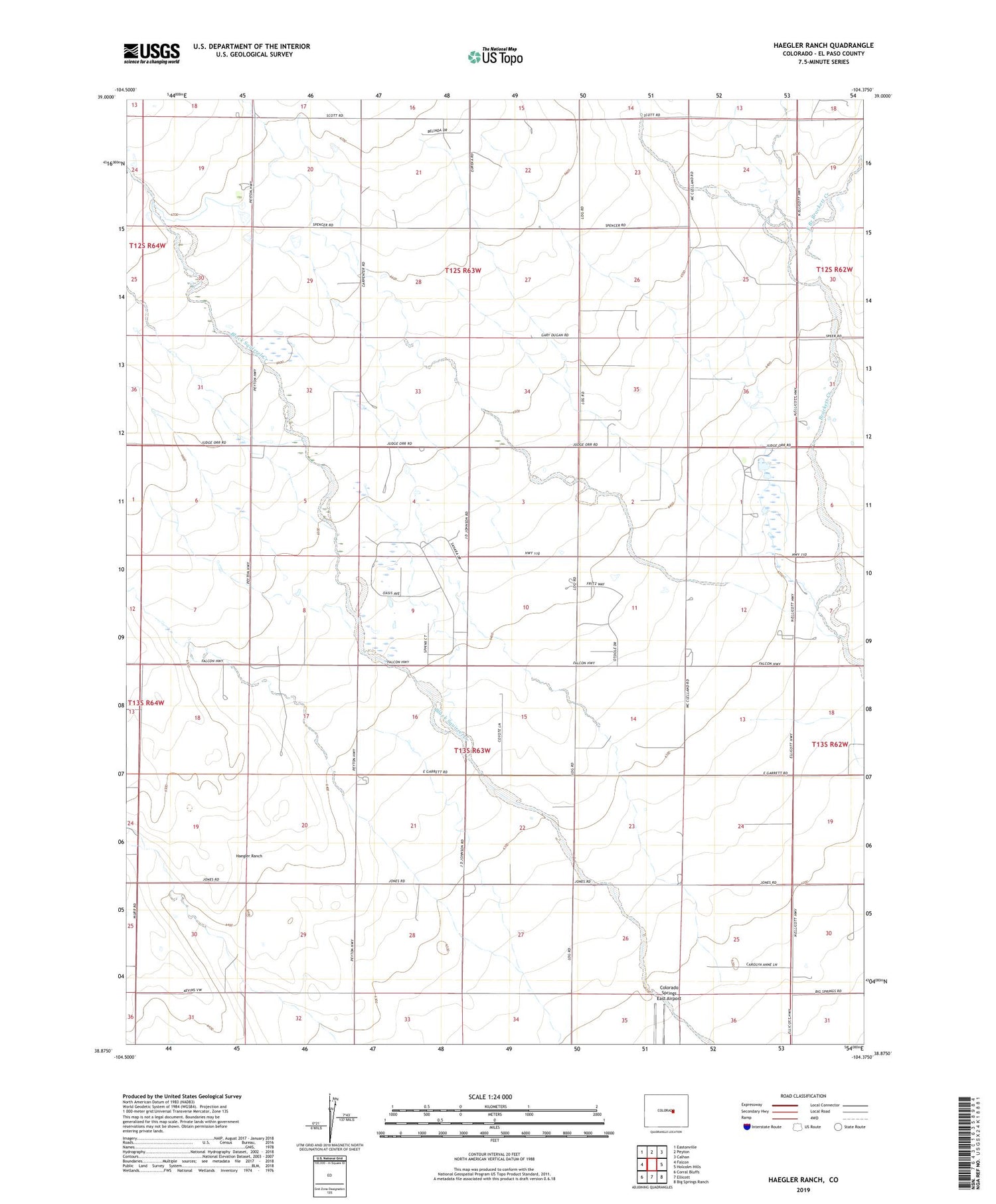
2022 topographic map quadrangle Haegler Ranch in the state of Colorado. Scale: 1:24000. Based on the newly updated USGS 7.5' US Topo map series, this map is in the following counties: El Paso. The map contains contour data, water features, and other items you are used to seeing on USGS maps, but also has updated roads and other features. This is the next generation of topographic maps. Printed on high-quality waterproof paper with UV fade-resistant inks.
Quads adjacent to this one:
West: Falcon
Northwest: Eastonville
North: Peyton
Northeast: Calhan
East: Holcolm Hills
Southeast: Big Springs Ranch
South: Ellicott
Southwest: Corral Bluffs
This map covers the same area as the classic USGS quad with code o38104h4.
Contains the following named places: East Branch Brackett Creek, Eisco Airport, Haegler Ranch, Hook and Line Ranch, La Vega Ranch, ZIP Code: 80831