
MyTopo
Hartsel Colorado US Topo Map
Couldn't load pickup availability
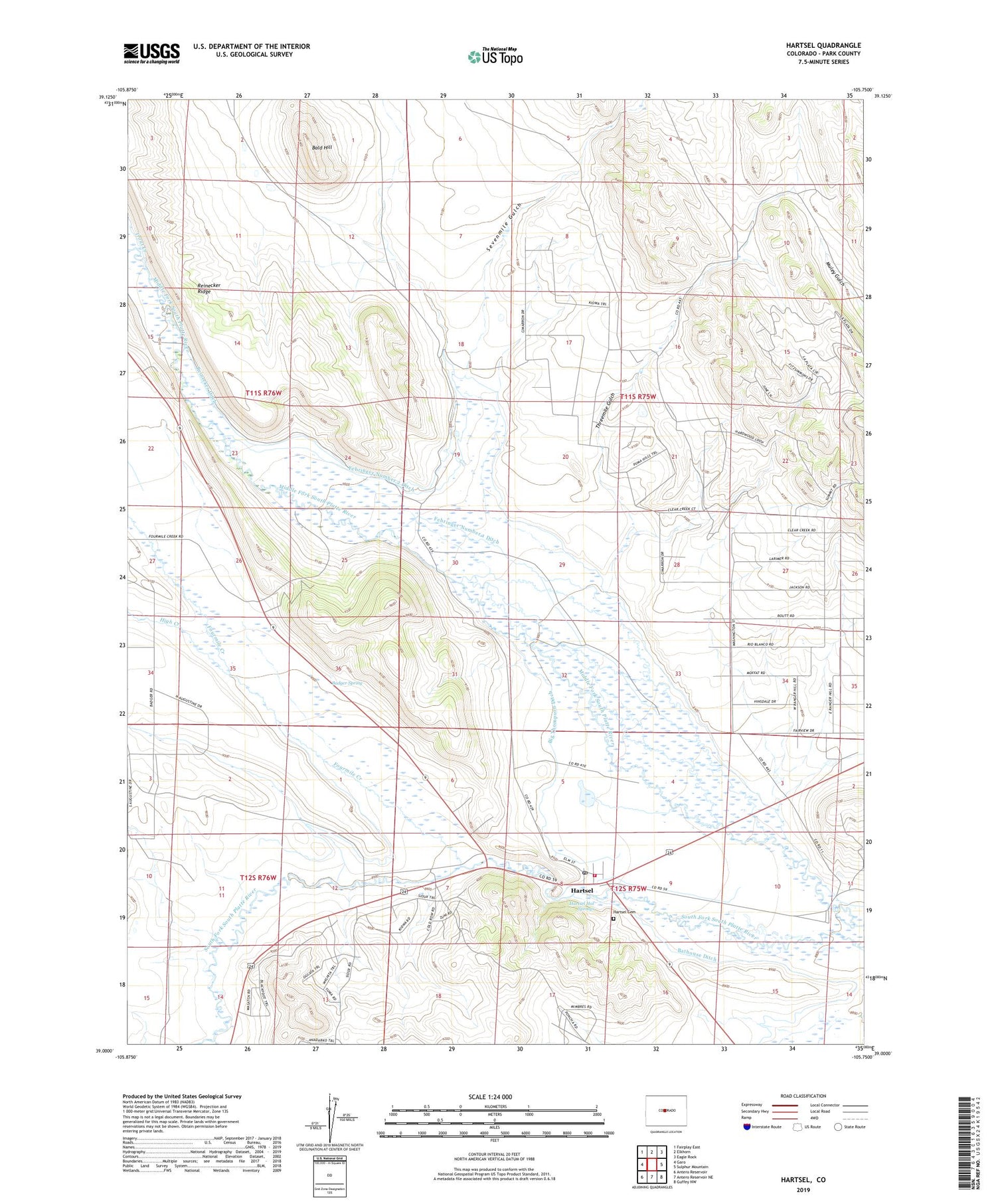
2022 topographic map quadrangle Hartsel in the state of Colorado. Scale: 1:24000. Based on the newly updated USGS 7.5' US Topo map series, this map is in the following counties: Park. The map contains contour data, water features, and other items you are used to seeing on USGS maps, but also has updated roads and other features. This is the next generation of topographic maps. Printed on high-quality waterproof paper with UV fade-resistant inks.
Quads adjacent to this one:
West: Garo
Northwest: Fairplay East
North: Elkhorn
Northeast: Eagle Rock
East: Sulphur Mountain
Southeast: Guffey NW
South: Antero Reservoir NE
Southwest: Antero Reservoir
This map covers the same area as the classic USGS quad with code o39105a7.
Contains the following named places: Badger Spring, Badger Spring Ranch, Bald Hill, Bathouse Ditch, Big Thompson Ditch, Carruthers Ranch, Colton Sheep Camp, Fehringer Number 1 Ditch, Fehringer Number 2 Ditch, Fourmile Creek, Hartsel, Hartsel Cemetery, Hartsel Census Designated Place, Hartsel Fire Protection District Station 1, Hartsel Hot Springs, Hartsel Post Office, Hartsel Ranch, High Creek, Hot Springs, Reinecker Ditch, Santa Maria Ranch, Sevenmile Gulch, Shoemate-Augustine Ranch, South Park Mining Company Mine, Threemile Gulch, Trout Creek, Turner Ranch


