MyTopo
Holly East Colorado US Topo Map
Couldn't load pickup availability
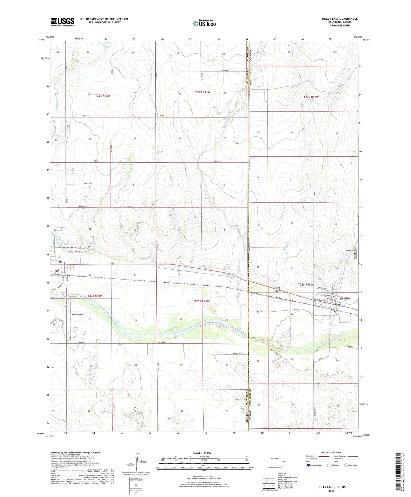
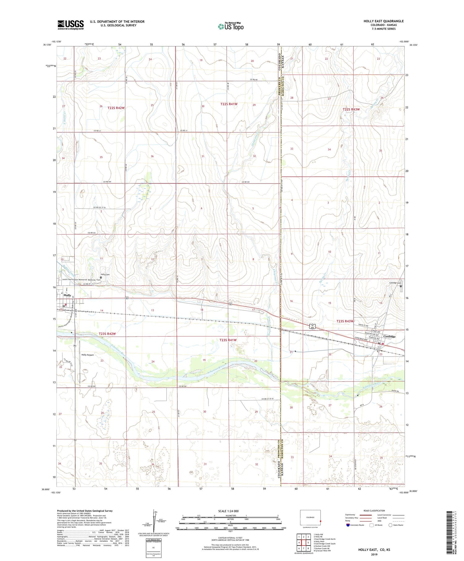
2022 topographic map quadrangle Holly East in the states of Colorado, Kansas. Scale: 1:24000. Based on the newly updated USGS 7.5' US Topo map series, this map is in the following counties: Prowers, Hamilton. The map contains contour data, water features, and other items you are used to seeing on USGS maps, but also has updated roads and other features. This is the next generation of topographic maps. Printed on high-quality waterproof paper with UV fade-resistant inks.
Quads adjacent to this one:
West: Holly West
Northwest: Holly NW
North: Holly NE
Northeast: East Bridge Creek North
East: East Bridge Creek South
Southeast: Syracuse West NW
South: Durkee Creek NE
Southwest: Durkee Creek NW
Contains the following named places: Bridge Creek, Cheyenne Creek, City of Coolidge, Coolidge, Coolidge Cemetery, Coolidge Post Office, Coolidge Wastewater Plant, East Horse Creek, Hamilton County Fire Department Coolidge Station, Holly, Holly Airport, Holly Cemetery, Holly Dump, Holly Post Office, Holly Volunteer Fire Department, Rock Tower Well, Santa Fe Trail Marker, Scoular Company Grain Elevator Number 2, Site of Old Trail City, Spring Creek, Town of Holly, Wild Horse Creek, Wood Reservoir, ZIP Code: 67836