MyTopo
Holyoke Colorado US Topo Map
Couldn't load pickup availability
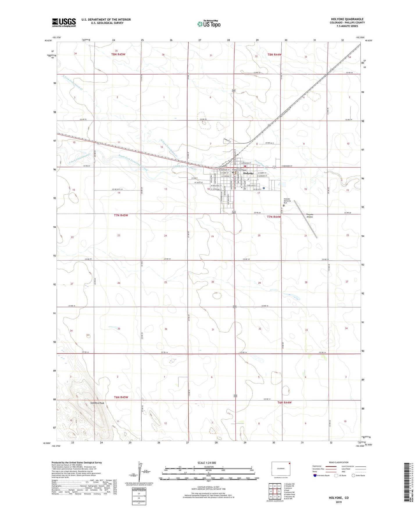
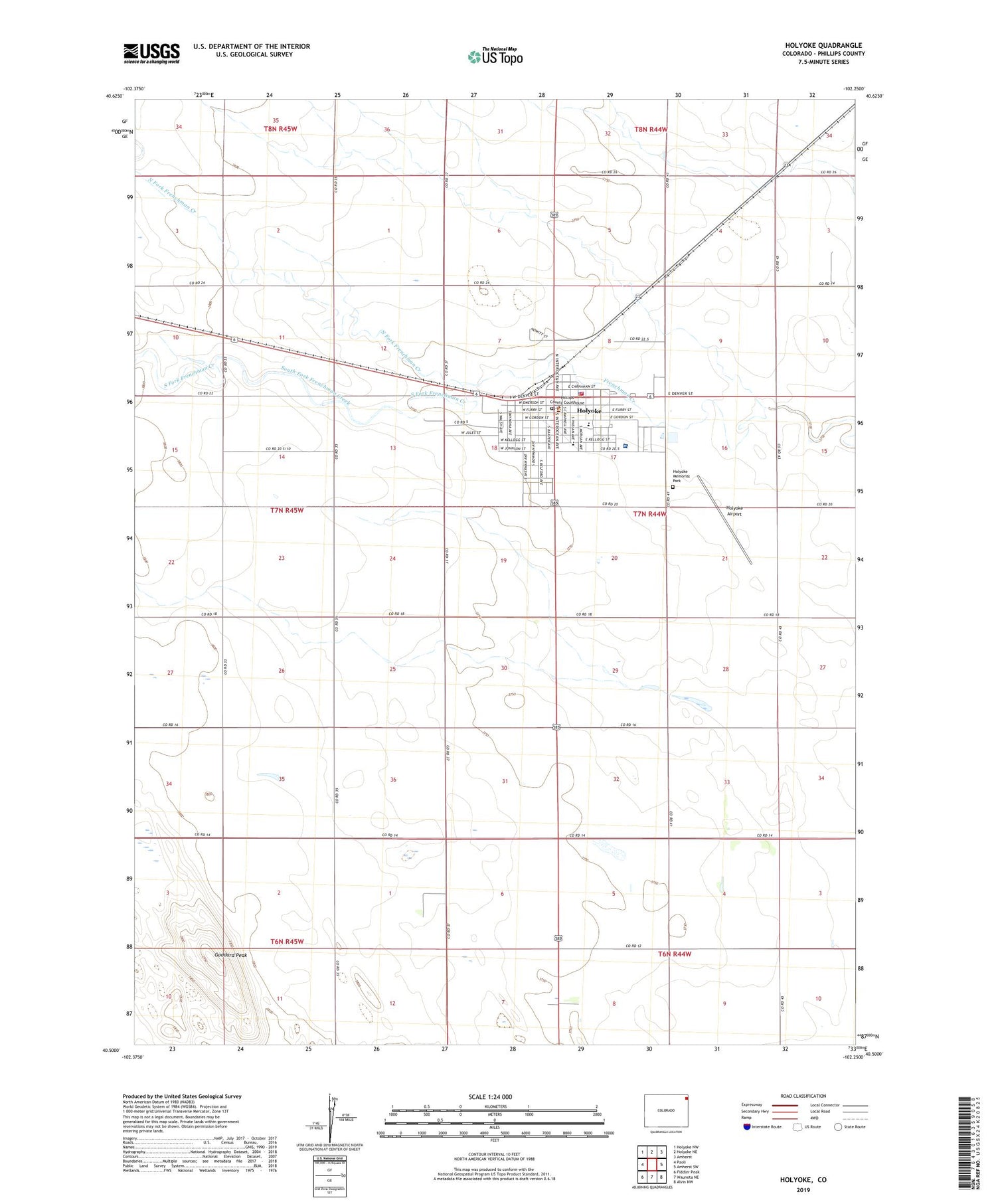
2022 topographic map quadrangle Holyoke in the state of Colorado. Scale: 1:24000. Based on the newly updated USGS 7.5' US Topo map series, this map is in the following counties: Phillips. The map contains contour data, water features, and other items you are used to seeing on USGS maps, but also has updated roads and other features. This is the next generation of topographic maps. Printed on high-quality waterproof paper with UV fade-resistant inks.
Quads adjacent to this one:
West: Paoli
Northwest: Holyoke NW
North: Holyoke NE
Northeast: Amherst
East: Amherst SW
Southeast: Alvin NW
South: Wauneta NE
Southwest: Fiddler Peak
This map covers the same area as the classic USGS quad with code o40102e3.
Contains the following named places: City of Holyoke, Dogtown Flats School, East Phillips County Ambulance, Goddard Peak, Holyoke, Holyoke Airport, Holyoke Memorial Park, Holyoke Police Department, Holyoke Post Office, Holyoke Volunteer Fire Department, Melissa Memorial Hospital, North Fork Frenchman Creek, Phillips County, Phillips County Sheriff's Office, South Fork Frenchman Creek, ZIP Code: 80734