
MyTopo
Hooker Mountain Colorado US Topo Map
Couldn't load pickup availability
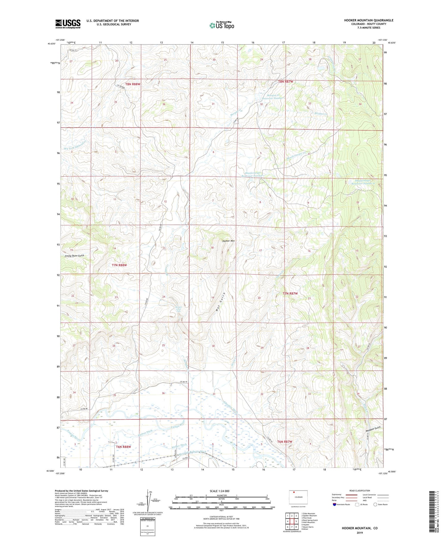
2022 topographic map quadrangle Hooker Mountain in the state of Colorado. Scale: 1:24000. Based on the newly updated USGS 7.5' US Topo map series, this map is in the following counties: Routt. The map contains contour data, water features, and other items you are used to seeing on USGS maps, but also has updated roads and other features. This is the next generation of topographic maps. Printed on high-quality waterproof paper with UV fade-resistant inks.
Quads adjacent to this one:
West: Rock Spring Gulch
Northwest: Slide Mountain
North: Quaker Mountain
Northeast: Pilot Knob
East: Wolf Mountain
Southeast: Milner
South: Mount Harris
Southwest: Hayden
This map covers the same area as the classic USGS quad with code o40107e2.
Contains the following named places: Champion Mine, Fish Creek, Gibralter Ditch, Goose Creek, Hayden Division, Hooker Mountain, Mat Gulch, Meadow Gulch, Morgan Creek, Morgan Creek Falls, Morgan Creek Number 1 Dam, Morgan Creek Reservoir Number 1, Shaefermeyer Creek, Shaefermeyer Reservoir Number 1, Shaefermeyer Reservoir Number 4, ZIP Code: 81639


