MyTopo
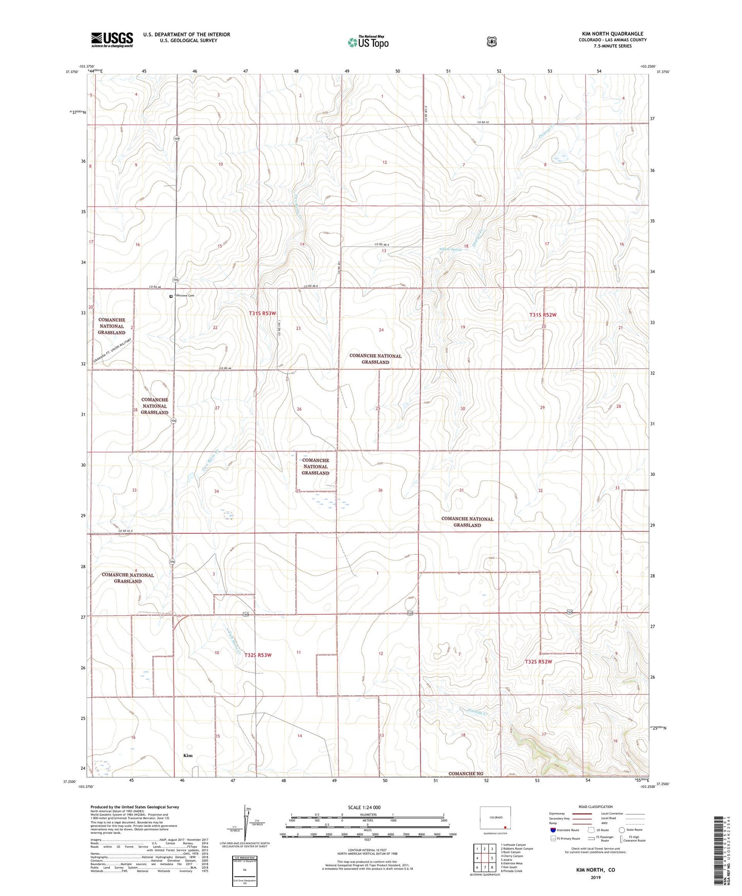
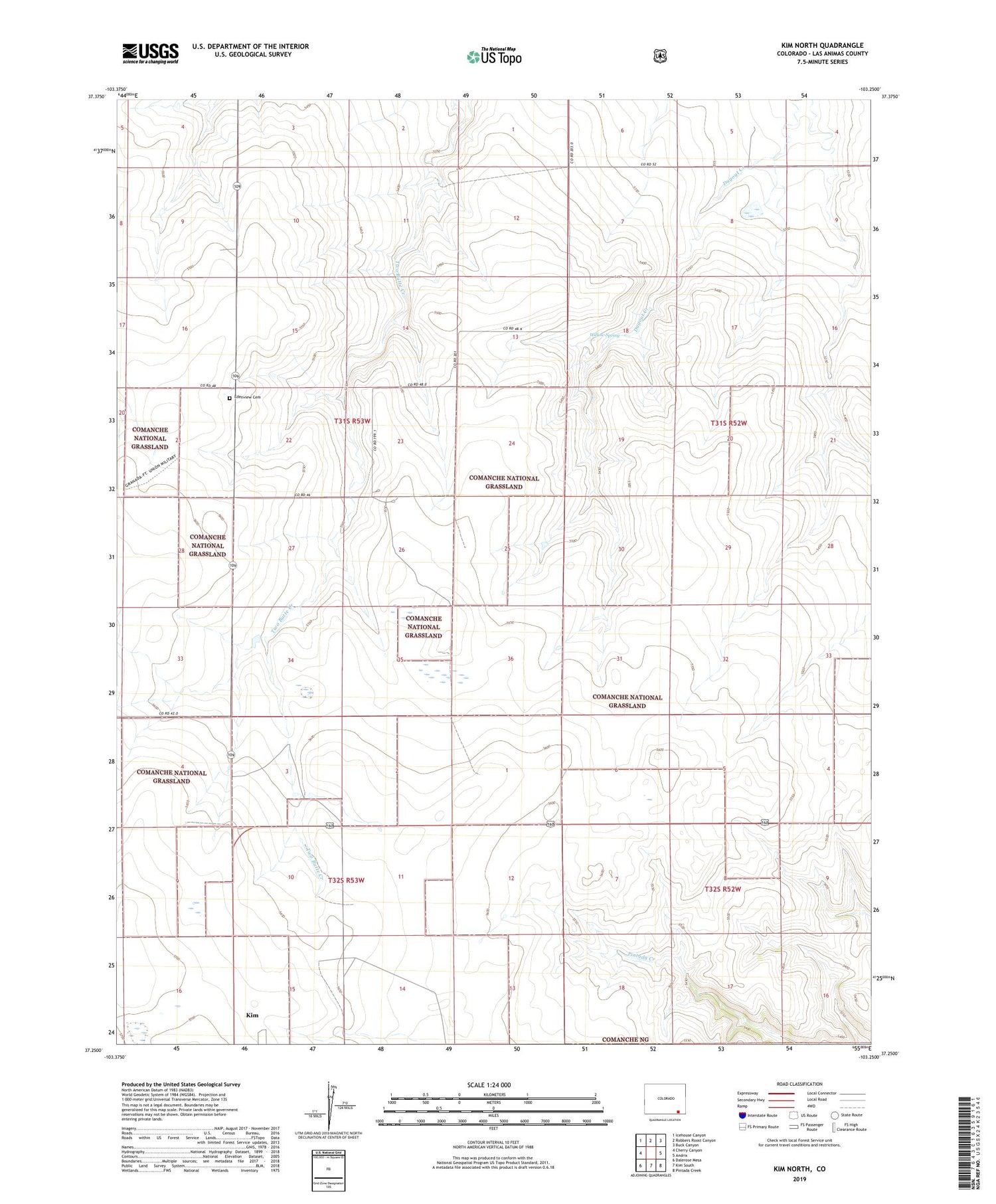
Kim North Colorado US Topo Map
Couldn't load pickup availability
Also explore the Kim North Forest Service Topo of this same quad for updated USFS data
2022 topographic map quadrangle Kim North in the state of Colorado. Scale: 1:24000. Based on the newly updated USGS 7.5' US Topo map series, this map is in the following counties: Las Animas. The map contains contour data, water features, and other items you are used to seeing on USGS maps, but also has updated roads and other features. This is the next generation of topographic maps. Printed on high-quality waterproof paper with UV fade-resistant inks.
Quads adjacent to this one:
West: Cherry Canyon
Northwest: Icehouse Canyon
North: Robbers Roost Canyon
Northeast: Buck Canyon
East: Andrix
Southeast: Pintada Creek
South: Kim South
Southwest: Dalerose Mesa
This map covers the same area as the classic USGS quad with code o37103c3.
Contains the following named places: Carl Sammons Division Dam, Carl Sammons Division Reservoir, Edenview Cemetery, Kim Division, Willow Spring