MyTopo
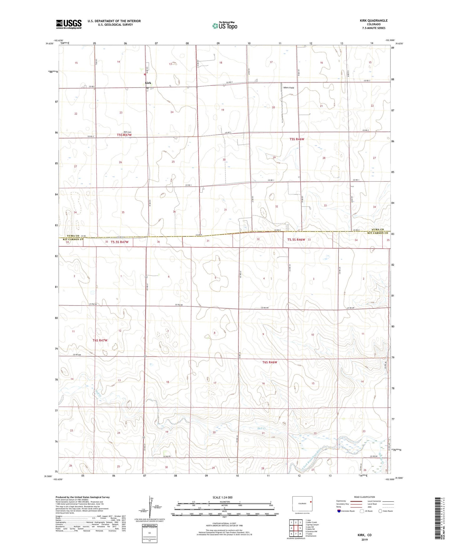
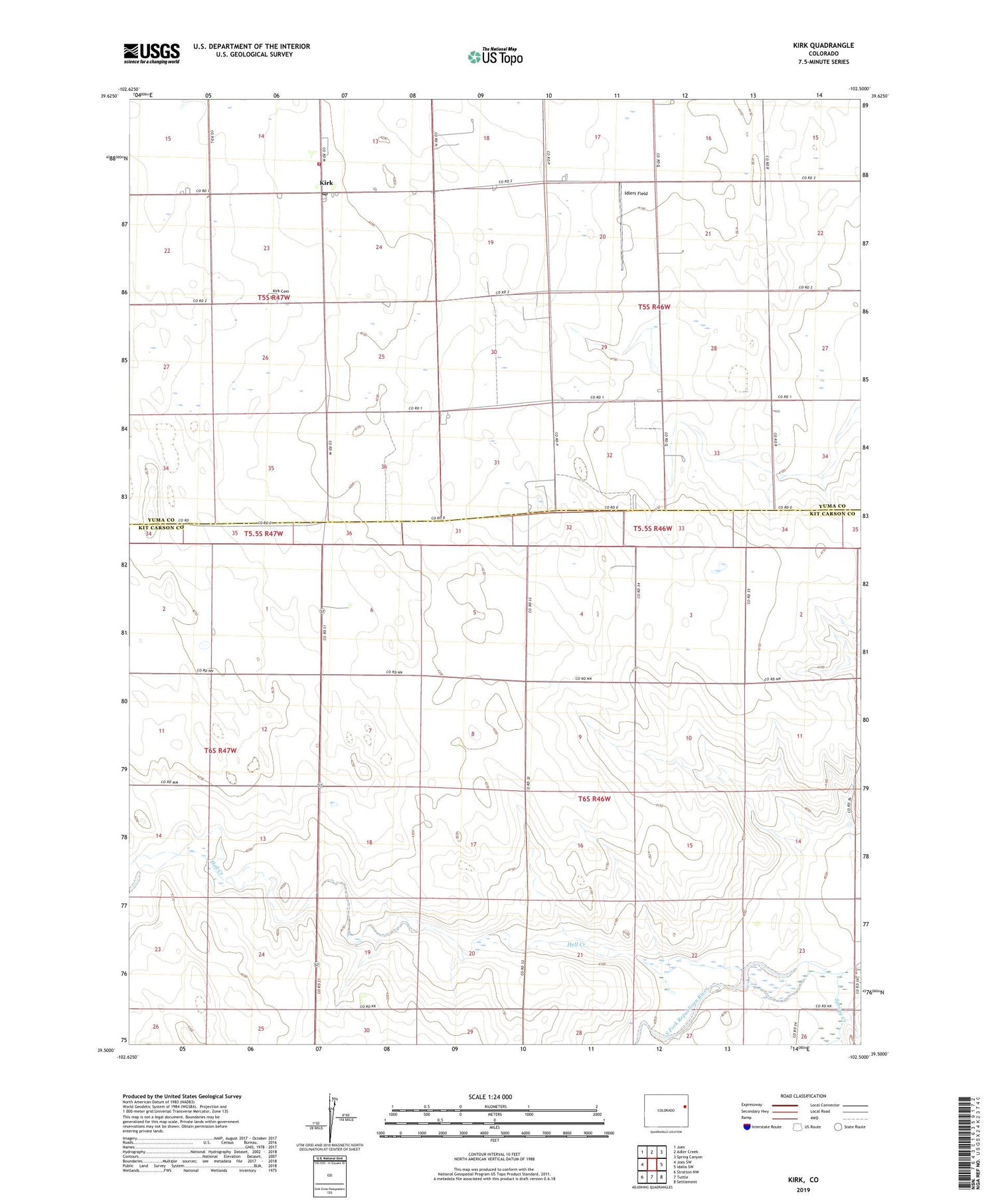
Kirk Colorado US Topo Map
Couldn't load pickup availability
2022 topographic map quadrangle Kirk in the state of Colorado. Scale: 1:24000. Based on the newly updated USGS 7.5' US Topo map series, this map is in the following counties: Kit Carson, Yuma. The map contains contour data, water features, and other items you are used to seeing on USGS maps, but also has updated roads and other features. This is the next generation of topographic maps. Printed on high-quality waterproof paper with UV fade-resistant inks.
Quads adjacent to this one:
West: Joes SW
Northwest: Joes
North: Adler Creek
Northeast: Spring Canyon
East: Idalia SW
Southeast: Settlement
South: Tuttle
Southwest: Stratton NW
This map covers the same area as the classic USGS quad with code o39102e5.
Contains the following named places: Hell Creek, Idlers Field, Kirk, Kirk Cemetery, Kirk Census Designated Place, Kirk Post Office, Kirk Volunteer Fire Department, Royce Darling Memorial Golf Course, South Y - W Ambulance, Spring Creek