MyTopo
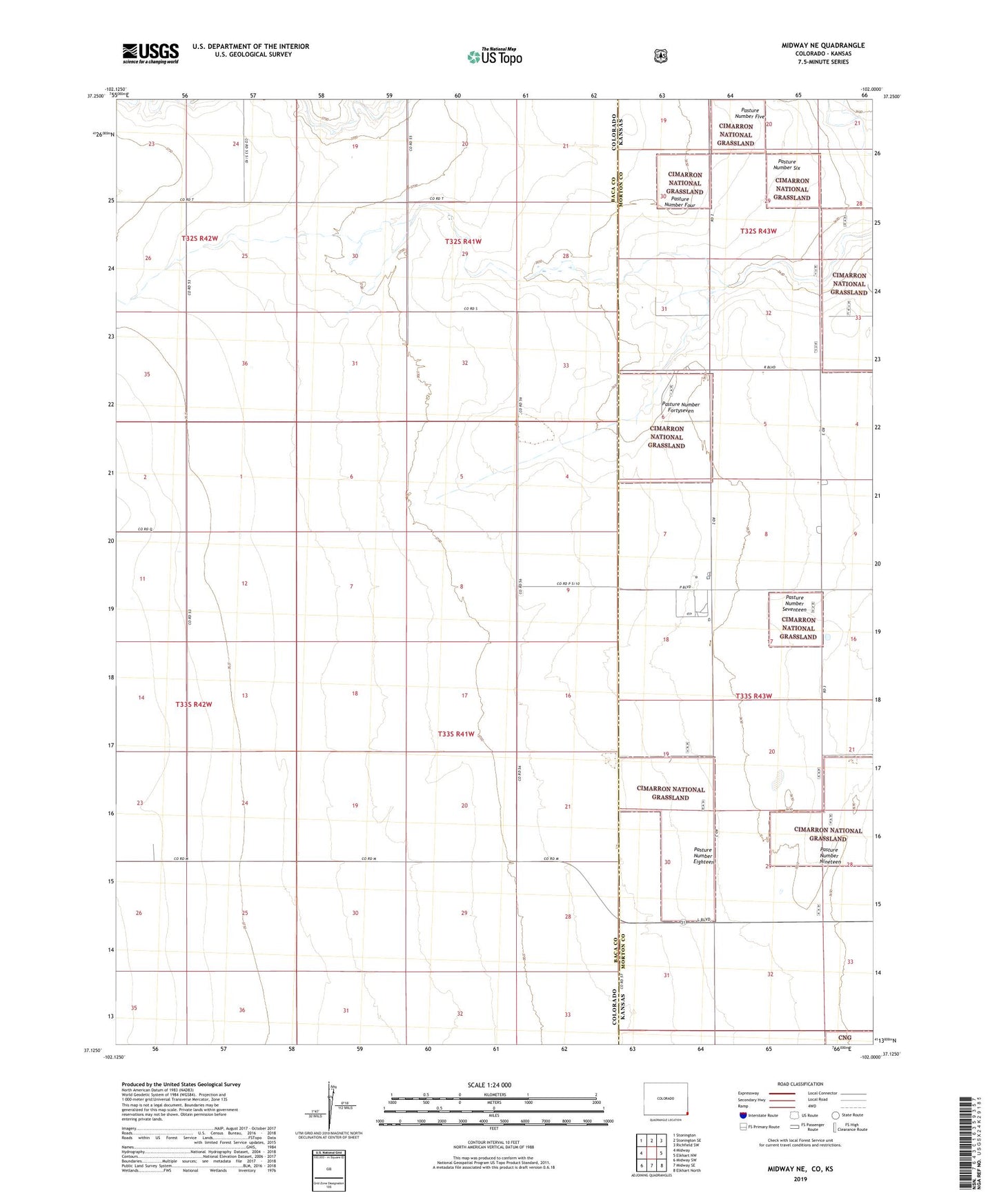
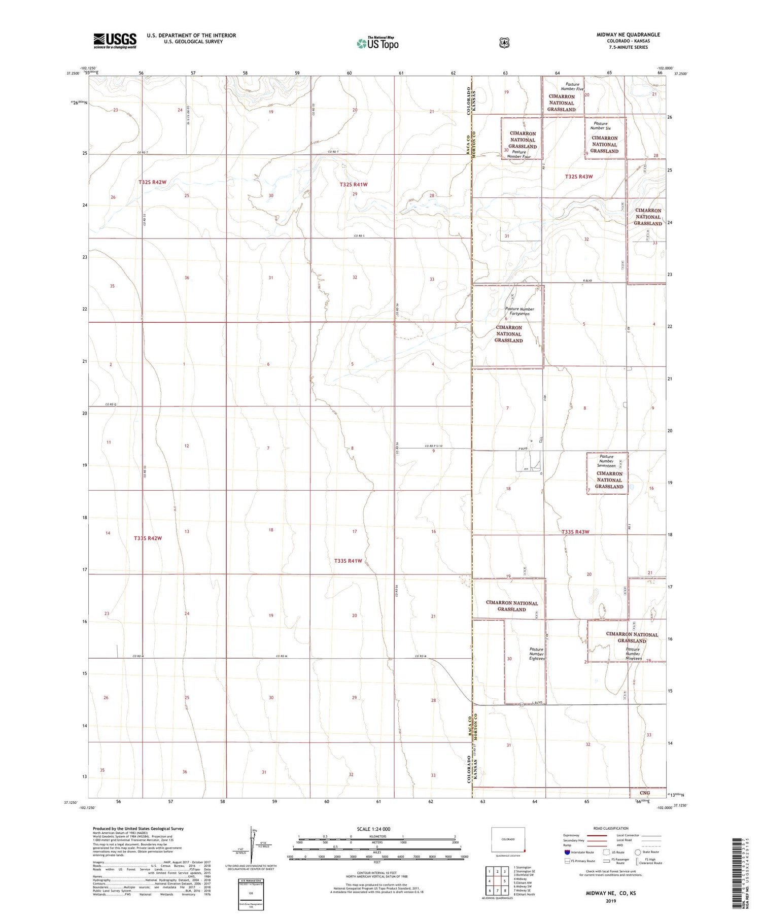
Midway NE Colorado US Topo Map
Couldn't load pickup availability
Also explore the Midway NE Forest Service Topo of this same quad for updated USFS data
2022 topographic map quadrangle Midway NE in the state of Colorado. Scale: 1:24000. Based on the newly updated USGS 7.5' US Topo map series, this map is in the following counties: Baca, Morton. The map contains contour data, water features, and other items you are used to seeing on USGS maps, but also has updated roads and other features. This is the next generation of topographic maps. Printed on high-quality waterproof paper with UV fade-resistant inks.
Quads adjacent to this one:
West: Midway
Northwest: Stonington
North: Stonington SE
Northeast: Richfield SW
East: Elkhart NW
Southeast: Elkhart North
South: Midway SE
Southwest: Midway SW
Contains the following named places: Colorado Interstate Gas Morton East Pumping Station, Pasture Number Eighteen, Pasture Number Five, Pasture Number Fortyseven, Pasture Number Four, Pasture Number Nineteen, Pasture Number Seventeen, Pasture Number Six, Taloga, Taloga School