MyTopo
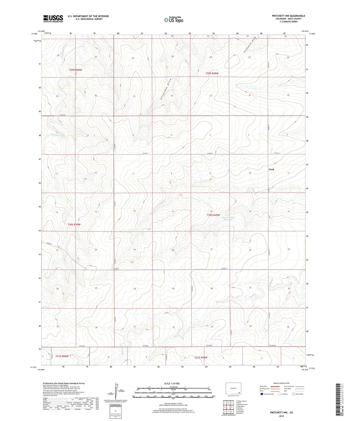
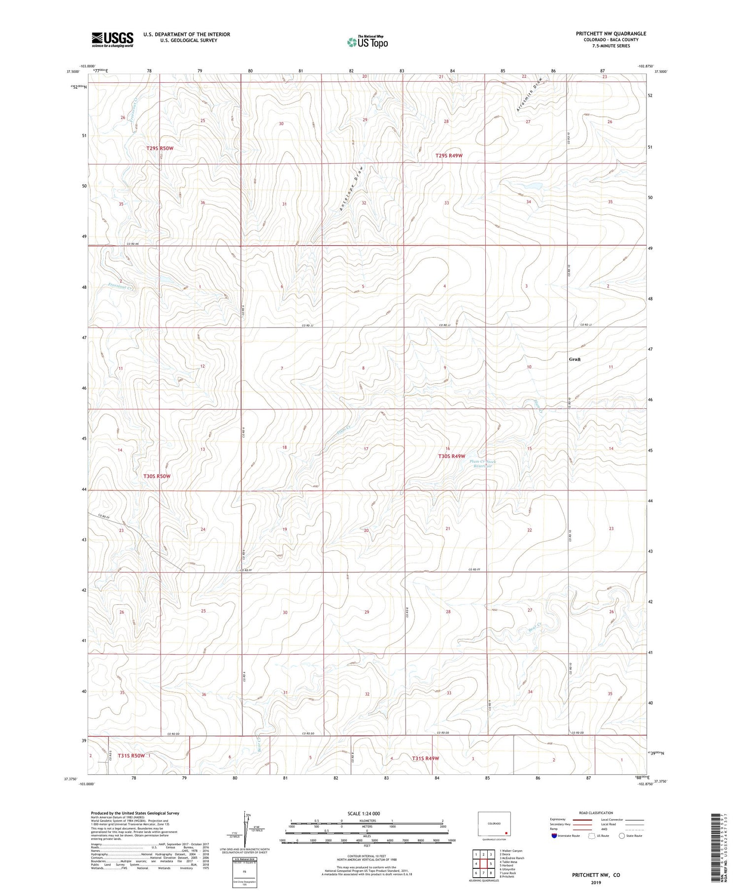
Pritchett NW Colorado US Topo Map
Couldn't load pickup availability
Also explore the Pritchett NW Forest Service Topo of this same quad for updated USFS data
2022 topographic map quadrangle Pritchett NW in the state of Colorado. Scale: 1:24000. Based on the newly updated USGS 7.5' US Topo map series, this map is in the following counties: Baca. The map contains contour data, water features, and other items you are used to seeing on USGS maps, but also has updated roads and other features. This is the next generation of topographic maps. Printed on high-quality waterproof paper with UV fade-resistant inks.
Quads adjacent to this one:
West: Table Mesa
Northwest: Walker Canyon
North: Deora
Northeast: McEndree Ranch
East: Harbord
Southeast: Pritchett
South: Lone Rock
Southwest: Utleyville
This map covers the same area as the classic USGS quad with code o37102d8.
Contains the following named places: Antelope Springs, Graft, Granada - Fort Union Route of Santa Fe National Historic Trail, Plum Creek Stock Dam, Plum Creek Stock Reservoir