MyTopo
Rock Creek Colorado US Topo Map
Couldn't load pickup availability
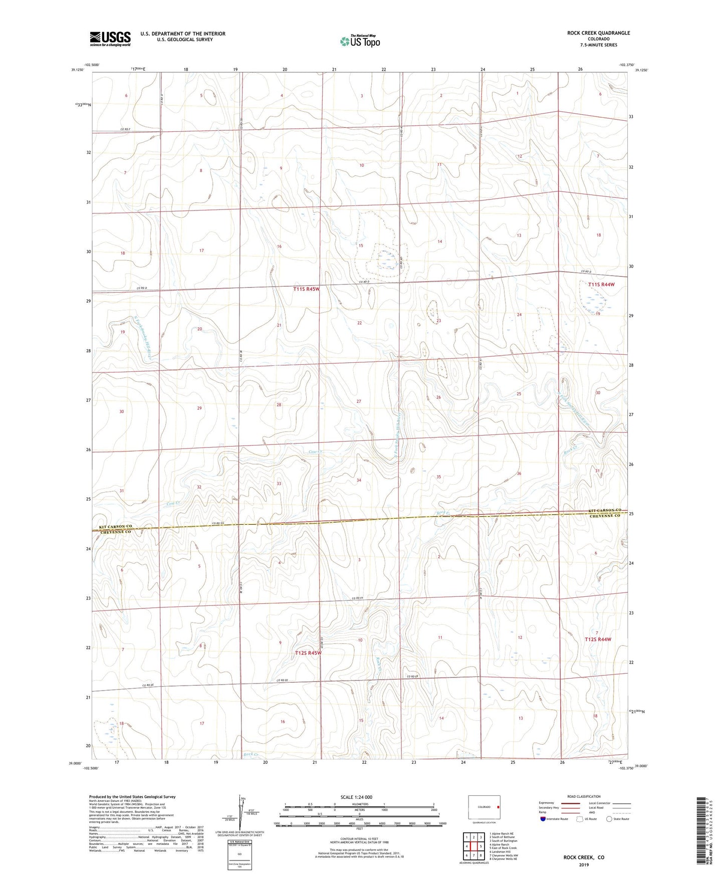
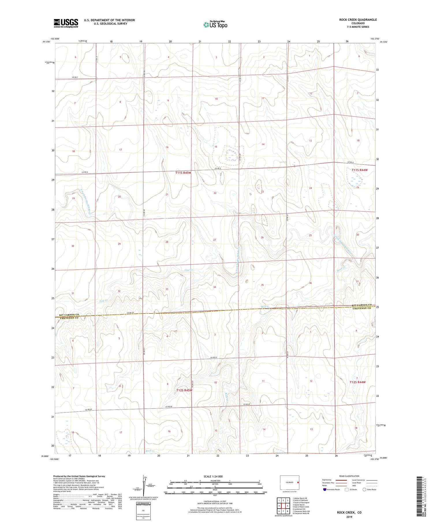
2022 topographic map quadrangle Rock Creek in the state of Colorado. Scale: 1:24000. Based on the newly updated USGS 7.5' US Topo map series, this map is in the following counties: Kit Carson, Cheyenne. The map contains contour data, water features, and other items you are used to seeing on USGS maps, but also has updated roads and other features. This is the next generation of topographic maps. Printed on high-quality waterproof paper with UV fade-resistant inks.
Quads adjacent to this one:
West: Alpine Ranch
Northwest: Alpine Ranch NE
North: South of Bethune
Northeast: South of Burlington
East: East of Rock Creek
Southeast: Cheyenne Wells NE
South: Cheyenne Wells NW
Southwest: Landsman Hill
This map covers the same area as the classic USGS quad with code o39102a4.
Contains the following named places: Cow Creek, Rock Creek, Windrift Ranch