MyTopo
Trimble Lake Colorado US Topo Map
Couldn't load pickup availability
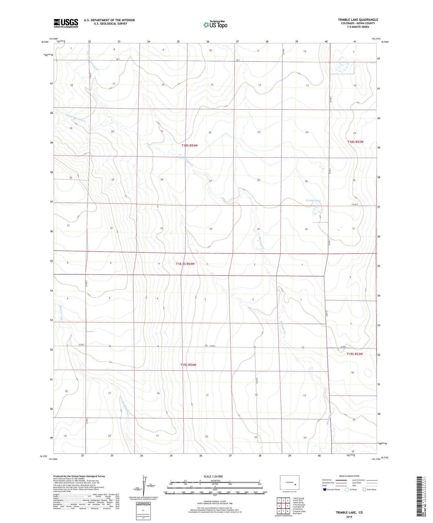
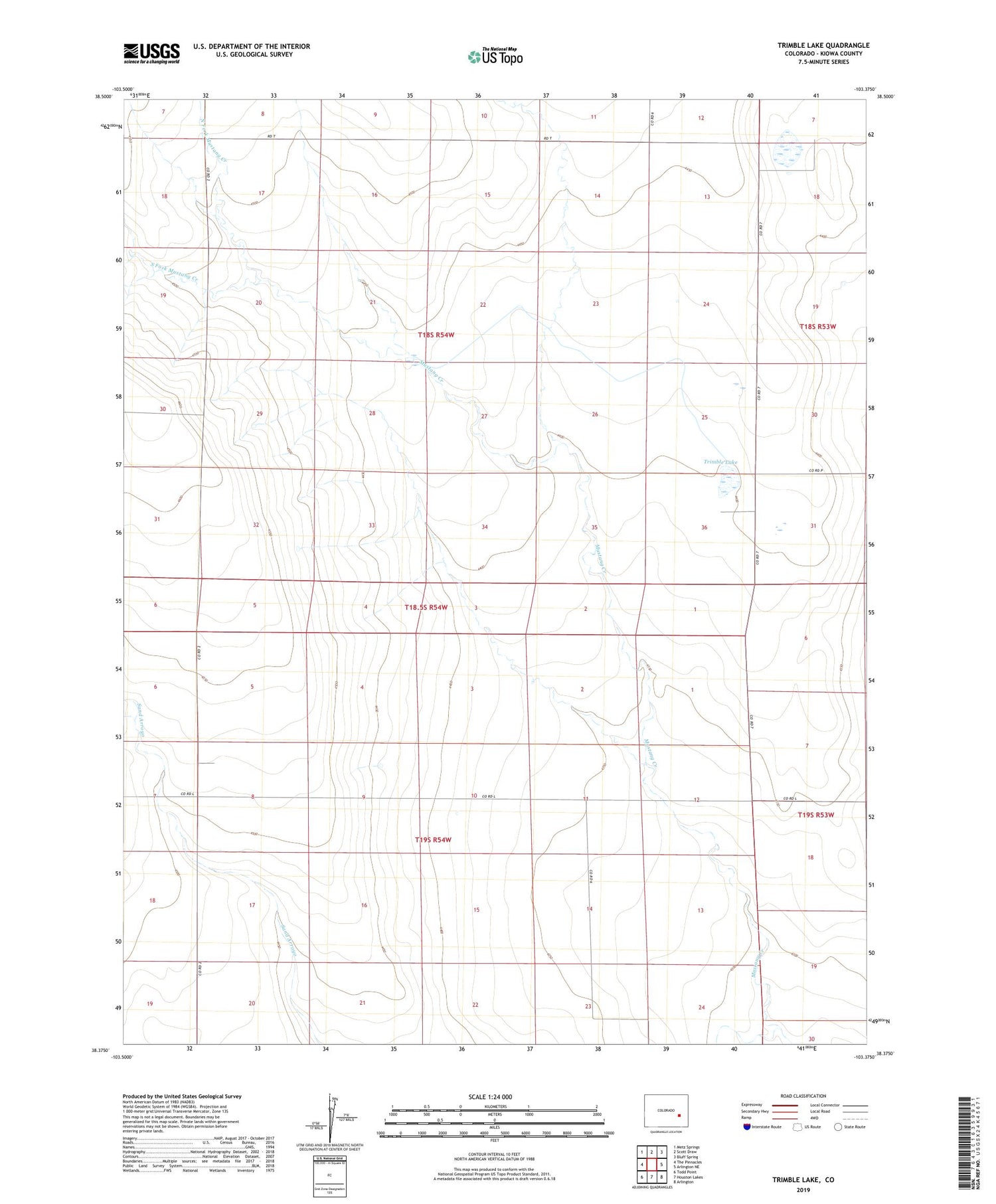
2022 topographic map quadrangle Trimble Lake in the state of Colorado. Scale: 1:24000. Based on the newly updated USGS 7.5' US Topo map series, this map is in the following counties: Kiowa. The map contains contour data, water features, and other items you are used to seeing on USGS maps, but also has updated roads and other features. This is the next generation of topographic maps. Printed on high-quality waterproof paper with UV fade-resistant inks.
Quads adjacent to this one:
West: The Pinnacles
Northwest: Metz Springs
North: Scott Draw
Northeast: Bluff Spring
East: Arlington NE
Southeast: Arlington
South: Houston Lakes
Southwest: Todd Point
This map covers the same area as the classic USGS quad with code o38103d4.
Contains the following named places: Best Dam, Best Reservoir, North Fork Mustang Creek, Sand Arroyo, South Fork Mustang Creek, Trimble Lake, ZIP Code: 81021