MyTopo
Weldona Colorado US Topo Map
Couldn't load pickup availability
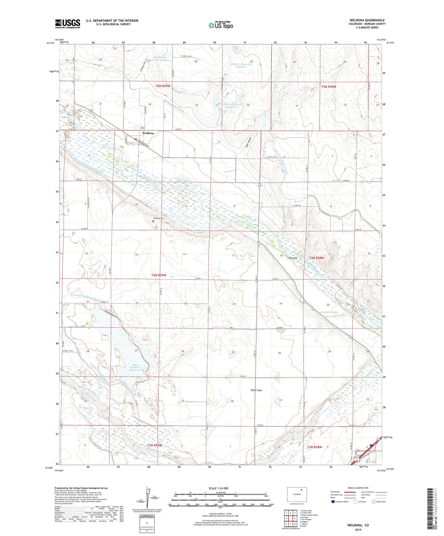
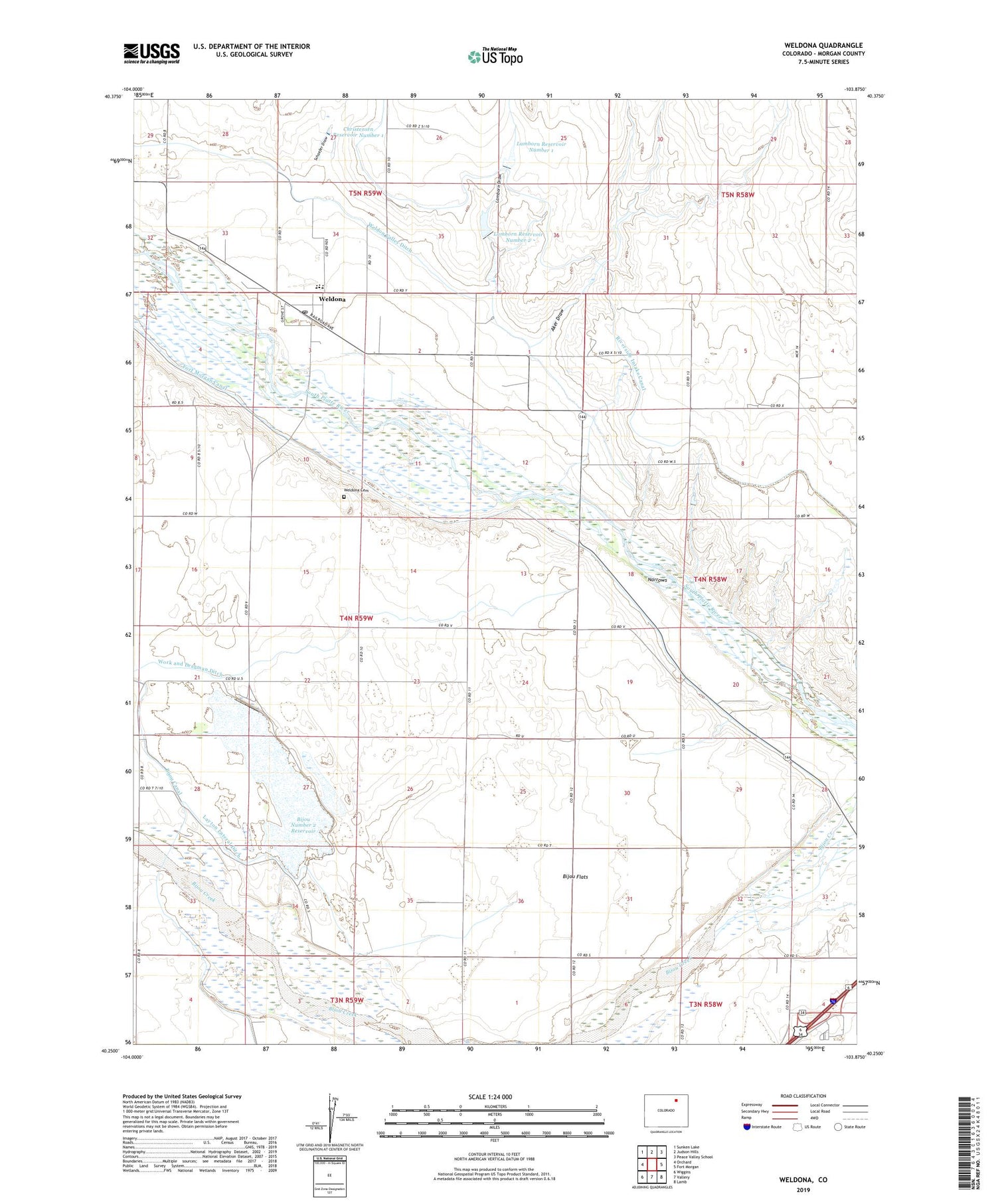
2022 topographic map quadrangle Weldona in the state of Colorado. Scale: 1:24000. Based on the newly updated USGS 7.5' US Topo map series, this map is in the following counties: Morgan. The map contains contour data, water features, and other items you are used to seeing on USGS maps, but also has updated roads and other features. This is the next generation of topographic maps. Printed on high-quality waterproof paper with UV fade-resistant inks.
Quads adjacent to this one:
West: Orchard
Northwest: Sunken Lake
North: Judson Hills
Northeast: Peace Valley School
East: Fort Morgan
Southeast: Lamb
South: Vallery
Southwest: Wiggins
This map covers the same area as the classic USGS quad with code o40103c8.
Contains the following named places: Aker Draw, Bijou Flats, Bijou Number 2 Dam, Bijou Number 2 Reservoir, Chapin Dairy Farms, Christensen Number 1 Dam, Lamborn Draw, Lamborn Number 1 Dam, Lamborn Number 2 Dam, Lamborn Reservoir Number 1, Lamborn Reservoir Number 2, Layton Lateral Ditch, McCracken Farms, Narrows, Schaefer Draw, Weldona, Weldona Cemetery, Weldona Census Designated Place, Weldona Post Office, Work and Dragman Ditch