MyTopo
Bowling Green Florida US Topo Map
Couldn't load pickup availability
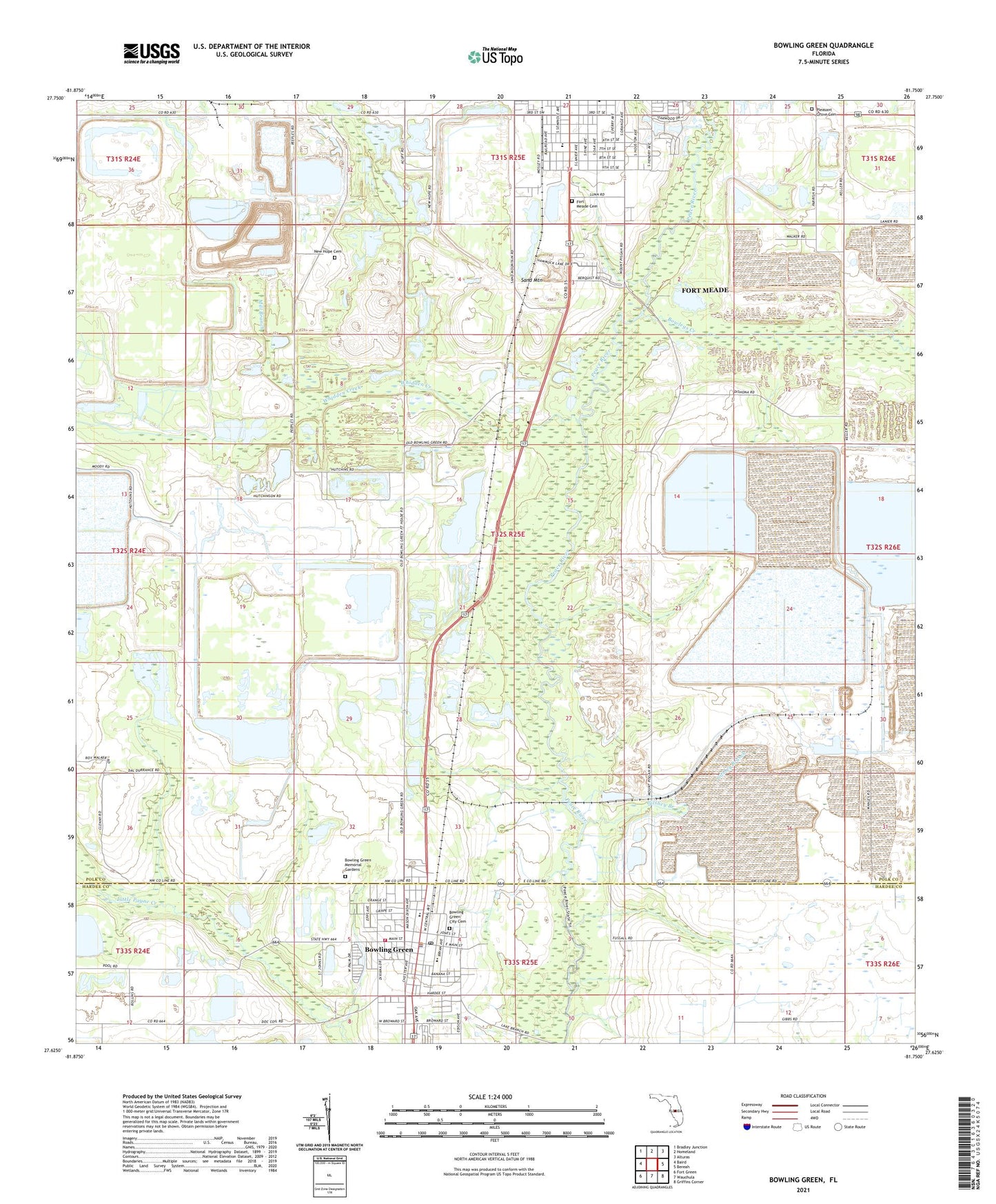
2024 topographic map quadrangle Bowling Green in the state of Florida. Scale: 1:24000. Based on the newly updated USGS 7.5' US Topo map series, this map is in the following counties: Polk, Hardee. The map contains contour data, water features, and other items you are used to seeing on USGS maps, but also has updated roads and other features. This is the next generation of topographic maps. Printed on high-quality waterproof paper with UV fade-resistant inks.
Quads adjacent to this one:
West: Baird
Northwest: Bradley Junction
North: Homeland
Northeast: Alturas
East: Bereah
Southeast: Griffins Corner
South: Wauchula
Southwest: Fort Green
This map covers the same area as the classic USGS quad with code o27081f7.
Contains the following named places: Bowlegs Creek, Bowling Green, Bowling Green Church of God, Bowling Green Elementary School, Bowling Green Police Department, Bowling Green Post Office, Christian Bible Fellowship Church, Christmas Tree Trailer Park, Church of the Living God, City of Bowling Green, Crooked Drain, Fort Meade Cemetery, Fort Meade Community Center, Fort Meade Middle School, Fort Meade Mobile Home Park, Gardner Mine Railroad Station, Gilshey Branch, Grace Mobile Home Park, Hammock Lake Mobile Estates, Hardee County Fire Rescue Department Station 3, Immanuel Baptist Church, Lewis Elementary School, McCullough Creek, McDuffie Mobile Home Park, Mill Branch, Mount Pisgah Church, New Hope Cemetery, Oakview Lakes Mobile Home Park, Paynes Creek Historic State Park, Peace River Church, Pleasant Grove Cemetery, Rockland Junction, Rockland Railroad Station, Sand Mountain, Swift Railroad Station, Twomile Lake, Valencia Mobile Home Park, Whidden Creek, ZIP Code: 33841