MyTopo
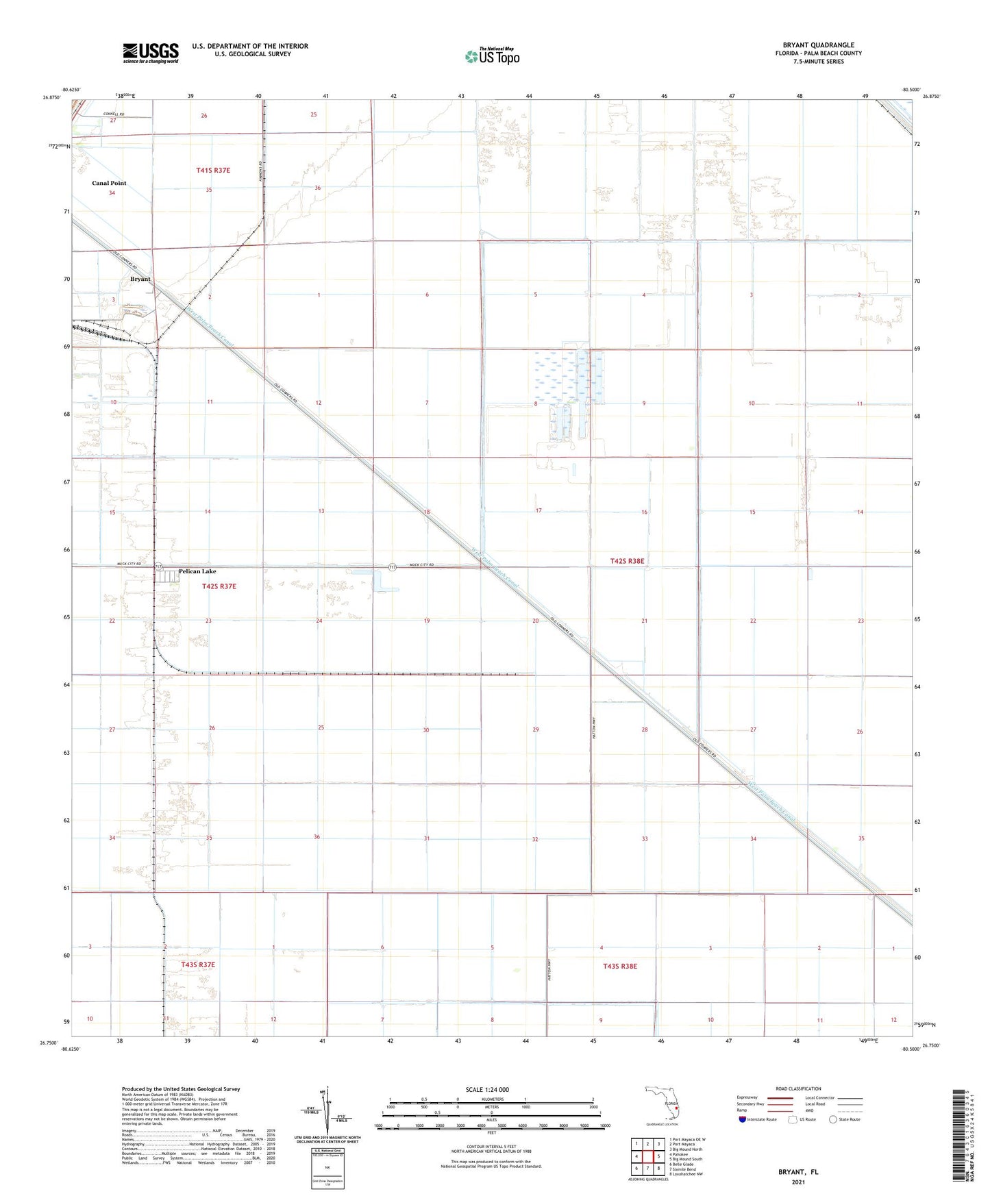
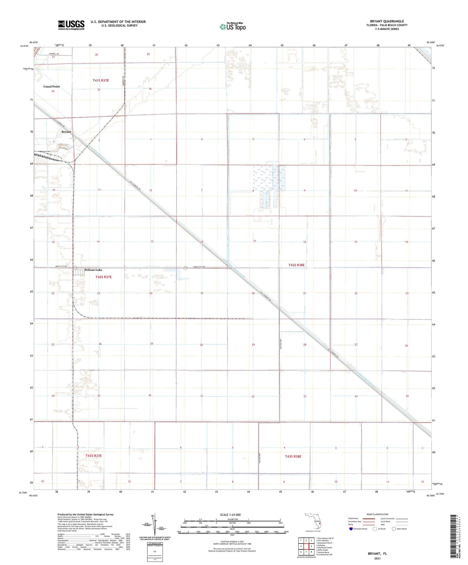
Bryant Florida US Topo Map
Couldn't load pickup availability
2024 topographic map quadrangle Bryant in the state of Florida. Scale: 1:24000. Based on the newly updated USGS 7.5' US Topo map series, this map is in the following counties: Palm Beach. The map contains contour data, water features, and other items you are used to seeing on USGS maps, but also has updated roads and other features. This is the next generation of topographic maps. Printed on high-quality waterproof paper with UV fade-resistant inks.
Quads adjacent to this one:
West: Pahokee
Northwest: Port Mayaca OE W
North: Port Mayaca
Northeast: Big Mound North
East: Big Mound South
Southeast: Loxahatchee NW
South: Sixmile Bend
Southwest: Belle Glade
This map covers the same area as the classic USGS quad with code o26080g5.
Contains the following named places: Bryant, Bryant Air Strip, Canal Point Census Designated Place, Pelican Lake, ZIP Code: 33476