MyTopo
Dry Tortugas OE E Florida US Topo Map
Couldn't load pickup availability
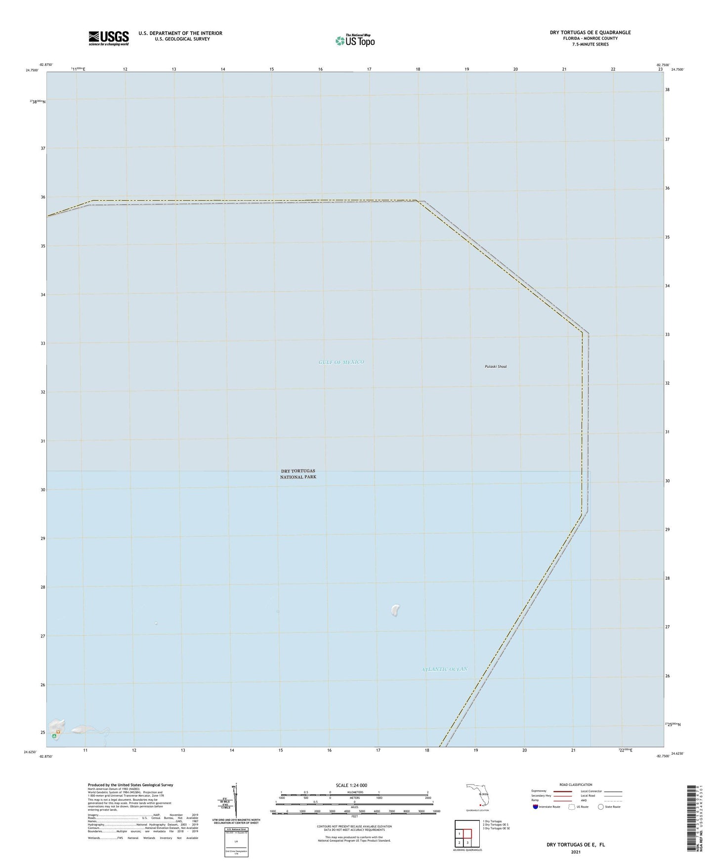
2025 topographic map quadrangle Dry Tortugas OE E in the state of Florida. Scale: 1:24000. Based on the newly updated USGS 7.5' US Topo map series, this map is in the following counties: Monroe. The map contains contour data, water features, and other items you are used to seeing on USGS maps, but also has updated roads and other features. This is the next generation of topographic maps. Printed on high-quality waterproof paper with UV fade-resistant inks.
Quads adjacent to this one:
West: Dry Tortugas
South: Dry Tortugas OE SE
Southwest: Dry Tortugas OE S
Contains the following named places: Bush Key, Bush Key Shoal, Dry Tortugas, Dry Tortugas National Park, East Key, Fort Jefferson, Fort Jefferson National Monument, Garden Key, Hospital Key, Long Key, Middle Ground, Middle Key, Northkey Harbor, Pulaski Shoal, Sawa Rock