MyTopo
Grossman Hammock Florida US Topo Map
Couldn't load pickup availability
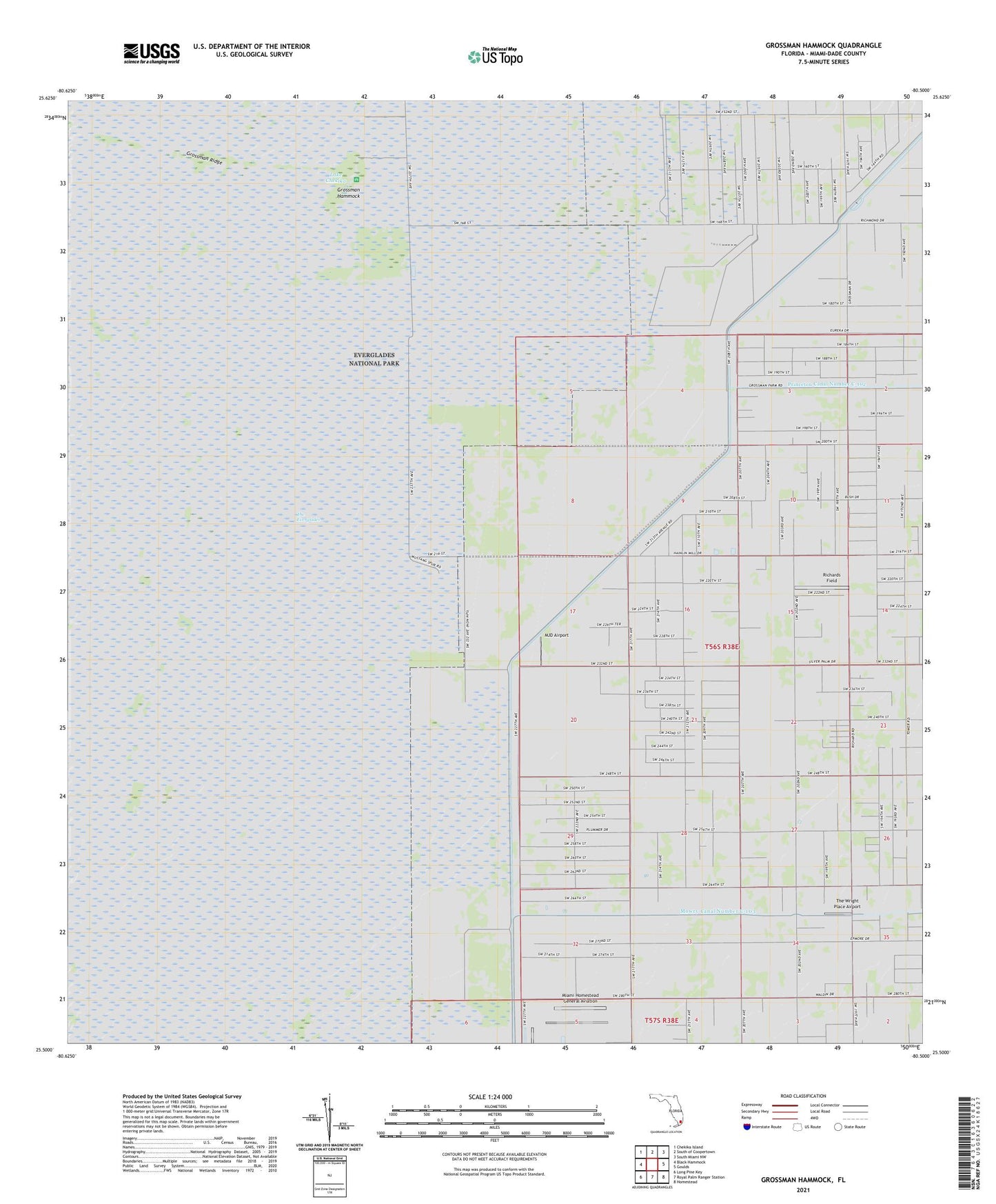
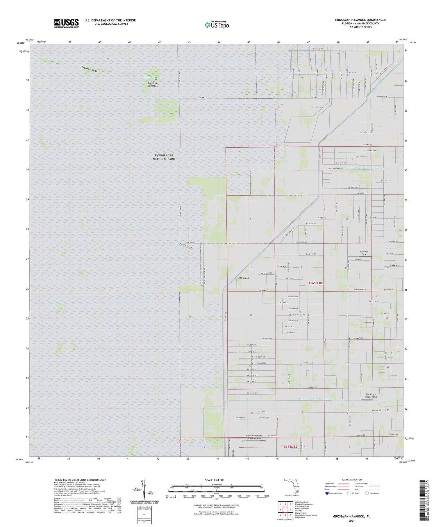
2024 topographic map quadrangle Grossman Hammock in the state of Florida. Scale: 1:24000. Based on the newly updated USGS 7.5' US Topo map series, this map is in the following counties: Miami-Dade. The map contains contour data, water features, and other items you are used to seeing on USGS maps, but also has updated roads and other features. This is the next generation of topographic maps. Printed on high-quality waterproof paper with UV fade-resistant inks.
Quads adjacent to this one:
West: Black Hammock
Northwest: Chekika Island
North: South of Coopertown
Northeast: South Miami NW
East: Goulds
Southeast: Homestead
South: Royal Palm Ranger Station
Southwest: Long Pine Key
This map covers the same area as the classic USGS quad with code o25080e5.
Contains the following named places: Aerojet Wildlife Management Area, B & L Farms Airport, Everglades National Park East Everglades Station, Grossman Hammock, Grossman Hammock State Park, Kendall Gliderport, Lake Chekika, Miami Homestead General Aviation, Miami-Dade County, MJD Airport, Richards Field, The Wright Place Airport, ZIP Codes: 33031, 33187