MyTopo
Mulberry Florida US Topo Map
Couldn't load pickup availability
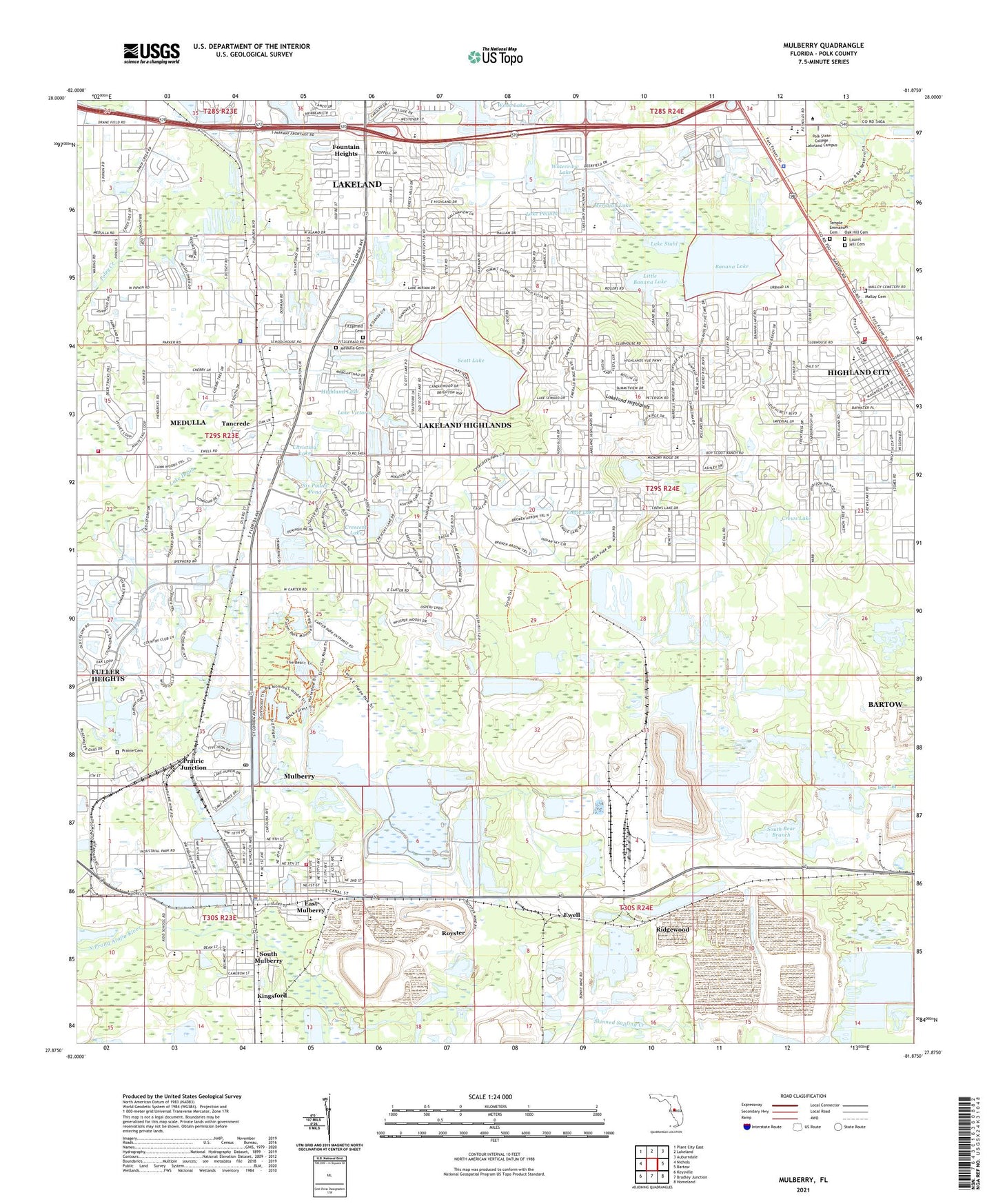
2024 topographic map quadrangle Mulberry in the state of Florida. Scale: 1:24000. Based on the newly updated USGS 7.5' US Topo map series, this map is in the following counties: Polk. The map contains contour data, water features, and other items you are used to seeing on USGS maps, but also has updated roads and other features. This is the next generation of topographic maps. Printed on high-quality waterproof paper with UV fade-resistant inks.
Quads adjacent to this one:
West: Nichols
Northwest: Plant City East
North: Lakeland
Northeast: Auburndale
East: Bartow
Southeast: Homeland
South: Bradley Junction
Southwest: Keysville
This map covers the same area as the classic USGS quad with code o27081h8.
Contains the following named places: Anglers Green Mobile Home Park, Ardella Church, Assembly of God Church, Banana Lake, Bartow Mall, Bartow Phosphate Complex Treatment Plant, Black Water Lake, Bonny Lake, Carlton Palmore Elementary School, Christina Lake, City of Mulberry, City of Mulberry Wastewater Treatment Plant, Clark Lake, Countryside Mobile Home Park, Crescent Lake, Crews Lake, Doctor C C Pearce Municipal Library, East Mulberry, Engle Lake, Ewell, First Apprenticeship Church, Fitzgerald Cemetery, Florida Department of Law Enforcement Lakeland Field Office, Fountain Heights, Fuller Heights, Fuller Heights Census Designated Place, Golden Gate Shopping Center, Highland City, Highland City Census Designated Place, Highland City Elementary School, Highland City Post Office, Highland Lake, Highland Pines Mobile Home Park, Highland Village Mobile Home Park, International M and C Park, Killian Greens Golf Club, Kingsford, Kingsford Elementary School, Lake Alamo, Lake Canyon, Lake Miriam Square, Lake Pointe Village Mobile Home Park, Lake Pollock, Lake Stahl, Lake Victoria, Lakeland Fire Tower, Lakeland Highlands, Lakeland Highlands Census Designated Place, Lakeland Highlands Middle School, Lakeland South Center, Little Banana Lake, Malloy Cemetery, Medulla, Medulla Cemetery, Medulla Census Designated Place, Medulla Church, Medulla Elementary School, Meridian Lake, Mineco Railroad Station, Mount Olive Church, Mount Olive Missionary Baptist Church, Mulberry, Mulberry Elementary School, Mulberry Fire Department, Mulberry First Assembly of God, Mulberry High School Heliport, Mulberry Middle School, Mulberry Post Office, Mulberry Senior High School, North Bear Branch, Oak Hill Cemetery, Paradise Lakes Mobile Home Park, Phyllis Lake, Polk County Emergency Medical Services Station 34, Polk County Emergency Medical Services Station 44 Southeast Lakeland, Polk County Emergency Medical Services Station 7 Mulberry, Polk County Fire Department Station 13 Highland City, Polk County Fire Department Station 480 Medulla I, Polk County Sheriff's Office, Polk County Sheriff's Office - Community Policing Unit Medulla, Polk County Sheriff's Office - Southwest District, Polk County Sheriff's Office Community Policing Unit Highlands City, Prairie Cemetery, Prairie Junction, Prairie Mine, Prairie Railroad Station, Presbyterian Church in the Highlands, Providence Church, Ridgewood, Royster, Royster Mine, Saint Johns Church, Saint Stephens Episcopal Church, Sanlan Ranch Mobile Home Park, Scott Lake, Scott Lake Elementary School, Scott-Lake Baptist Church, Seward Lake, Six Pound Pond, Skinned Sapling Creek, South Bear Branch, South Mulberry, Southside Assembly of God Church, Southside Postal Store Post Office, Spurgeon Baptist Bible College, Tancrede, Temple Emmanuel Cemetery, Turtle Creek, Twin Lakes Mobile Home Park, Waterview Lake, WEZY-FM (Lakeland), Wood Lake, WYFO-FM (Lakeland), ZIP Codes: 33812, 33813


