MyTopo
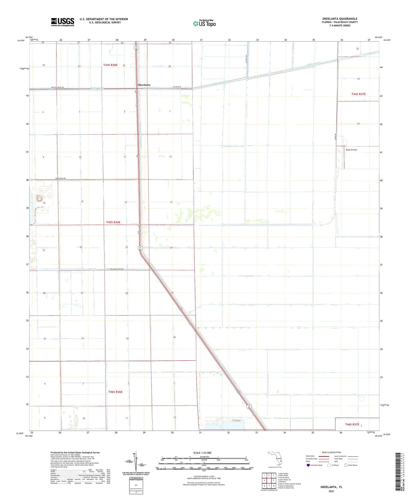
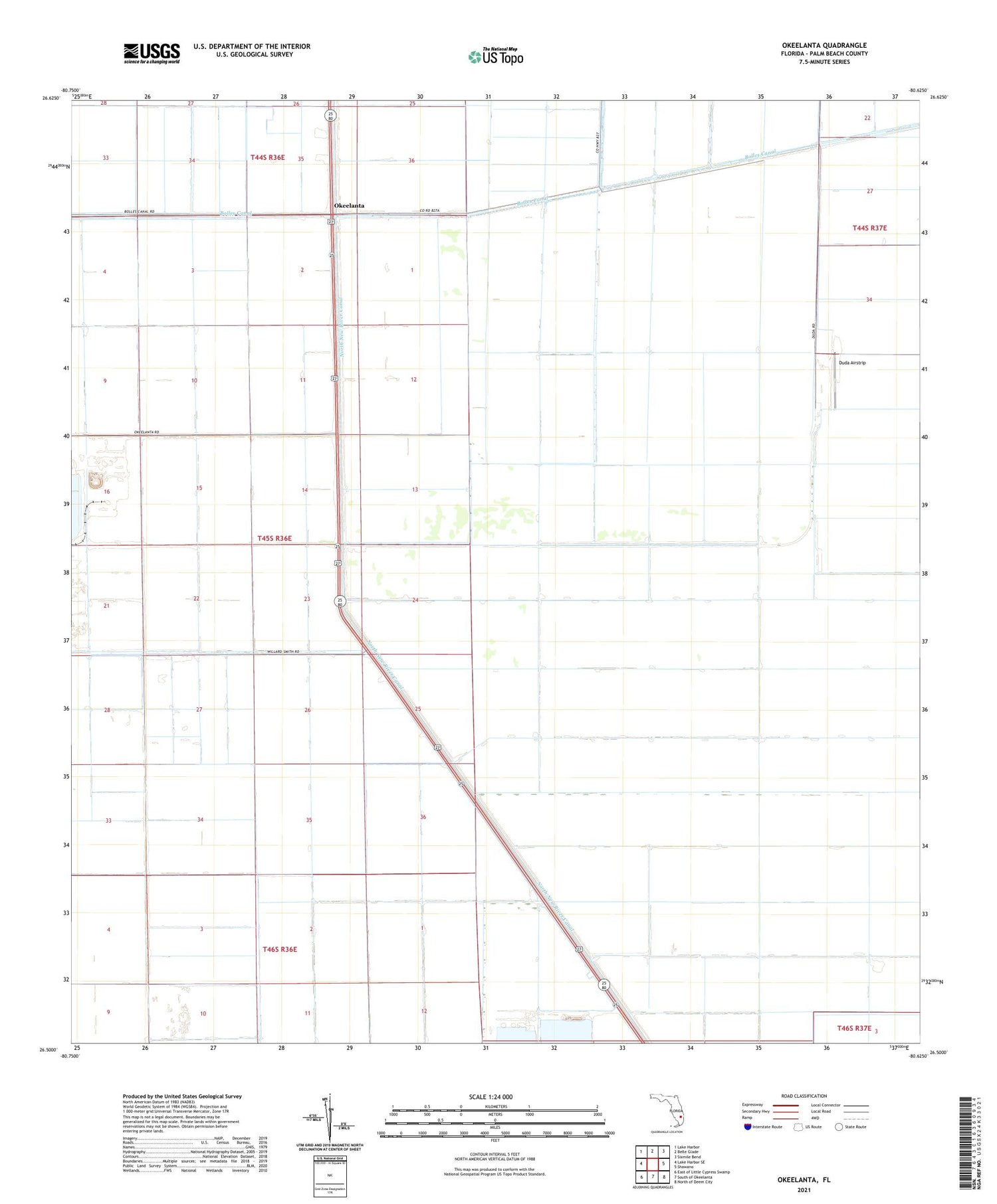
Okeelanta Florida US Topo Map
Couldn't load pickup availability
2024 topographic map quadrangle Okeelanta in the state of Florida. Scale: 1:24000. Based on the newly updated USGS 7.5' US Topo map series, this map is in the following counties: Palm Beach. The map contains contour data, water features, and other items you are used to seeing on USGS maps, but also has updated roads and other features. This is the next generation of topographic maps. Printed on high-quality waterproof paper with UV fade-resistant inks.
Quads adjacent to this one:
West: Lake Harbor SE
Northwest: Lake Harbor
North: Belle Glade
Northeast: Sixmile Bend
East: Shawano
Southeast: North of Deem City
South: South of Okeelanta
Southwest: East of Little Cypress Swamp
This map covers the same area as the classic USGS quad with code o26080e6.
Contains the following named places: Duda Airstrip, Okeelanta, Okeelanta Station Railroad Station, ZIP Code: 33493