
MyTopo
Osteen Florida US Topo Map
Couldn't load pickup availability
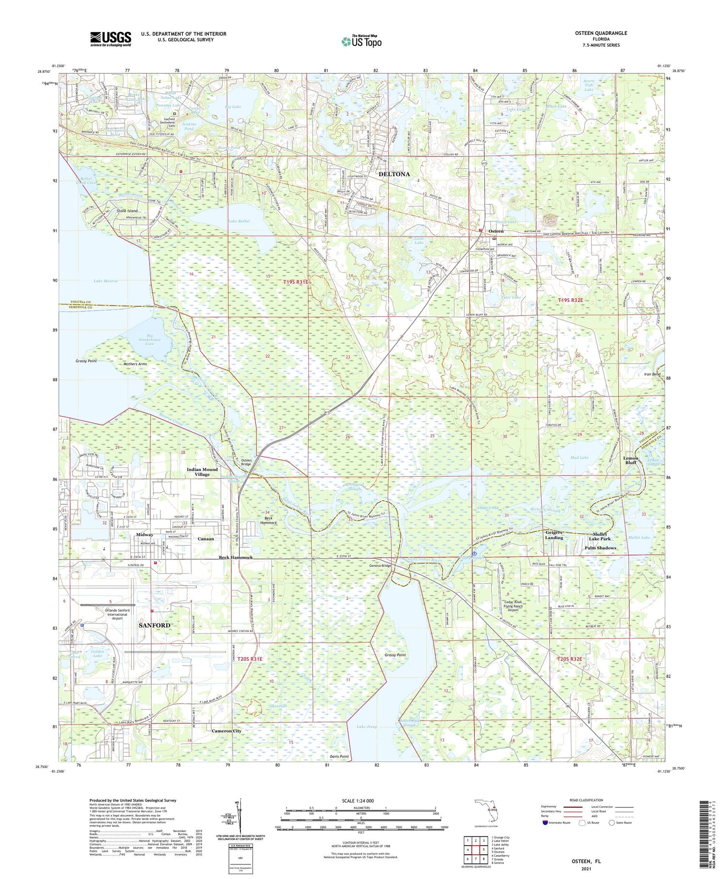
2021 topographic map quadrangle Osteen in the state of Florida. Scale: 1:24000. Based on the newly updated USGS 7.5' US Topo map series, this map is in the following counties: Volusia, Seminole. The map contains contour data, water features, and other items you are used to seeing on USGS maps, but also has updated roads and other features. This is the next generation of topographic maps. Printed on high-quality waterproof paper with UV fade-resistant inks.
Quads adjacent to this one:
West: Sanford
Northwest: Orange City
North: Lake Helen
Northeast: Lake Ashby
East: Osceola
Southeast: Geneva
South: Oviedo
Southwest: Casselberry
Contains the following named places: Acorn Fish Lake, Beany Pond, Beardell Avenue Chapel, Beck Hammock, Bethel Creek, Bethel Creek Cove, Big Lake, Big Smokehouse Cove, Black Lake, Boden, Brickyard Slough, Brisson Railroad Station, Broken Arrow Lake, Cameron City, Canaan, Cedar Knoll Flying Ranch Airport, Chaco Railroad Station, Christ Wesleyan Church, Chub Creek, Coffey Slough, Dixon Lake, Fellowship Baptist Church, First Baptist Church of Osteen, First Spanish Baptist Church of Deltona, Garfield Settlement Cemetery, Geigers Landing, Geneva Bridge, Glorious United Pentecostal Church of God, Golden Lake, Grassy Point, Hickmans Landing, Hickory Slough, Indian Mound Slough, Indian Mound Village, Iron Bend, Jacksons Bay, Jenkins Pond, Lake Bethel, Lake Butler Chain, Lake Doyle, Lake Eulalia, Lake Hutchinson, Lake Onora, Lemon Bluff, Lemon Bluff Fishing Campground Marina, Little Lake, Midway, Midway Census Designated Place, Midway Elementary School, Monroe Canal, Moores Railroad Station, Mothers Arms, Mud Lake, Mullet Lake, Mullet Lake Park, Naked Place, Naval Air Station Sanford, Orlando Sanford International Airport, Orlando Sanford International Airport Authority Fire Department Station 51, Osteen, Osteen Bridge, Osteen Elementary School, Osteen Post Office, Outlook Lake, Palm Shadows, Panama Lake, Paradise Lakes Travel Trailer Park, Prairie Landing, River Greens Golf Course, Roseland Park, Rotten Egg Slough, Saint Johns Lake, Saint Pauls Church, Sanford International Airport Police Department, Seminole County Fire Department Station 41, Sipes Railroad Station, Snake Creek, Stone Island, Tanner Lake, The Savannah, Thompson Lake, Thormpson Pond, Thornhill Lake, Three Otter Creek, Tyler Lake, Volusia County Fire Services Station 34 Indian Mound, Volusia County Fire Services Station 36 Osteen, WESH-TV (Daytona Beach), Woodruff Creek, ZIP Code: 32773


