MyTopo
Osceola Florida US Topo Map
Couldn't load pickup availability
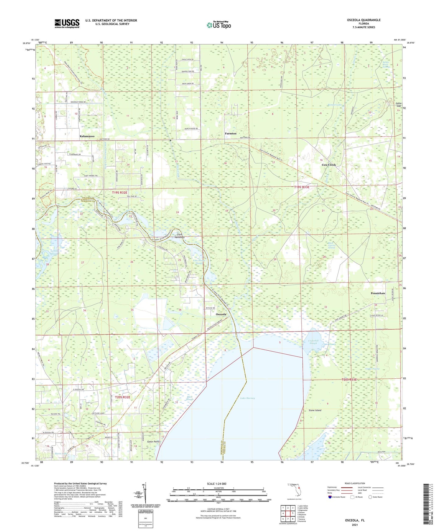
2024 topographic map quadrangle Osceola in the state of Florida. Scale: 1:24000. Based on the newly updated USGS 7.5' US Topo map series, this map is in the following counties: Volusia, Seminole. The map contains contour data, water features, and other items you are used to seeing on USGS maps, but also has updated roads and other features. This is the next generation of topographic maps. Printed on high-quality waterproof paper with UV fade-resistant inks.
Quads adjacent to this one:
West: Osteen
Northwest: Lake Helen
North: Lake Ashby
Northeast: Edgewater
East: Maytown
Southeast: Aurantia
South: Geneva
Southwest: Oviedo
This map covers the same area as the classic USGS quad with code o28081g1.
Contains the following named places: Black Cypress Swamp, Bonnet Lake, Clark Hammock, Cow Creek, Cow House Slough, Deep Creek, Deep Creek Diversion Canal, Duck Slough, Farmton, Forks of the Creek, Gator Gap, Gator Point, Gopher Slough, Gopher Swamp, Harts Lake, Kalamazoo, Lake Harney, Le Fils Slough, Osceola, Osceola Naval Outer Landing Field, Pennichaw, Stone Island, Underhill Branch, Underhill Slough, ZIP Codes: 32732, 32764