MyTopo
Lake Ashby Florida US Topo Map
Couldn't load pickup availability
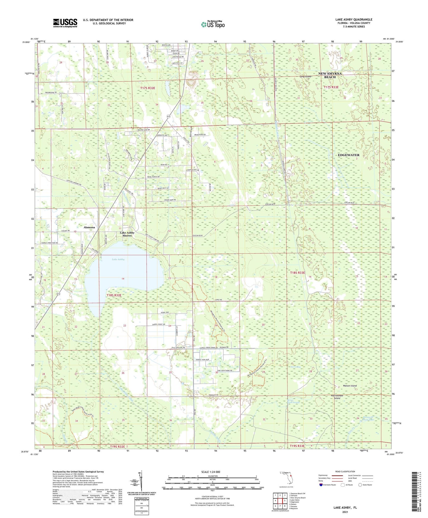
2024 topographic map quadrangle Lake Ashby in the state of Florida. Scale: 1:24000. Based on the newly updated USGS 7.5' US Topo map series, this map is in the following counties: Volusia. The map contains contour data, water features, and other items you are used to seeing on USGS maps, but also has updated roads and other features. This is the next generation of topographic maps. Printed on high-quality waterproof paper with UV fade-resistant inks.
Quads adjacent to this one:
West: Lake Helen
Northwest: Daytona Beach SW
North: Samsula
Northeast: New Smyrna Beach
East: Edgewater
Southeast: Maytown
South: Osceola
Southwest: Osteen
This map covers the same area as the classic USGS quad with code o28081h1.
Contains the following named places: Alamana, Ashby Lookout Tower, Buzzards Roost Lake, Harris Bay, Lake Ashby, Lake Ashby Canal, Lake Ashby Creek, Lake Ashby Mobile Home Park, Lake Ashby Shores, Leffler Airport, Long Island, Opossum Camp, Rattlesnake Island, Samsula Camp, Samsula Canal, Sandy Drain, Watson Island, ZIP Code: 32168