MyTopo
Pavilion Key Florida US Topo Map
Couldn't load pickup availability
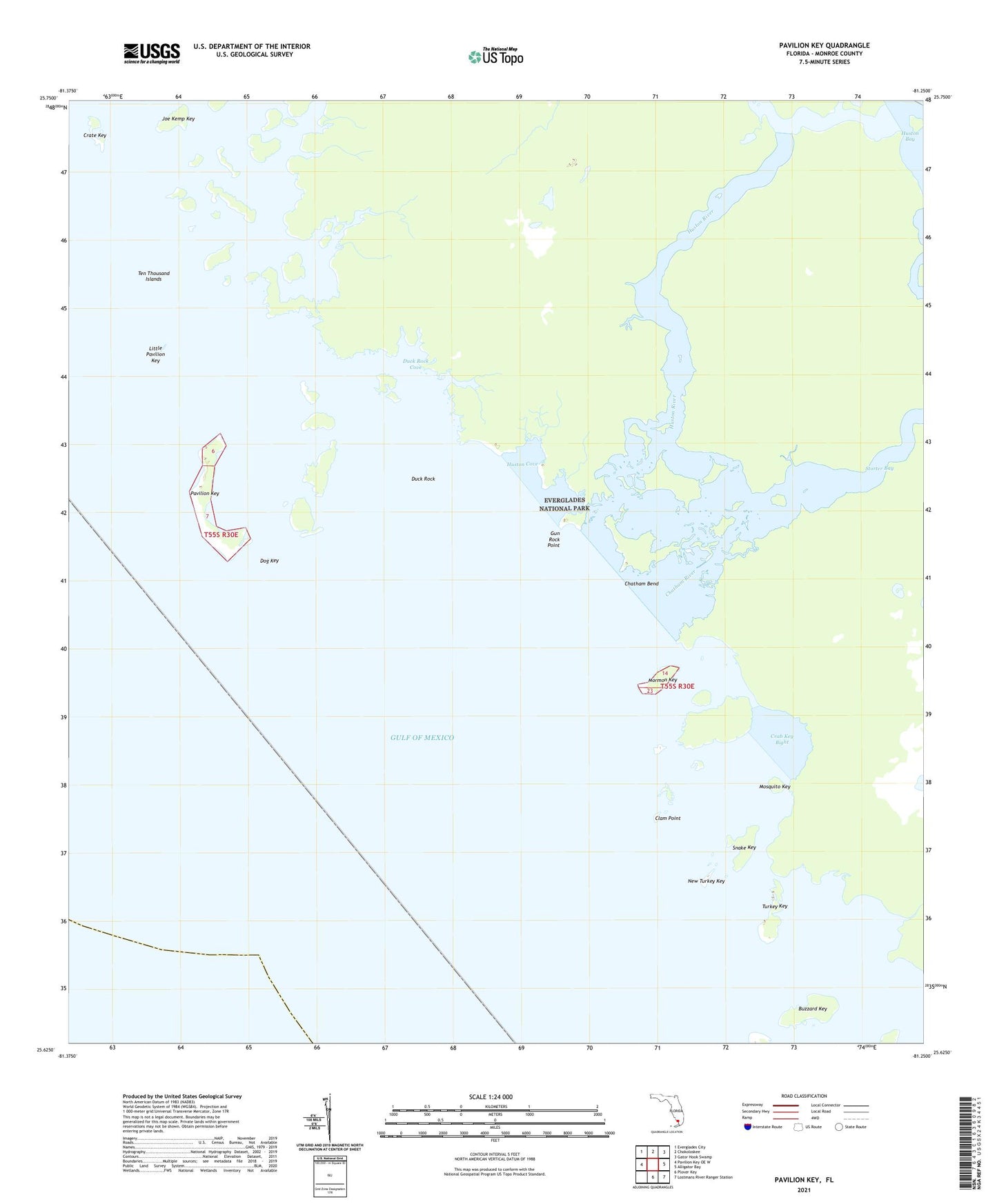
2025 topographic map quadrangle Pavilion Key in the state of Florida. Scale: 1:24000. Based on the newly updated USGS 7.5' US Topo map series, this map is in the following counties: Monroe. The map contains contour data, water features, and other items you are used to seeing on USGS maps, but also has updated roads and other features. This is the next generation of topographic maps. Printed on high-quality waterproof paper with UV fade-resistant inks.
Quads adjacent to this one:
West: Pavilion Key OE W
Northwest: Everglades City
North: Chokoloskee
Northeast: Gator Hook Swamp
East: Alligator Bay
Southeast: Lostmans River Ranger Station
South: Plover Key
This map covers the same area as the classic USGS quad with code o25081f3.
Contains the following named places: Buzzard Key, Charley Creek, Chatham Bend, Chatham River, Clam Point, Crab Key Bight, Crate Key, Dog Key, Duck Rock, Duck Rock Cove, Gun Rock Point, Huston Cove, Huston River, Joe Kemp Key, Little Pavilion Key, Mormon Key, Mosquito Key, New Turkey Key, Pavilion Key, Pavilion Key Light 10, Snake Key, Storter Bay, Turkey Key