MyTopo
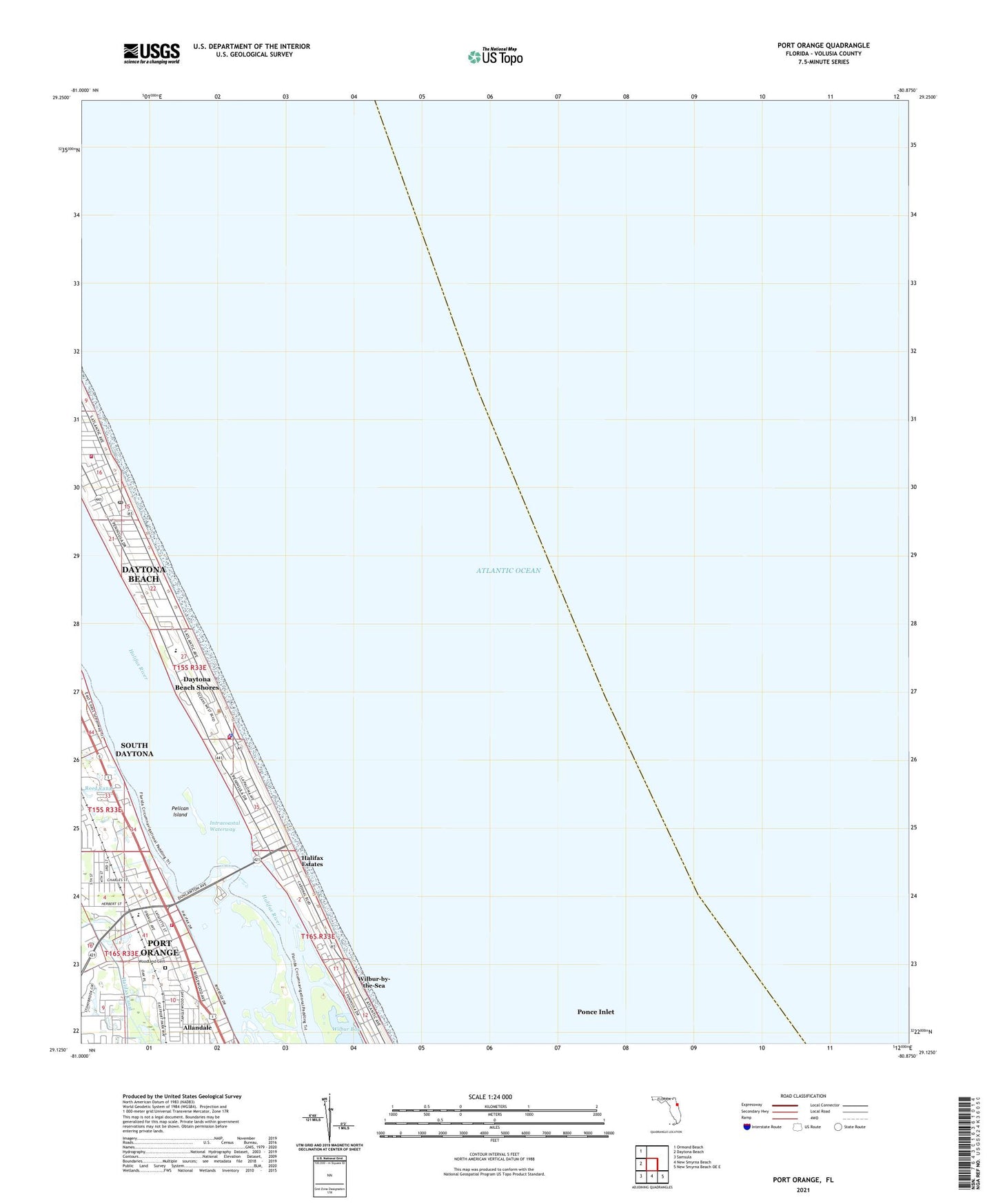
Port Orange Florida US Topo Map
Couldn't load pickup availability
2024 topographic map quadrangle Port Orange in the state of Florida. Scale: 1:24000. Based on the newly updated USGS 7.5' US Topo map series, this map is in the following counties: Volusia. The map contains contour data, water features, and other items you are used to seeing on USGS maps, but also has updated roads and other features. This is the next generation of topographic maps. Printed on high-quality waterproof paper with UV fade-resistant inks.
Quads adjacent to this one:
West: Daytona Beach
Northwest: Ormond Beach
Southeast: New Smyrna Beach OE E
South: New Smyrna Beach
Southwest: Samsula
This map covers the same area as the classic USGS quad with code o29080b8.
Contains the following named places: All Saints Lutheran Church, Blue Skies Mobile Home Village, Chapel in the Garden, Church of the Epiphany, City of Daytona Beach Shores, Daytona Beach Fire Department Station 2, Daytona Beach Shores, Daytona Beach Shores Department of Public Safety Fire Station, Daytona Beach Shores Police Department, Daytona Beach Shores Post Office, Dunlawton, Dunlawton Square, East-Port Orange Congregations of Jehovahs Witnesses, Epiphany Catholic Church Church, First Baptist Church of Port Orange, First United Methodist Church of Port Orange, Foursquare Gospel Church, Grace Episcopal Church, Halifax Estates, Halifax Trailer Park, Pelican Island, Port Orange, Port Orange Elementary School, Port Orange Fire and Rescue Department Station 71, Port Orange Plaza, Port Orange Post Office, Port Orange Presbyterian Church, Port Orange Wastewater Treatment Plant, R J Longstreet Elementary School, South Peninsula Division, Suwannee Mobile Home Park, Tanglewood Mobile Estates, Waters Edge Mobile Home Park, Wilbur-by-the-Sea, Wilbur-By-The-Sea Post Office, Woodland Cemetery