MyTopo
Shark Valley Lookout Tower Florida US Topo Map
Couldn't load pickup availability
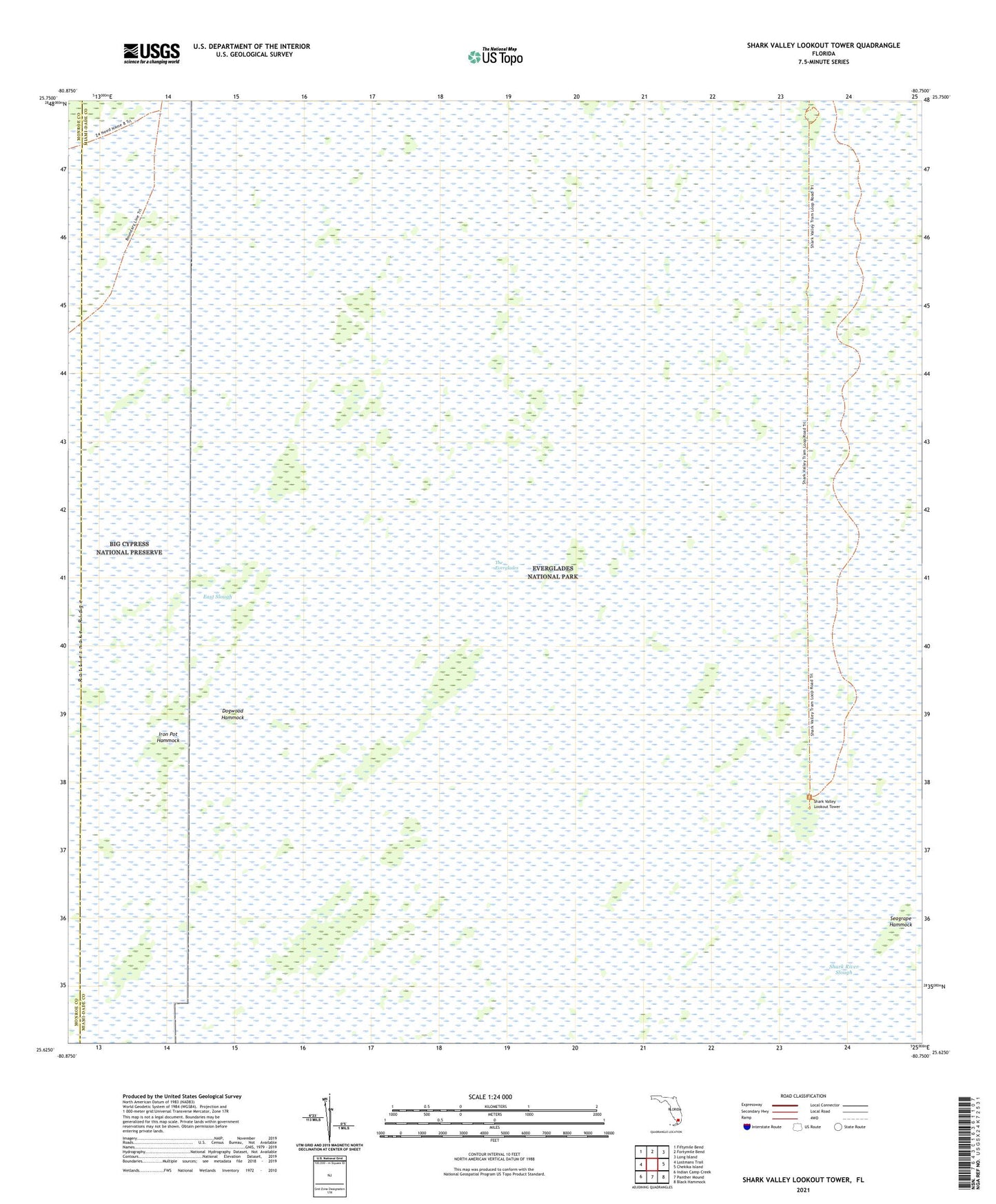
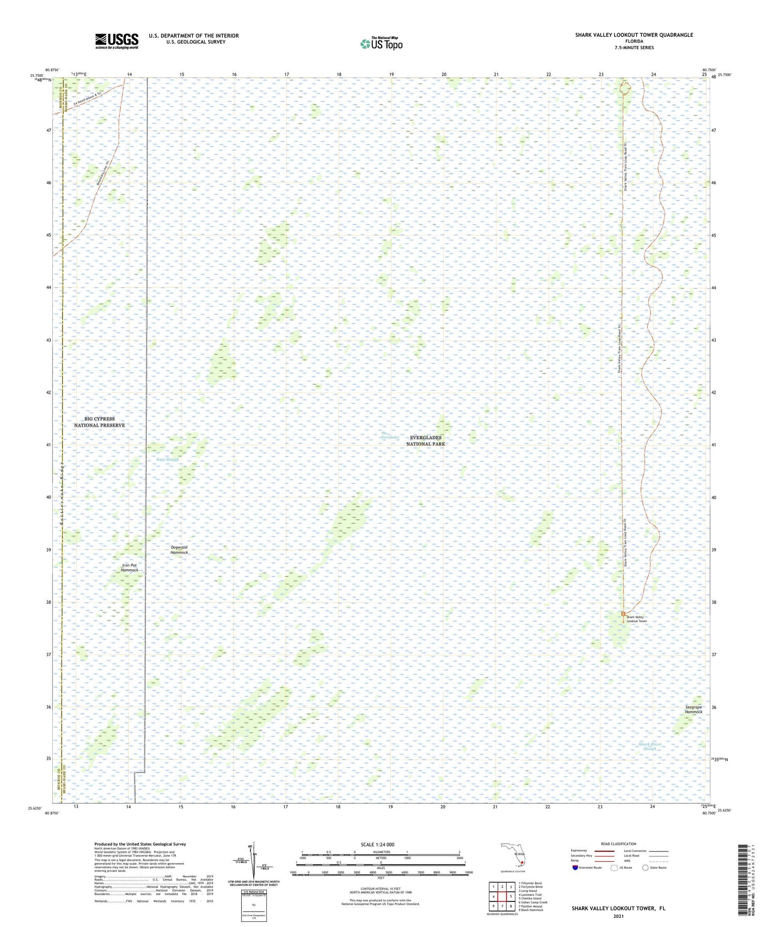
2024 topographic map quadrangle Shark Valley Lookout Tower in the state of Florida. Scale: 1:24000. Based on the newly updated USGS 7.5' US Topo map series, this map is in the following counties: Miami-Dade, Monroe. The map contains contour data, water features, and other items you are used to seeing on USGS maps, but also has updated roads and other features. This is the next generation of topographic maps. Printed on high-quality waterproof paper with UV fade-resistant inks.
Quads adjacent to this one:
West: Lostmans Trail
Northwest: Fiftymile Bend
North: Fortymile Bend
Northeast: Long Island
East: Chekika Island
Southeast: Black Hammock
South: Panther Mound
Southwest: Indian Camp Creek
This map covers the same area as the classic USGS quad with code o25080f7.
Contains the following named places: Dogwood Hammock, Iron Pot Hammock, Pops Hammock Seminole Village, Seagrape Hammock, Shark Valley Lookout Tower