MyTopo
Spuds Florida US Topo Map
Couldn't load pickup availability
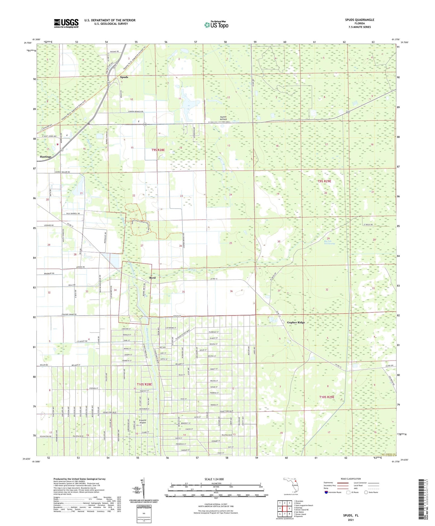
2024 topographic map quadrangle Spuds in the state of Florida. Scale: 1:24000. Based on the newly updated USGS 7.5' US Topo map series, this map is in the following counties: St. Johns, Flagler. The map contains contour data, water features, and other items you are used to seeing on USGS maps, but also has updated roads and other features. This is the next generation of topographic maps. Printed on high-quality waterproof paper with UV fade-resistant inks.
Quads adjacent to this one:
West: Hastings
Northwest: Riverdale
North: Elkton
Northeast: Saint Augustine Beach
East: Dinner Island NE
Southeast: Espanola
South: Dinner Island
Southwest: San Mateo
This map covers the same area as the classic USGS quad with code o29081f4.
Contains the following named places: Big Fish Tail Swamp, Byrd, Emanuel Church, Flagler Estates Census Designated Place, Frontier Airport, Gopher Ridge, Gopher Ridge Tower, Hastings Census Designated Place, Hastings Division, Hutson Airfield, Mount Olive Church, Saint Johns County Fire Rescue Station 8 - Hastings, San Buenaventura, Sixteenmile Creek, Spuds, Tater Farms Strip, ZIP Code: 32145