
MyTopo
Broxton South Georgia US Topo Map
Couldn't load pickup availability
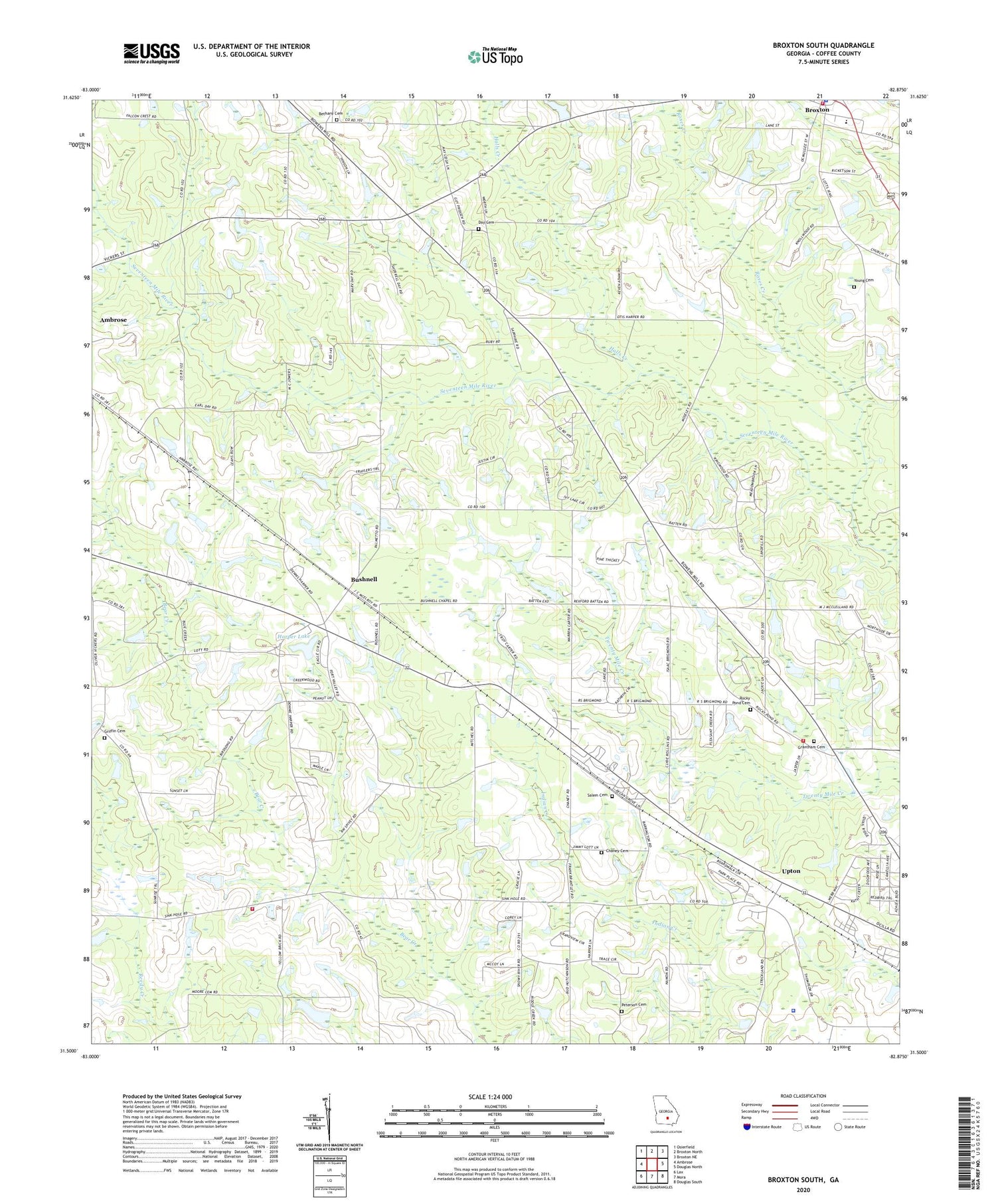
2024 topographic map quadrangle Broxton South in the state of Georgia. Scale: 1:24000. Based on the newly updated USGS 7.5' US Topo map series, this map is in the following counties: Coffee. The map contains contour data, water features, and other items you are used to seeing on USGS maps, but also has updated roads and other features. This is the next generation of topographic maps. Printed on high-quality waterproof paper with UV fade-resistant inks.
Quads adjacent to this one:
West: Ambrose
Northwest: Osierfield
North: Broxton North
Northeast: Broxton NE
East: Douglas North
Southeast: Douglas South
South: Mora
Southwest: Lax
This map covers the same area as the classic USGS quad with code o31082e8.
Contains the following named places: Bethany Cemetery, Bethany Church, Broxton Baptist Church, Broxton Library, Broxton Police Department, Bushnell, Bushnell Church, Chaney Cemetery, City of Broxton, Coffee County Fire and Rescue Department Station 10, Coffee County Fire and Rescue Department Station 14, Coffee County Jail, Coffee County Sheriff's Department, Day Cemetery, Grantham Cemetery, Griffin Cemetery, Halls Creek, Harper Lake, Harper Lake Dam, Perimeter West Industrial Park, Peterson Cemetery, Rocky Pond Cemetery, Rocky Pond Church, Roses Creek, Salem Cemetery, Salem Holiness Baptist Church, Sunnyside Church, Upton, Young Cemetery


