MyTopo
Grooverville Georgia US Topo Map
Couldn't load pickup availability
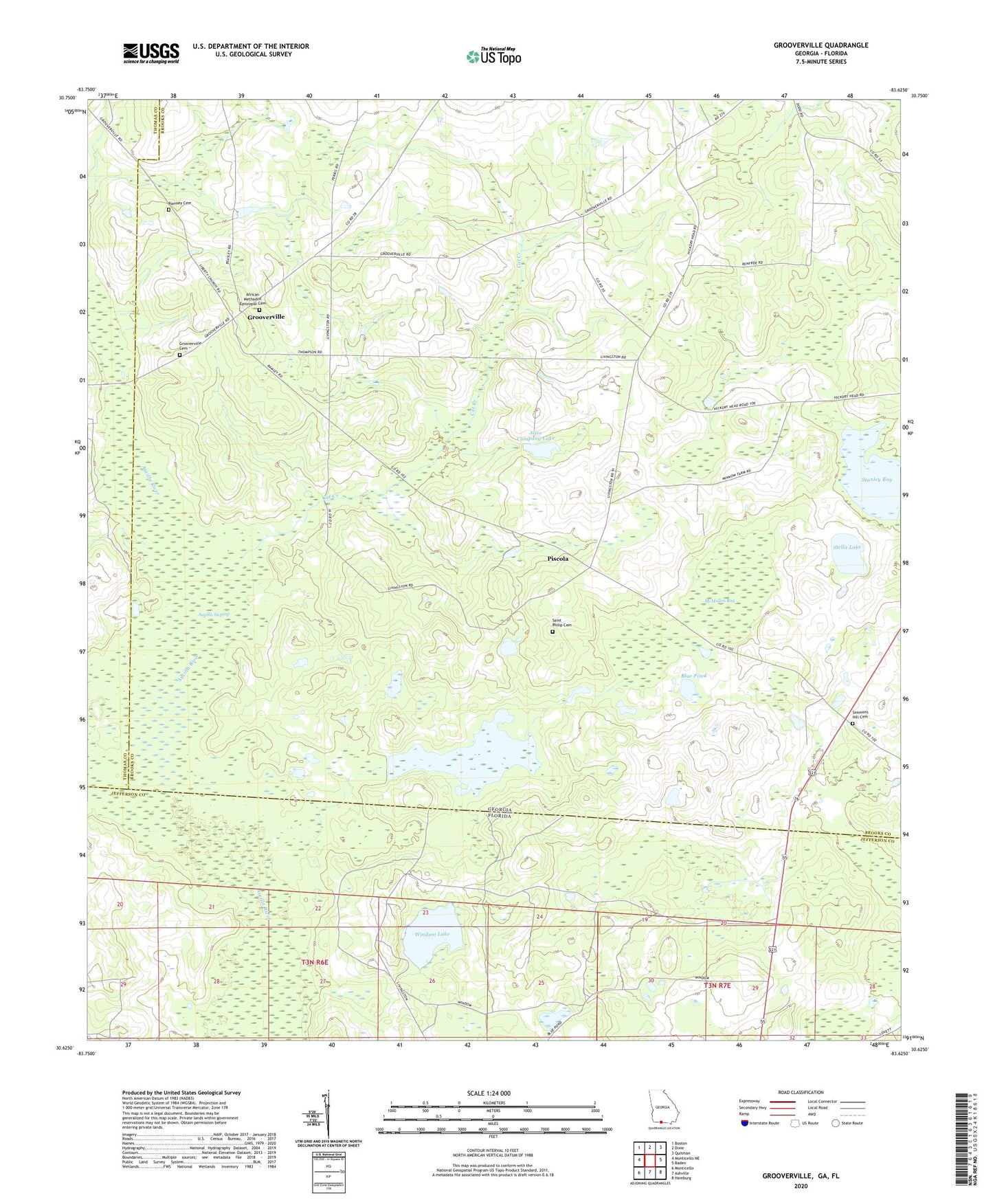
2024 topographic map quadrangle Grooverville in the states of Georgia, Florida. Scale: 1:24000. Based on the newly updated USGS 7.5' US Topo map series, this map is in the following counties: Brooks, Jefferson, Thomas. The map contains contour data, water features, and other items you are used to seeing on USGS maps, but also has updated roads and other features. This is the next generation of topographic maps. Printed on high-quality waterproof paper with UV fade-resistant inks.
Quads adjacent to this one:
West: Monticello NE
Northwest: Boston
North: Dixie
Northeast: Quitman
East: Baden
Southeast: Hamburg
South: Ashville
Southwest: Monticello
This map covers the same area as the classic USGS quad with code o30083f6.
Contains the following named places: African Methodist Episcopal Cemetery, Alico Company Dam, Alico Company Lake, Aucilla Swamp, Blue Pond, Cat Creek, Dixie Division, Elam Church, Elizabeth Church, Grooverville, Grooverville Cemetery, Grooverville Methodist Church, Grooverville School, Jesus Christ Church, Liberty Baptist Church, Long Lake, Long Lake Dam, McMullen Bay, Mount Moriah Church, Mount Moriah School, New Zion Church, Pine Hill Church, Piscola, Ramsey Cemetery, Saint Philip Cemetery, Saint Philip Church, Simmons Hill Church, Stanley Bay, Stella Lake, Summer Hill Cemetery, Windom Lake