
MyTopo
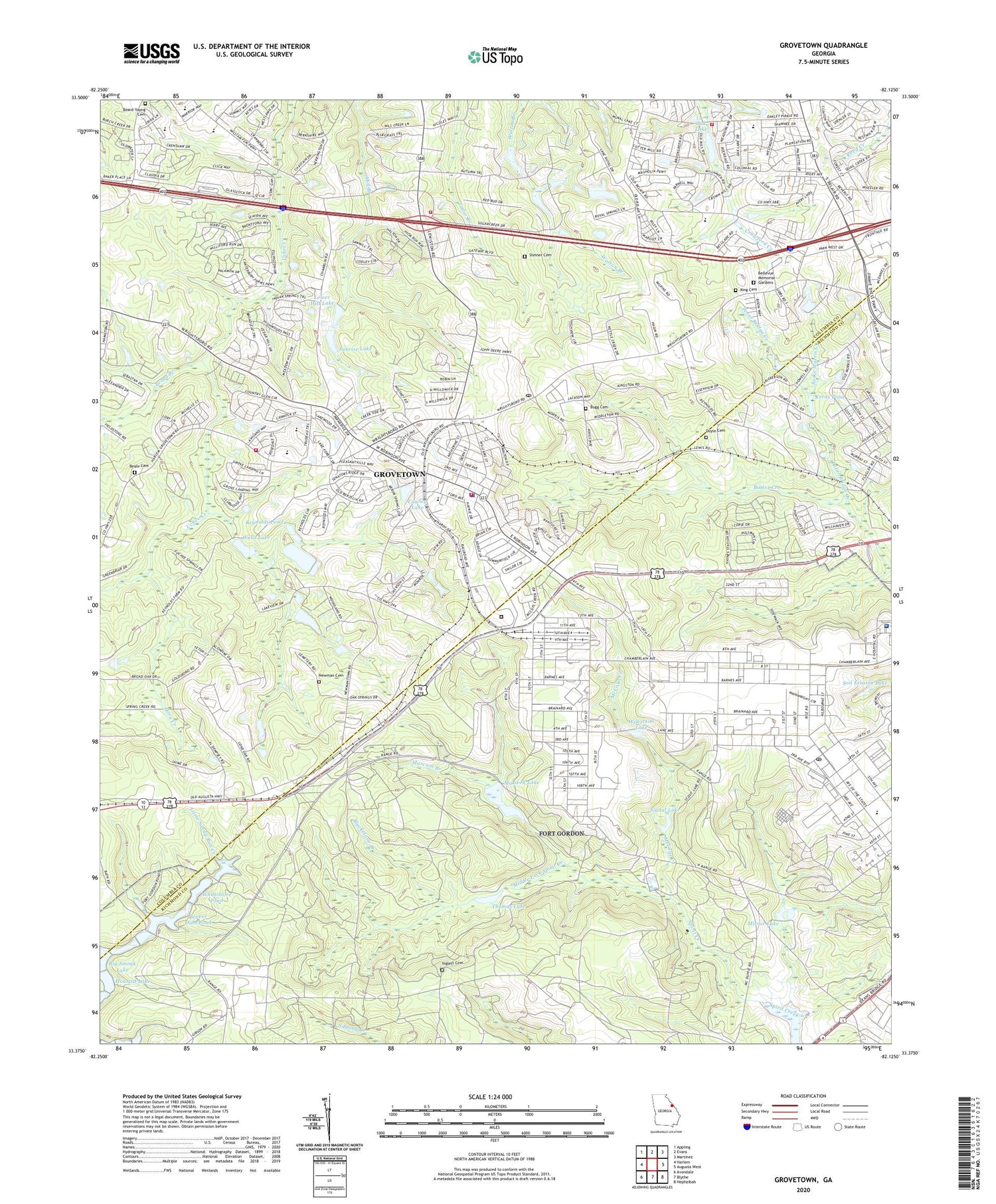
Grovetown Georgia US Topo Map
Couldn't load pickup availability
2024 topographic map quadrangle Grovetown in the state of Georgia. Scale: 1:24000. Based on the newly updated USGS 7.5' US Topo map series, this map is in the following counties: Richmond, Columbia. The map contains contour data, water features, and other items you are used to seeing on USGS maps, but also has updated roads and other features. This is the next generation of topographic maps. Printed on high-quality waterproof paper with UV fade-resistant inks.
Quads adjacent to this one:
West: Harlem
Northwest: Appling
North: Evans
Northeast: Martinez
East: Augusta West
Southeast: Hephzibah
South: Blythe
Southwest: Avondale
This map covers the same area as the classic USGS quad with code o33082d2.
Contains the following named places: Augusta State Medical Prison, Avery Landing, Baldwins Lake, Baldwins Lake Dam, Beale Cemetery, Beard-Young Cemetery, Beaver Dam Pond, Belglade, Bellevue Memorial Gardens, Bethesda Church, Big Smoak Lake, Blackstone Branch, Blanchard Park, Broad Branch, Brookwood Elementary School, Buffalo Ranch, Bugg Cemetery, Cawley Lake, Cawley Lake Dam, Cedar Ridge Elementary School, Church of the Lord Jesus Christ, City of Grovetown, Columbia County Crossroads Academy, Columbia County Fire Rescue Station 4, Columbia County Fire Rescue Station 7, Dodge Racetrack, Doyle Cemetery, Dwight David Eisenhower Army Medical Center, Flying J Airstrip, Forrest, Fort Gordon, Fort Gordon Post Office, Georgia State Patrol Troop E Post 25 Grovetown, Greater Augusta Christian Academy, Grovetown, Grovetown City Hall, Grovetown Department of Public Safety, Grovetown Elementary School, Grovetown Fire Department, Grovetown High School, Grovetown Middle School, Grovetown Police Department, Grovetown Post Office, Grovetown Public Safety Fire Station 2, Helen Huffman Lake, Helen Huffman Lake Dam, Henderson School, Hill and Dale Trailer Park, Horn Creek, Howard Lake, Inglett Cemetery, Jerusalem Church, Kensington, Kerns Pond, Kettle Creek, King Cemetery, Lake Royal, Lewiston Downs, Lower Hitt Lake, Lower Hitts Lake Dam, Maple Creek, Marcum Branch, Marvin Church, Maxwell Lake, McCoys Creek, Middle Fork Spirit Creek, Mirror Lake, Mount Lebanon Church, Mount Pleasant Church, Newman Cemetery, Oak Lake, Oak Lake Dam, Olive Terrace, Polar Bridge Creek, Quail Creek, Reids Chapel, Reynolds Pond, Ridge Crossing, Ridge Point, Sadie Morris Creek, Signal Lake, Silver Maple Ridge, Smithwick, Steiner Cemetery, Steiner Grove Church, Steiner School, Sugarcreek, Sunrise Lake, Thomas Lake, Tower Pines, Upper Hitt Lake Dam, Water Branch Church, Water Branch School, Wells Lake, Wells Lake Dam, Westmont, Westmont Elementary School, Whittimore Pond, Wilkerson Lake, Windy Acres Trailer Park, World War Two German Prisoner of War Cemetery, ZIP Codes: 30813, 30903, 30905


