MyTopo
Lyerly Georgia US Topo Map
Couldn't load pickup availability
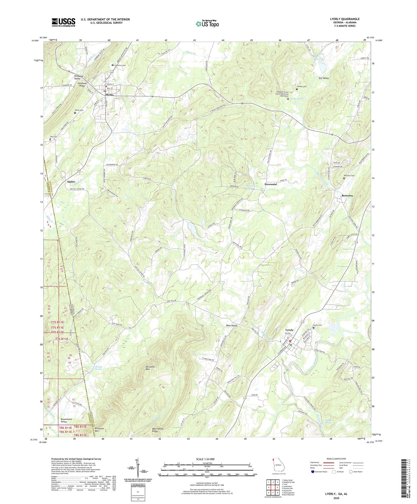
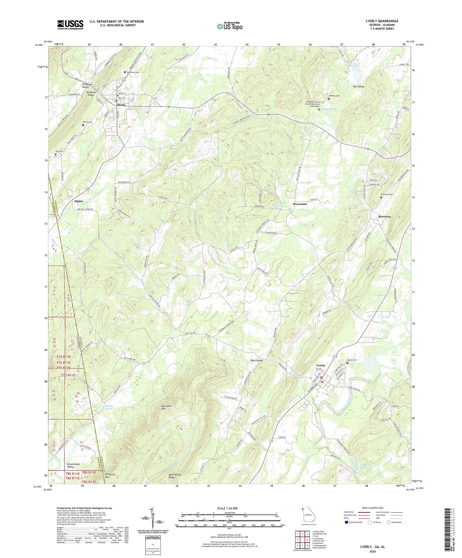
2024 topographic map quadrangle Lyerly in the states of Georgia, Alabama. Scale: 1:24000. Based on the newly updated USGS 7.5' US Topo map series, this map is in the following counties: Chattooga, Cherokee. The map contains contour data, water features, and other items you are used to seeing on USGS maps, but also has updated roads and other features. This is the next generation of topographic maps. Printed on high-quality waterproof paper with UV fade-resistant inks.
Quads adjacent to this one:
West: Jamestown
Northwest: Valley Head
North: Dougherty Gap
Northeast: Trion
East: Summerville
Southeast: Rock Mountain
South: Chattoogaville
Southwest: Gaylesville
This map covers the same area as the classic USGS quad with code o34085d4.
Contains the following named places: Alpine, Alpine Church, Alpine Creek, Ami Cemetery, Angus McLeod Park, Berryton, Berryton Baptist Church, Berryton Cemetery, Berryton Church of God, City of Menlo, Clarks Creek, Dirtseller Mountain, Dry Branch, Fairview, Faith Temple, First Baptist Church of Lyerly, Fosters Store, Gamble Cemetery, Gamble Spring, Hair Lake, Hair Lake Dam, Hair Spring, Jones Chapel, Lawrence Cemetery, Lyerly, Lyerly Cemetery, Lyerly City Hall, Lyerly Elementary School, Lyerly High School, Lyerly Post Office, Lyerly Volunteer Fire Department, Menlo, Menlo Cemetery, Menlo Elementary School, Menlo Park, Menlo Post Office, Menlo Volunteer Fire Department, Mineral Springs, Moseley Springs, Mosteller Creek, Mount Bethel Church, Oak Hill Church, Perennial, Perennial Springs, Perrennial Springs Baptist Church, Pleasant Green Church Memorial Monument, Pleasant Green Presbyterian Church, Starkville, Summerville State Fish Hatchery, Taliaferro, Taliaferro Creek, Taliaferro Springs, Thomas Chapel, Town of Lyerly