
MyTopo
Hawi OE N Hawaii US Topo Map
Couldn't load pickup availability
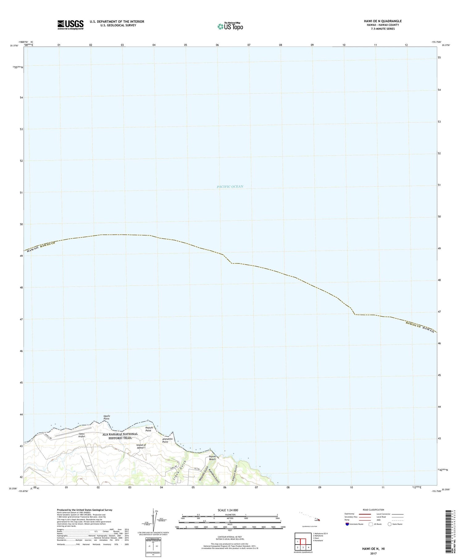
2024 topographic map quadrangle Hawi OE N in the state of Hawaii. Scale: 1:24000. Based on the newly updated USGS 7.5' US Topo map series, this map is in the following counties: Hawaii. The map contains contour data, water features, and other items you are used to seeing on USGS maps, but also has updated roads and other features. This is the next generation of topographic maps. Printed on high-quality waterproof paper with UV fade-resistant inks.
Quads adjacent to this one:
West: Mahukona OE N
Southeast: Honokane
South: Hawi
Southwest: Mahukona
Contains the following named places: Alanahihi Point, Hawi, Hoea Camp, Hualua 2, Hualua One, Kahei One, Kahei Three, Kahei Two, Kapua, Kapu'a Gulch, Kealahewa, Kepuhi Point, Kumakua Gulch, Lipoa Gulch, Ohanaula Gulch, Pahoa Beach, Pu'uepa 1, Upolu Airport, 'Upolu Point, Waipiele Gulch


