MyTopo
Keahole Point Hawaii US Topo Map
Couldn't load pickup availability
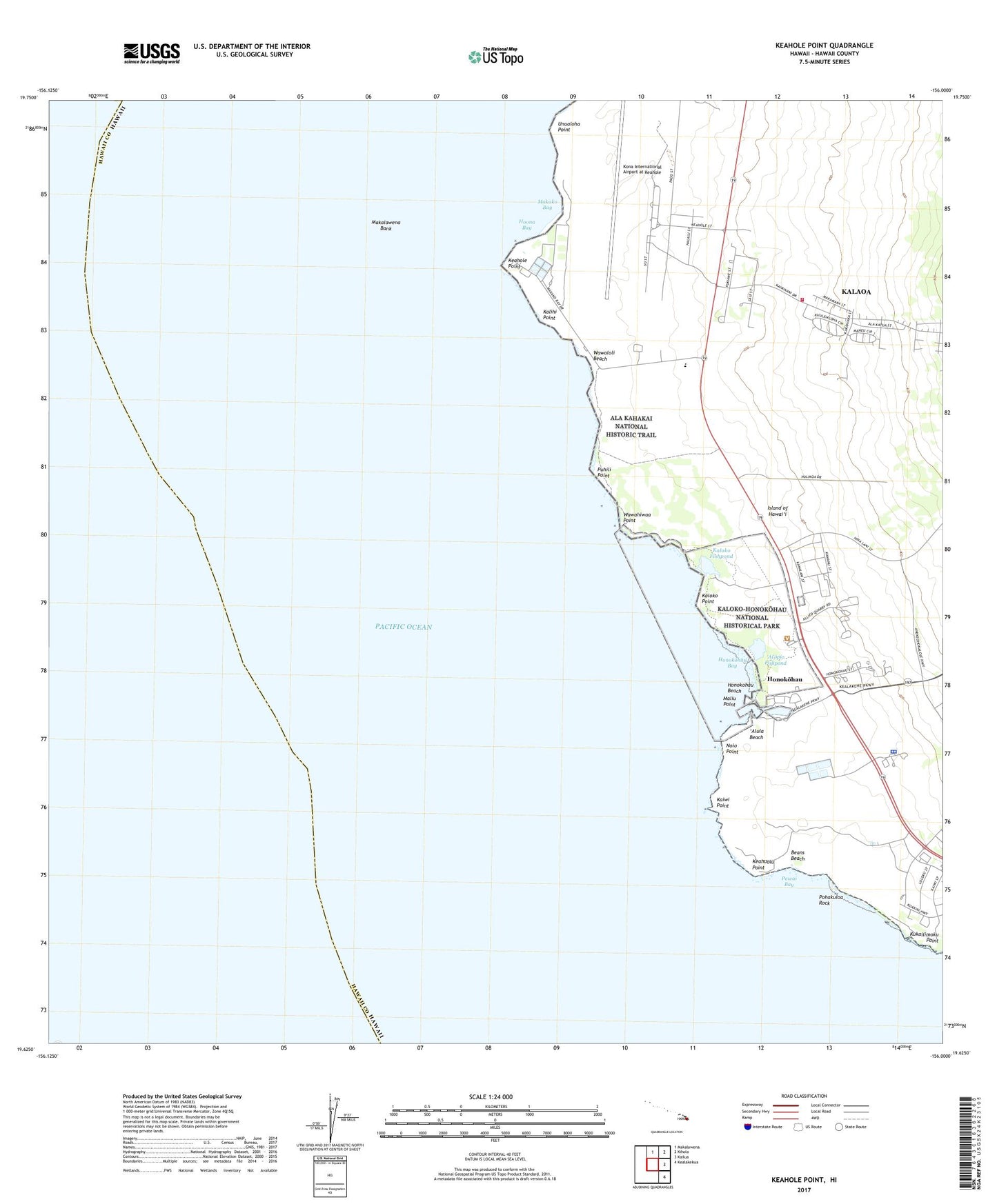
2024 topographic map quadrangle Keahole Point in the state of Hawaii. Scale: 1:24000. Based on the newly updated USGS 7.5' US Topo map series, this map is in the following counties: Hawaii. The map contains contour data, water features, and other items you are used to seeing on USGS maps, but also has updated roads and other features. This is the next generation of topographic maps. Printed on high-quality waterproof paper with UV fade-resistant inks.
Quads adjacent to this one:
North: Makalawena
Northeast: Kiholo
East: Kailua
Southeast: Kealakekua
This map covers the same area as the classic USGS quad with code o19156f1.
Contains the following named places: Ahu'ena Heiau, 'Ai'opio Fishpond, 'Alula Beach, Beans Beach, Ellison Onizuka Kona International Airport at Keahole, Hale o Mano Heiau, Haleohiu, Haleolono Heiau, Hamanamana, Hawaii County Police Department Kona Station, Honokohau, Honokohau 1-2, Honokohau Bay, Honokohau Beach, Honokohau Hawaiian Home Land, Honokohau Small Boat Harbor, Hoona Bay, Kaehole Southwest Substation, Kaiminani Census Designated Place, Kaiwi Point, Kalaoa Hawaiian Homeland, Kalaoa One-Four, Kalaoa Three-Four, Kalaoa Volunteer Fire Station 07B, Kalaoa-'O'oma Homesteads, Kalihi Point, Kaloko Fishpond, Kaloko Point, Kaloko-Honokohau National Historical Park, Keahole Point, Keahuolu Point, Kealakehe Homesteads, KIPA-AM (Kalaoa), Kohanaiki, Kona Airport, Kukailimoku Point, Lanihau, Maka'eo, Makako Bay, Maka'ula, Maliu Point, Mamalahoa Trail, Natural Energy Laboratory, Noio Point, Old Kona Airport State Recreation Area, Old Mamalahoa Trail, 'O'oma 2, Pawai Bay, Pohakuloa Rock, Puhili Point, Unualoha Point, Wawahiwa'a Point, Wawaloli Beach