MyTopo
Lualailua Hills Hawaii US Topo Map
Couldn't load pickup availability
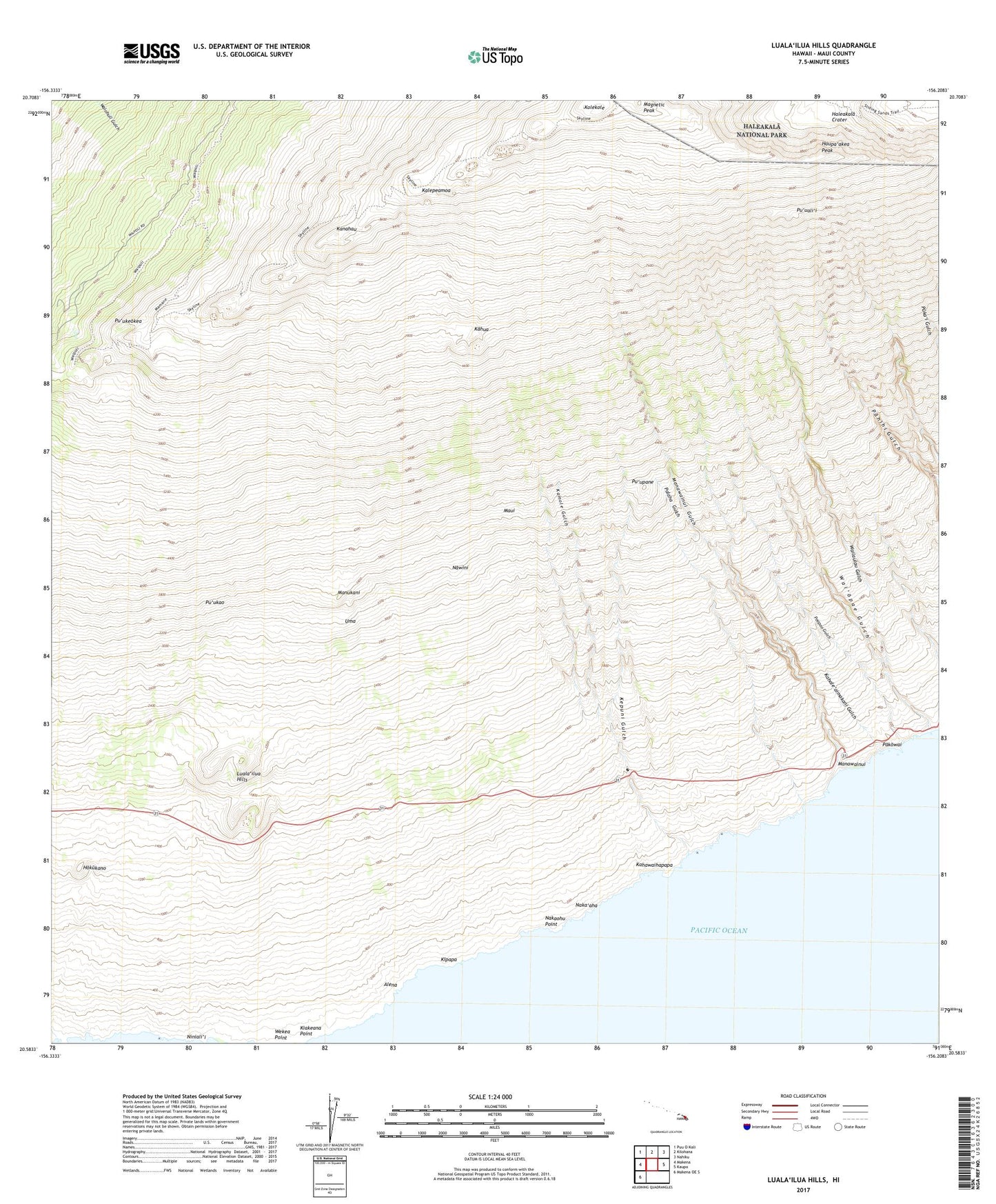
2024 topographic map quadrangle Lualailua Hills in the state of Hawaii. Scale: 1:24000. Based on the newly updated USGS 7.5' US Topo map series, this map is in the following counties: Maui. The map contains contour data, water features, and other items you are used to seeing on USGS maps, but also has updated roads and other features. This is the next generation of topographic maps. Printed on high-quality waterproof paper with UV fade-resistant inks.
Quads adjacent to this one:
West: Makena
Northwest: Puu O Kali
North: Kilohana
Northeast: Nahiku
East: Kaupo
Southwest: Makena OE S
This map covers the same area as the classic USGS quad with code o20156e2.
Contains the following named places: Alena, Auwahi, Haupa'akea Peak, Hokukano, Kahale'aimakani Gulch, Kahawaihapapa, Kahikinui Forest Reserve, Kahikinui Hawaiian Home Land, Kahikinui House, Kahua, Kalepeamoa, Kamole Gulch, Kanahau, Kepuni Gulch, Kiakeana Point, Kipapa, Kolekole, Kula Forest Reserve, Lower Trail, Luala'ilua, Luala'ilua Hills, Magnetic Peak, Mahamenui, Manawainui, Manawainui Gulch, Manukani, Naka'aha, Nakaohu, Nakaohu Point, Nakula, Nawini, Niniali'i, Pakowai, Palaha Gulch, Polipoli Springs State Recreation Area, Poopoo Gulch, Pu'uali'i, Pu'ukao, Pu'ukeokea, Pu'upane, Uma, Wailaulau Gulch, Wai'opae Gulch, ZIP Code: 96790