MyTopo
Makaha Point Hawaii US Topo Map
Couldn't load pickup availability
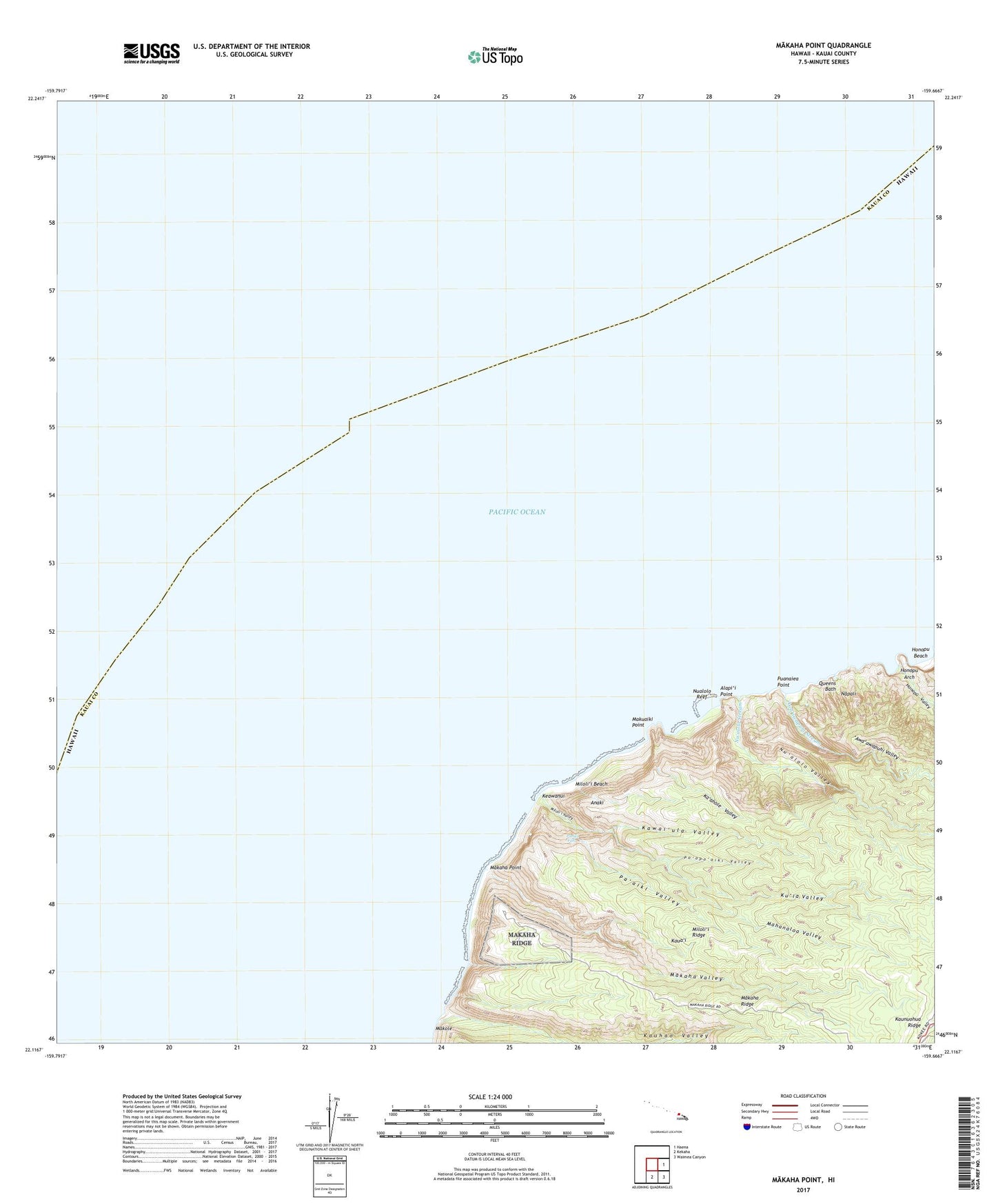
2024 topographic map quadrangle Makaha Point in the state of Hawaii. Scale: 1:24000. Based on the newly updated USGS 7.5' US Topo map series, this map is in the following counties: Kauai. The map contains contour data, water features, and other items you are used to seeing on USGS maps, but also has updated roads and other features. This is the next generation of topographic maps. Printed on high-quality waterproof paper with UV fade-resistant inks.
Quads adjacent to this one:
East: Haena
Southeast: Waimea Canyon
South: Kekaha
This map covers the same area as the classic USGS quad with code o22159a6.
Contains the following named places: Alapi'i Point, Anaki, 'Awa'awapuhi Stream, 'Awa'awapuhi Trail, 'Awa'awapuhi Valley, Honopu Arch, Honopu Beach, Honopu Valley, Ka'ahole Valley, Kaki'oke'oke'o Picnic Area, Kauhao Valley, Kawai'ula Valley, Keawanui, Keawanui Landing, Kokee Instrumentation Station, Ku'ia Natural Area Reserve, Ku'ia Valley, Mahanaloa Valley, Makaha Point, Makaha Ridge, Makaha Valley, Makole, Makuaiki Point, Milolii, Miloli'i Beach, Miloli'i Ridge, Miloli'i State Park, Miloli'i Valley, Nualolo, Nualolo Kai Beach, Nualolo Reef, Nu'alolo Stream, Nu'alolo Trail, Nu'alolo Valley, Nu'alolokai State Park, Paaiki Falls, Pa'aiki Valley, Pine Forest Drive Picnic Area, Po'opo'oiki Valley, Puanaiea Point, Queens Bath