MyTopo
Niihau South Hawaii US Topo Map
Couldn't load pickup availability
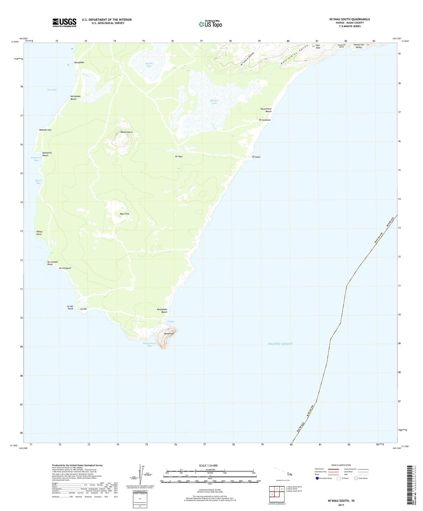
2024 topographic map quadrangle Niihau South in the state of Hawaii. Scale: 1:24000. Based on the newly updated USGS 7.5' US Topo map series, this map is in the following counties: Kauai. The map contains contour data, water features, and other items you are used to seeing on USGS maps, but also has updated roads and other features. This is the next generation of topographic maps. Printed on high-quality waterproof paper with UV fade-resistant inks.
Quads adjacent to this one:
West: Niihau South OE W
North: Niihau North OE W
Northeast: Niihau North
This map covers the same area as the classic USGS quad with code k21160g1.
Contains the following named places: Halali'i Lake, Halulu Lake, Honua'ula Valley, Kaha'ino, Kala'ala'au Valley, Kamalino, Kamalino Bay, Kamalino Beach, Kaumuhonu Bay, Kawa'ewa'e, Kawaihoa, Kealea, Keanahaki Beach, Ke'elinawi Point, Ke'elinawili, Ki'iala'a Valley, Kiloi'a Bay, Le'ahi, Le'ahi Point, Makahu'ena, Mau'uloa, Niihau Division, Nonopapa, Nonopapa Beach, 'O'iamoi, Pahau Point, Pali Paia, Po'ooneone, Po'ooneone Beach, Waiapuaa Valley, Yam Bay