MyTopo
Olowalu Hawaii US Topo Map
Couldn't load pickup availability
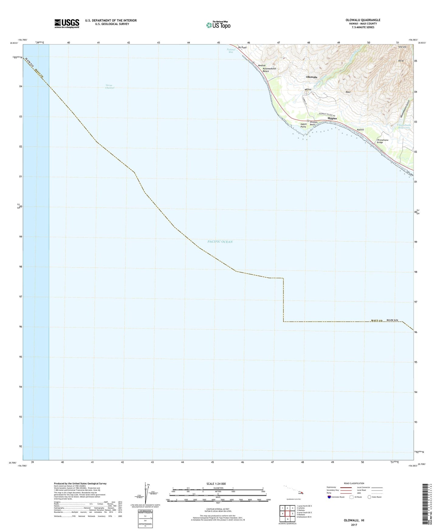
2024 topographic map quadrangle Olowalu in the state of Hawaii. Scale: 1:24000. Based on the newly updated USGS 7.5' US Topo map series, this map is in the following counties: Maui. The map contains contour data, water features, and other items you are used to seeing on USGS maps, but also has updated roads and other features. This is the next generation of topographic maps. Printed on high-quality waterproof paper with UV fade-resistant inks.
Quads adjacent to this one:
North: Lahaina
Northeast: Wailuku
East: Maalaea
This map covers the same area as the classic USGS quad with code o20156f5.
Contains the following named places: Au'au Channel, Awalua, Hekili Point, Ka Puali, Kailiili, Kaiwaloa Heiau, Kilea, Ko'ai, Kulanaokalai Beach, Mopua, Nalima Wai, Olowalu, Olowalu Beach, Olowalu Census Designated Place, Olowalu Ditch, Olowalu Shaft, Olowalu Stream, Olowalu Wharf, Punahoa, Ukumehame Beach State Park, Ukumehame Bridge, Ukumehame Gulch, Ukumehame Reservoirs, Ukumehame Shaft, 'Ula'ula, West Maui Forest Reserve