
MyTopo
Pahoa North Hawaii US Topo Map
Couldn't load pickup availability
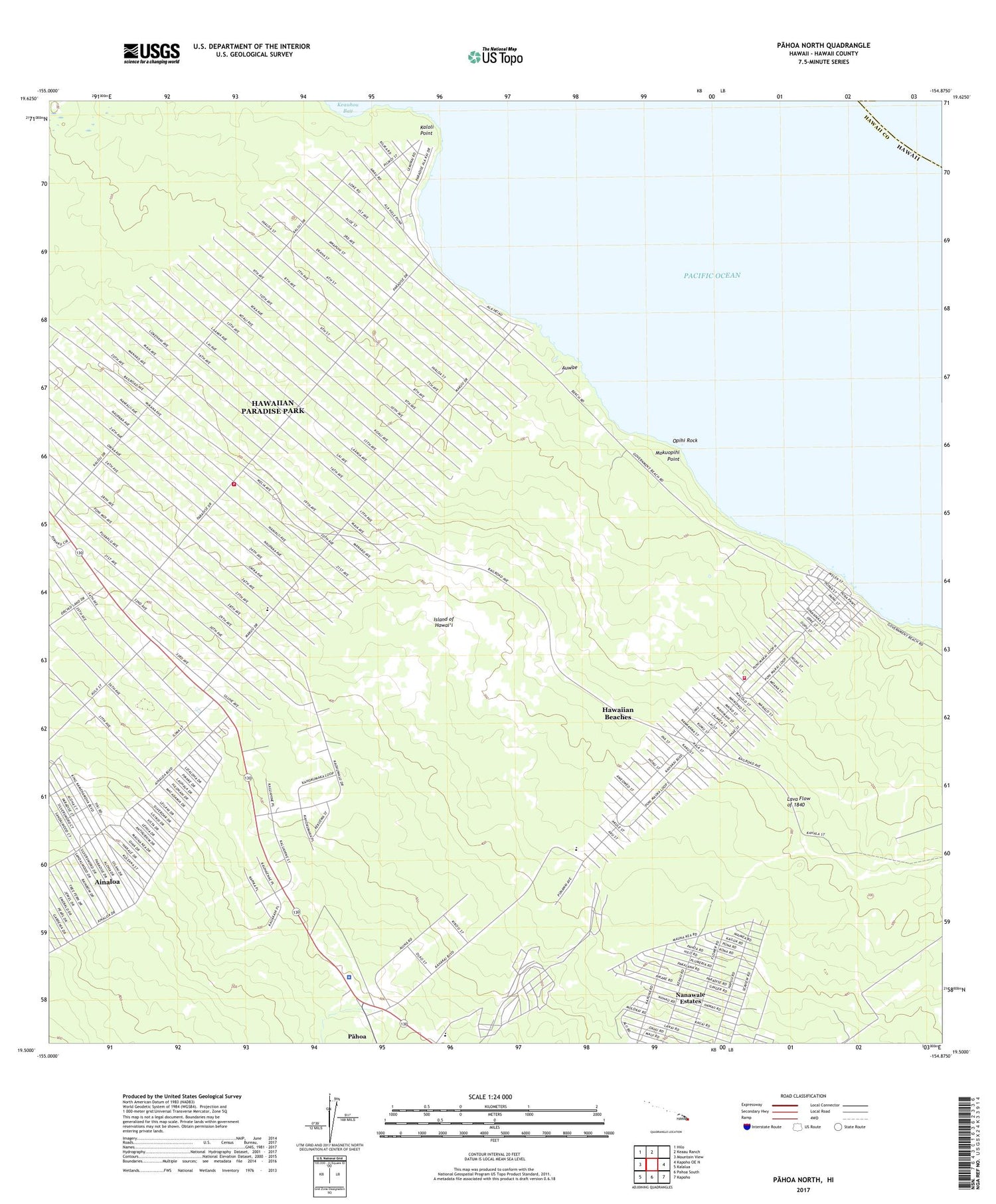
2024 topographic map quadrangle Pahoa North in the state of Hawaii. Scale: 1:24000. Based on the newly updated USGS 7.5' US Topo map series, this map is in the following counties: Hawaii. The map contains contour data, water features, and other items you are used to seeing on USGS maps, but also has updated roads and other features. This is the next generation of topographic maps. Printed on high-quality waterproof paper with UV fade-resistant inks.
Quads adjacent to this one:
West: Mountain View
Northwest: Hilo
North: Keaau Ranch
East: Kapoho OE N
Southeast: Kapoho
South: Pahoa South
Southwest: Kalalua
This map covers the same area as the classic USGS quad with code o19154e8.
Contains the following named places: Ainaloa, Ainaloa Census Designated Place, 'Auwae, Hawai'i Beaches Estates, Hawaii County Fire Department Station 10 Pahoa, Hawaii County Fire Department Station 18 Paradise Park, Hawaiian Beaches, Hawaiian Beaches Census Designated Place, Hawaiian Beaches Park, Hawaiian Beaches Volunteer Fire Station 10A, Hawaiian Paradise Park, Hawaiian Paradise Park Census Designated Place, Honolulu, Honolulu Landing, Hui Hanalike Park, Kahuwai, Kaloli Point, Keauhou Bay, Keonepoko Homesteads, Keonepoko Iki, Keonepoko Nui, Lava Flow of 1840, Maku'u, Maku'u Hawaiian Home Land, Makuu Station, Moku'opihi Point, Nanawale, Nanawale Estates, Nanawale Estates Census Designated Place, Nanawale Forest Reserve, Nanawale Homesteads, National Guard Reservation, 'Opihi Rock, Pahoa Landing Strip, Pahoa Police Station, Paradise Park Volunteer Fire Station 18A, Puna Forest Hunters Trail, Puna Hawaiian Home Land, Puna Trail, Puua, Tiki Gardens, Twentymile Station, Twentyone Mile Station, Twentytwo Mile Station, Waiakahiula, Waiakahiula One, Waikahekahe, Waikahekahe Nui, ZIP Code: 96749


