MyTopo
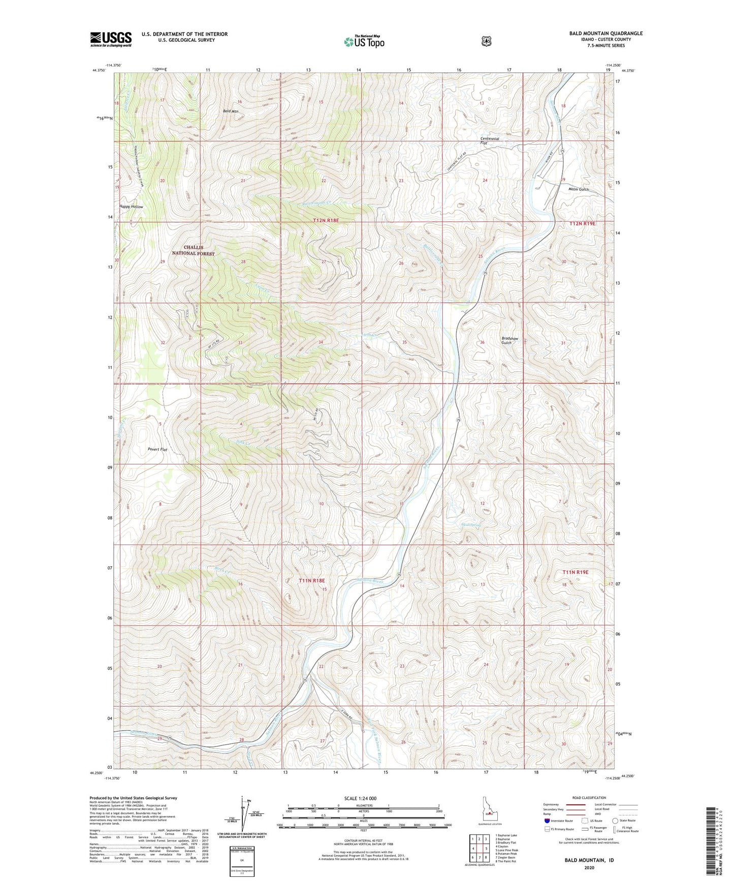
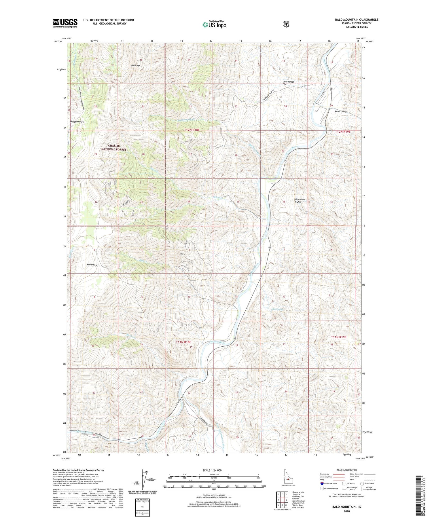
Bald Mountain Idaho US Topo Map
Couldn't load pickup availability
Also explore the Bald Mountain Forest Service Topo of this same quad for updated USFS data
2024 topographic map quadrangle Bald Mountain in the state of Idaho. Scale: 1:24000. Based on the newly updated USGS 7.5' US Topo map series, this map is in the following counties: Custer. The map contains contour data, water features, and other items you are used to seeing on USGS maps, but also has updated roads and other features. This is the next generation of topographic maps. Printed on high-quality waterproof paper with UV fade-resistant inks.
Quads adjacent to this one:
West: Clayton
Northwest: Bayhorse Lake
North: Bayhorse
Northeast: Bradbury Flat
East: Lone Pine Peak
Southeast: The Paint Pot
South: Ziegler Basin
Southwest: Potaman Peak
This map covers the same area as the classic USGS quad with code o44114c3.
Contains the following named places: Alkali Spring, Bald Mountain, Birch Creek, Bradshaw Gulch, Centennial Flat, Crystal, East Fork Bureau of Land Management, East Fork Salmon River, Lyon Creek, Malm Gulch, Povert Flat, Rattlesnake Creek, Silver Bell Mine, Sink Creek, Spud Creek, Turtle Mine