MyTopo
Circular Butte Idaho US Topo Map
Couldn't load pickup availability
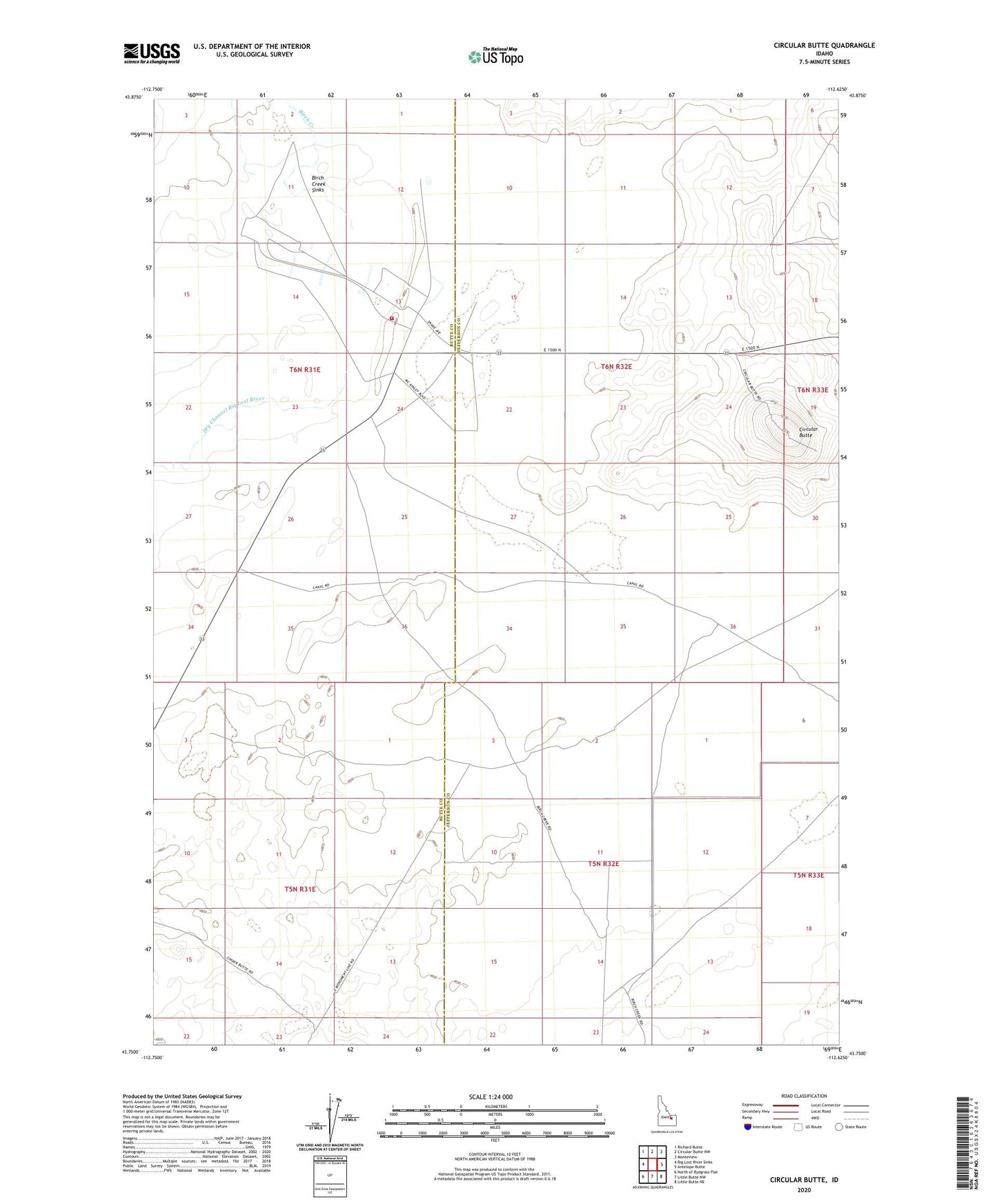
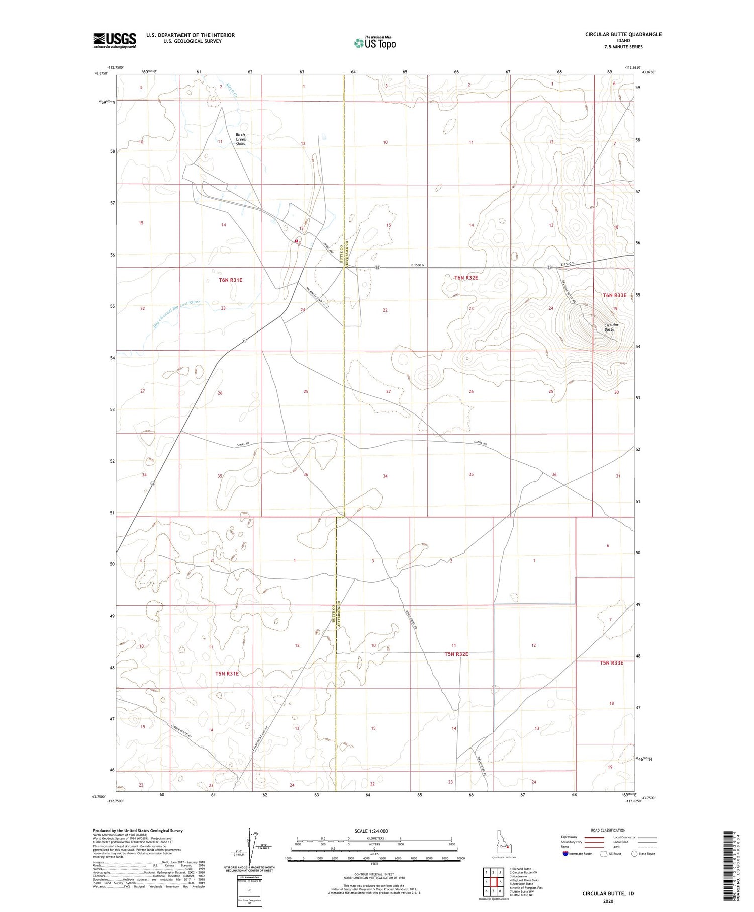
2023 topographic map quadrangle Circular Butte in the state of Idaho. Scale: 1:24000. Based on the newly updated USGS 7.5' US Topo map series, this map is in the following counties: Butte, Jefferson. The map contains contour data, water features, and other items you are used to seeing on USGS maps, but also has updated roads and other features. This is the next generation of topographic maps. Printed on high-quality waterproof paper with UV fade-resistant inks.
Quads adjacent to this one:
West: Big Lost River Sinks
Northwest: Richard Butte
North: Circular Butte NW
Northeast: Monteview
East: Antelope Butte
Southeast: Little Butte NE
South: Little Butte NW
Southwest: North of Ryegrass Flat
This map covers the same area as the classic USGS quad with code o43112g6.
Contains the following named places: Birch Creek, Birch Creek Sinks, Circular Butte, Dry Channel Big Lost River, Idaho National Laboratory Safety Department Station 3