MyTopo
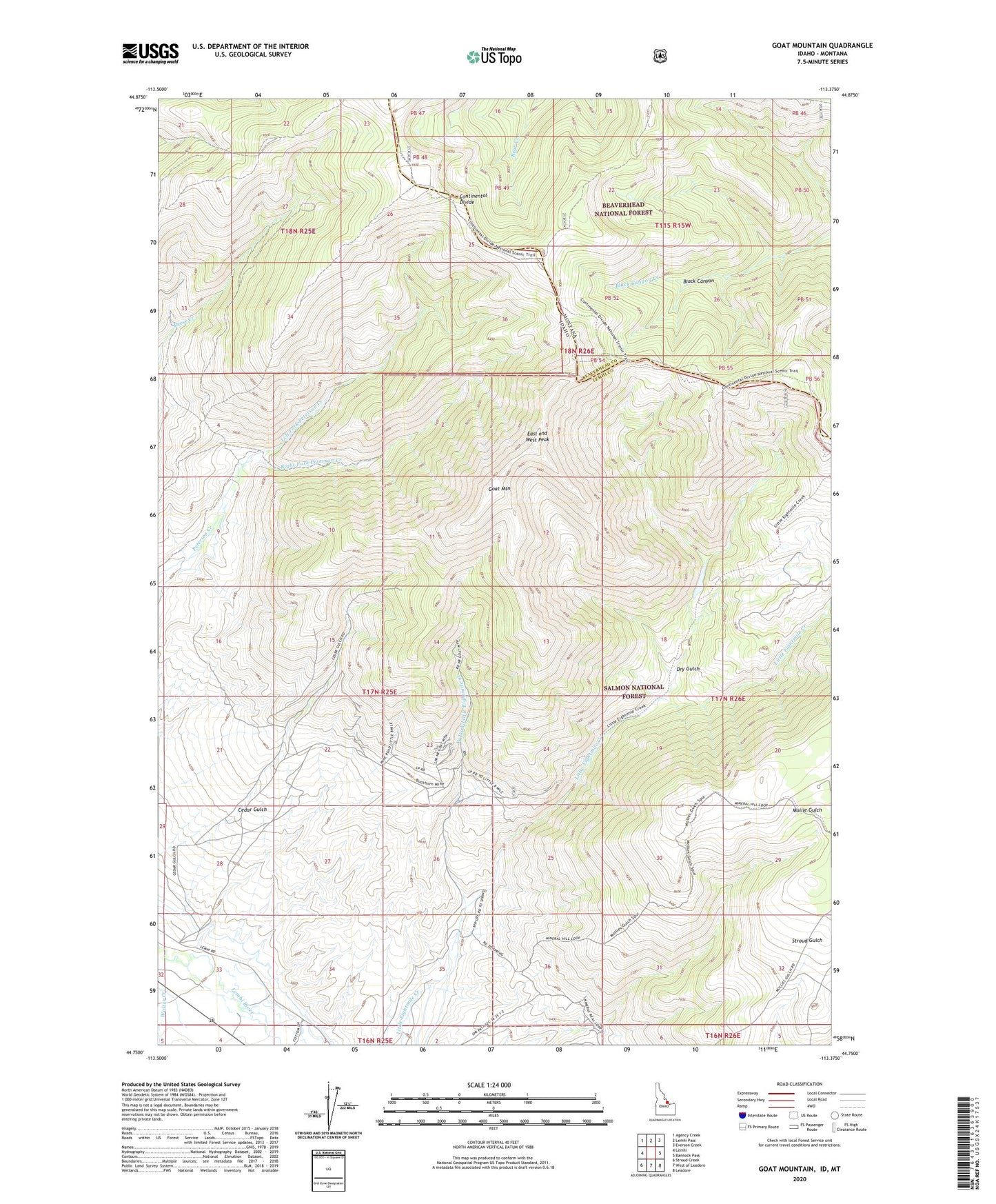
Goat Mountain Idaho US Topo Map
Couldn't load pickup availability
Also explore the Goat Mountain Forest Service Topo of this same quad for updated USFS data
2024 topographic map quadrangle Goat Mountain in the state of Idaho. Scale: 1:24000. Based on the newly updated USGS 7.5' US Topo map series, this map is in the following counties: Lemhi, Beaverhead. The map contains contour data, water features, and other items you are used to seeing on USGS maps, but also has updated roads and other features. This is the next generation of topographic maps. Printed on high-quality waterproof paper with UV fade-resistant inks.
Quads adjacent to this one:
West: Lemhi
Northwest: Agency Creek
North: Lemhi Pass
Northeast: Everson Creek
East: Bannock Pass
Southeast: Leadore
South: West of Leadore
Southwest: Stroud Creek
Contains the following named places: Buckhorn Mine, Cedar Gulch, Commodore Mine, Dry Gulch, East and West Peak, Friday Cabin, Goat Mountain, Left Fork Peterson Creek, Maryland Mine, Right Fork Peterson Creek, West Fork Little Eightmile Creek