MyTopo
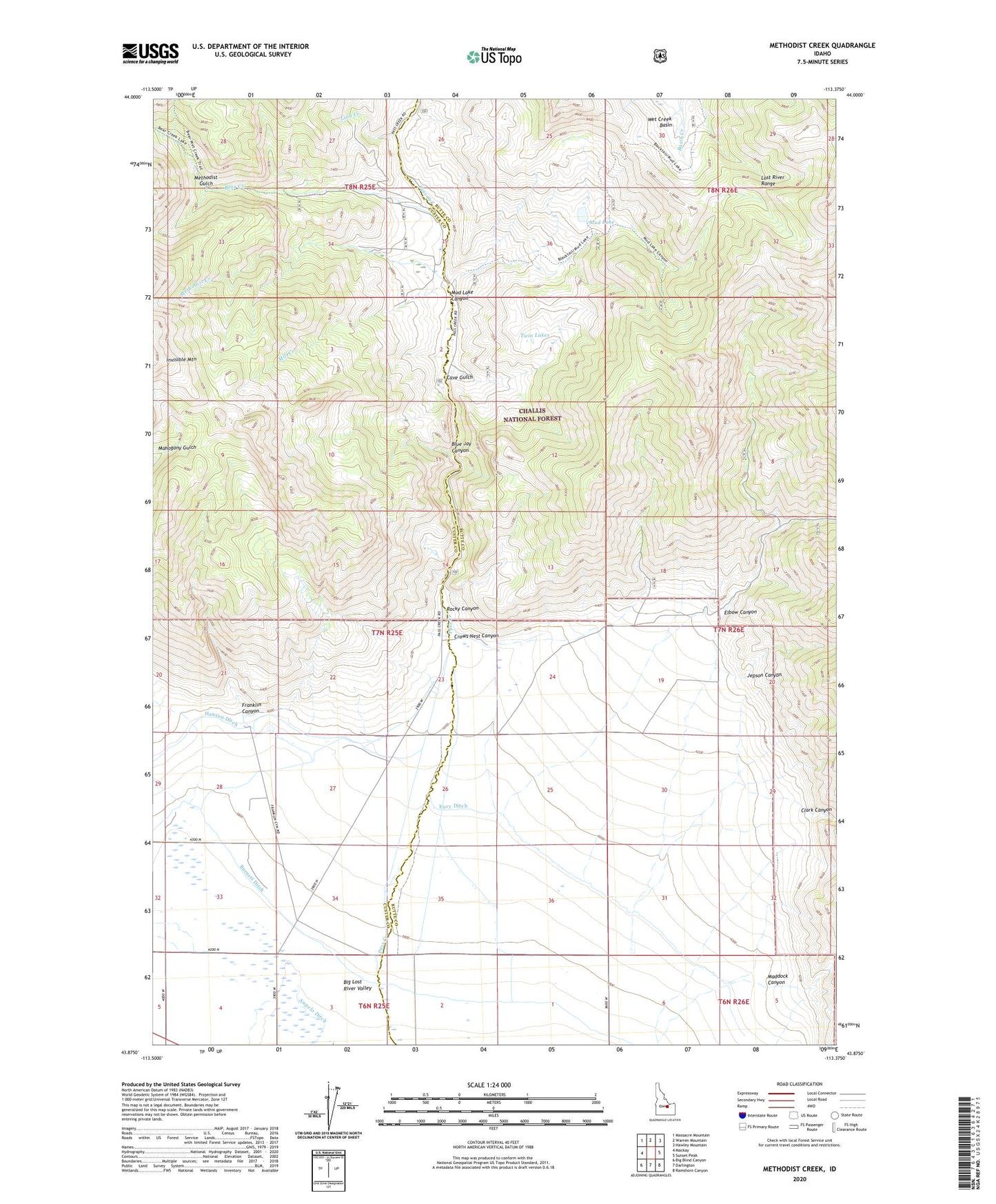
Methodist Creek Idaho US Topo Map
Couldn't load pickup availability
Also explore the Methodist Creek Forest Service Topo of this same quad for updated USFS data
2023 topographic map quadrangle Methodist Creek in the state of Idaho. Scale: 1:24000. Based on the newly updated USGS 7.5' US Topo map series, this map is in the following counties: Butte, Custer. The map contains contour data, water features, and other items you are used to seeing on USGS maps, but also has updated roads and other features. This is the next generation of topographic maps. Printed on high-quality waterproof paper with UV fade-resistant inks.
Quads adjacent to this one:
West: Mackay
Northwest: Massacre Mountain
North: Warren Mountain
Northeast: Hawley Mountain
East: Sunset Peak
Southeast: Ramshorn Canyon
South: Darlington
Southwest: Big Blind Canyon
This map covers the same area as the classic USGS quad with code o43113h4.
Contains the following named places: Asay Ranch, Bear Creek, Bear Creek Campground, Blue Jay Canyon, Cave Gulch, Clark Canyon, Crows Nest Canyon, Elbow Canyon, Franklin Canyon, Fury Ditch, Jepson Canyon, Lion Creek, Lost River Range, Maddock Canyon, Methodist Creek, Methodist Gulch, Mill Creek, Mountain View Guard Station, Mud Lake, Mud Lake Canyon, Pass Creek, Rocky Canyon, Twin Lakes